
On Monday, October 19th, three of us enjoyed a warm, partly sunny fall day for the 32nd annual
White Mountain Crop Hunger Walk, a "hike for hunger" that benefits the
programs of Church World Service. Our route was a 10.2 mile loop over North Moat Mountain via the Moat Mountain Trail and Red Ridge Trail, a rugged trip with great views from the summit and along the open crest of Red Ridge. Hikers on this trek included Thom Davis, Gary Tompkins and this correspondent.
Since its inception in 1989 our walk has raised more than $89,000 for
the anti-hunger programs of Church World Service, with more than $22,000
of that provided to local food pantries in the western White Mountains.
We owe the success of our walk to the consistent generosity of our
sponsors.
We started from the trailhead on West Side Road in North Conway at 9:30 am. This is also the starting point for the short, easy walk to the extremely popular Diana's Baths. This parking lot was jam-packed all through the busy season, but there was plenty of parking space on a midweek post-foliage day.

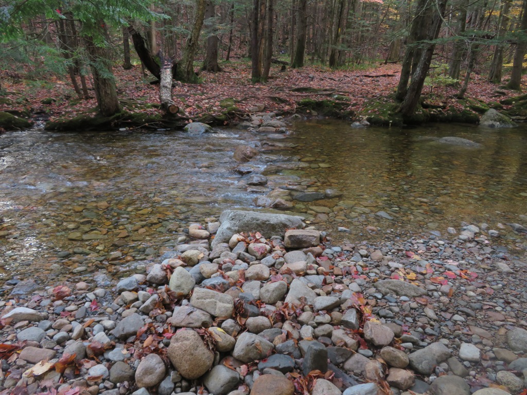
Diana's Baths are a picturesque series of cascades and pools on Lucy Brook, just 0.6 mile along a graded gravel path. The trail reaches the Baths at the site of an old mill.

The cascades were in good flow after recent rain.

The first 2.4 miles of Moat Mountain Trail is an easy, pleasant walk up the valley of Lucy Brook.

At 1.2 miles the Red Ridge Trail, our return route, veers left across the brook. We were pleased to see that the crossing looked easily manageable.
A bit farther, the Moat Mountain Trail also crosses Lucy Brook.

Nice October walking.

This cascade is a nice destination for a mellow 4.4 mile round trip walk.

Thom and Gary practicing appropriate social distancing.

Junction with the Attitash Trail, which continues 7.2 miles over Big Attitash Mountain and Table Mountain.

Here the Moat Mountain Trail turns left and the real climb to North Moat begins, ascending 2100 ft. in 1.9 miles. The first section rises through hemlock forest.

Farther up the trail becomes ledgy amidst spruce forest.

A granite glacial erratic, contrasting with the Moat Volcanic bedrock of the ledges.

Ledgy walking is the theme on the Moats, which were burned over in a huge forest fire in the 1850s.

The first views open up at 2300 ft., looking across the Saco Valley to Kearsarge North.

Clambering up more ledges.

A beautiful stretch on a spruce-wooded shoulder.

Many of the ledges in the woods were wet, and occasionally slippery. We were glad we were ascending this north-facing side of the mountain, and not coming down over these slabs.

A stiff climb up the summit cone.

Breaking into the open near the top.

Looking out to the Presidentials, partly mantled with the weekend's early snowfall.
\

Western perspective.

The 3196-ft. summit of North Moat is one of the top viewpoints in the Whites.

Thom takes it in.

Zoom on Mt. Washington.

Fall color of three-toothed cinquefoil.

A group of AMC New Hampshire Chapter hikers joined us at the summit. Lu Ann Laquerre, in front on the right, celebrated her finish of the 52 With a View list here on North Moat. Congratulations!

We posed for our traditional group photo.

The AMC group heads back for the return traverse across the Moat Range.

What a summit!

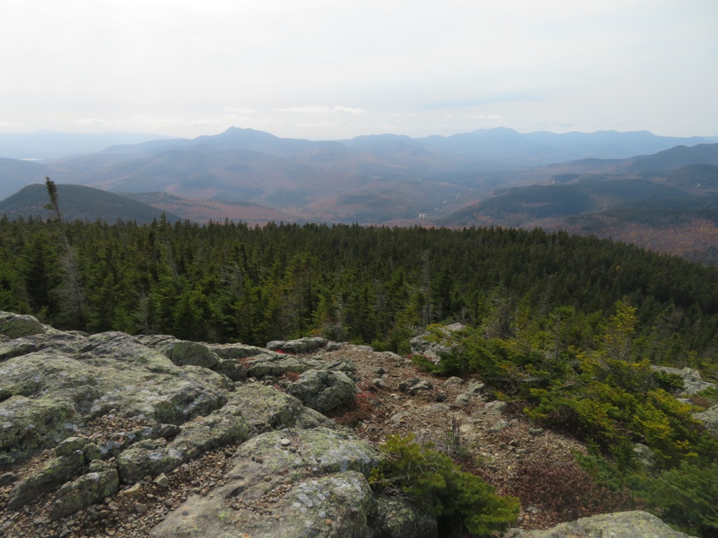
My favorite North Moat vista is westward to waves of peaks and ridges beyond the dark jumble of Big Attitash Mountain.

The Sandwich Range spans the SW horizon.
Summit benchmark.

Heading out for the traverse across to Red Ridge. The peak of South Moat peers out in the distance. Thom hustled ahead of Gary and me so he could redline the trail across to Middle Moat.

Lovely stretch along a wooded shoulder just south of the summit cone.

This was the largest patch of snow we saw.

The first of several steep down-scrambles heading south along the ridge.

Looking back up at another scramble.

Cool rock wall alongside the trail.

Gary down-climbs another steep pitch.

Interesting jointing in this rock face.

Climbing up to a little knob along the crest.

A ledge on the west side of this knob is one of the best vantage points on the range, with a striking vista up the Swift River Valley.

Yes, this ledge is part of the trail. There is a bypass through the woods.

View back to North Moat from a ledgy knob near the junction with Red Ridge Trail.

Breaking out of the woods onto the open crest of Red Ridge.

Looking down the range to Middle and South Moat.

One of the great open ridge walks.

Heading down. The trail is in the open for 0.4 mile.


Beautiful outcrop.

Gary takes in the view from a vantage point much lower on the ridge.

Late foliage in the Saco Valley.

This "eroded trap dike" mentioned in the AMC White Mountain Guide description has been bypassed with a short blazed relocation.

View from an open slope far down on the flank of the ridge. An interesting trail!

The trail drops down into the valley of Moat Brook, where Thom rejoined us for the last three easy miles after his side jaunt to Middle Moat. We negotiated the last 1.2 miles of CropWalk #32 by headlamp. Please click here if you wish to make a donation to our cause. Thank you!


Moats have been off my radar, but obviously deserve wider recognition!
ReplyDelete