
On a warm, sunny late summer day I returned to Tunnel Brook Notch to visit the tallest (topping out at 2900+ ft.) and wildest-looking of the eight slides on the eastern face of Mt. Clough. The upper part of this slide (seen below in a zoomed view from the big slide in Mt. Moosilauke's Slide Ravine) is all bare ledge, tilted at an angle of 38 to 40 degrees, as measured on Caltopo. That's steep! I wasn't sure how far I would be able to go up on it. I thought about bringing my approach shoes, but decided against it, reasoning that they might enable me to climb to a point from which it would be difficult to descend. I once climbed to Clough's summit via a nearby slide to the north, and I would not be repeating that sufferfest bushwhack. So I would need to descend from whatever high point I reached.

To reach the notch I used the very pleasant approach up Tunnel Brook Trail from its southern trailhead on Long Pond Road near Glencliff. This leads through fine hardwood forest at easy to moderate grades with good footing.

Halfway up you pass the small reservoir for the Glencliff Home.

The woods at the broad height-of-land have a wild feel to them.

First view of Mud Pond and the slides in Slide Ravine.

A wider view towards the north end of Mud Pond. Here I met two ladies returning from a walk through the notch. When I said I was going up onto a slide, one of them wanted to make sure someone knew where I was going (I noted that my wife could follow my route on my Garmin InReach) and wondered what all I was carrying in my big pack - a question I often receive. I later learned that the questioner was famed skier Penny Pitou, who won two silver medals in the 1960 Winter Olympics at Squaw Valley, and lives in the Lakes Region!

Beautiful section of trail along the string of beaver ponds in the notch.

Sun and sparkling water.

Another pond.

From the shore of the next pond to the north, I had a good look at the upper part of the slide. The smooth steep slabs looked impressive and a bit intimidating.


After a long chat with John, I started whacking up through some nice birch woods.

Some distance up the slope I came upon this old beaver-gnawed stump sporting a mushroom cap.


Boulder cave.

Monolith.

The seductive birch woods lured me off course, so I ended up on a small gravel slide outlier to the north.

Pioneer vegetation has reclaimed much of this strip.

From the top, a first view out over the notch.

Goldenrod and Pearly Everlasting brightened the slope.

Weaving through rocks en route to the main slide.

This part of the slide is fairly steep, but broken up by brushy terraces.

Expanding views.

I scrambled up to where the continuous bedrock exposure begins.

I thought about scrambling up through here, but knew it was probably steeper than it looked....

...as shown by this side view.


A Black Hawk cruised by below, perhaps on a mountain training mission. Those pilots are amazing when it comes to plucking an injured hiker off a mountainside.

Zoom on the big slide in Slide Ravine, which Ray "Jazzbo" Caron and I had visited a couple of weeks earlier.


The steep slabs continued.


First colors of fall.

Massive ledges.

Gorgeous view of the notch from this lofty perch at 2750 ft.

Looking up towards the top of the slide. This was my turnaround point, as the terrain was getting quite sketchy.

In the woods beside a slide, one can count on feeling the sweet caress of scrubby birches and conifers.


Heading down, time for a switchback to the left.

Interesting terraces in the schist.

Fractured.

Easier going down a scrubby section.

The Giant Stairs, in miniature.

Nice low-angle slabs near the bottom.

Looking up.

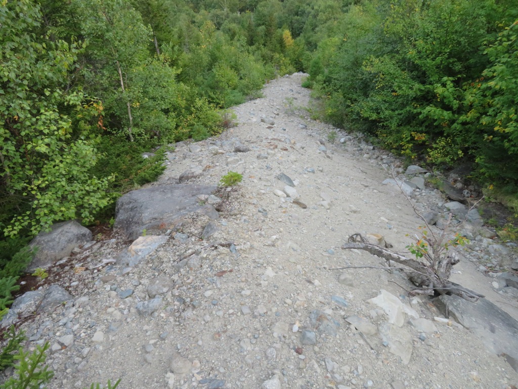
Where the exposed ledge meets the till deposit at the bottom of the slide.

Gravelly spine.
From here, the top of the slide looms high above.


Time for a slide guidebook!
ReplyDeleteHi Paul! Not a guidebook, more of a history:
DeleteThe Landslides on Mount Moosilauke (in progress)
https://docs.google.com/document/d/1BK0Gtzee7rexiu5PCmeGnNTFwhRDt_jC9vS3_ImNNyw/edit
Slide History of the Sandwich Range
https://docs.google.com/document/d/1UgIQQAtUi-j4CwrLdJD1Hqqk219v13oekvC01yfdvOg/edit