
A memorable 12-hour adventure with Thom Davis in the Wild River Wilderness. After a four mile approach on the Moriah Brook Trail, we bushwhacked up a NW tributary to the big slide unleashed on the NE slope of Mt. Lethe by Tropical Storm Irene in 2011. After miles of interesting brook and woods scenery, we faced an impressive scene of rocky destruction at the slide. Thom, a geology professor at Bentley University, provided fascinating commentary on the many geologic features seen along the way.
This Google Earth image shows the slide that was our ultimate objective. It might be called the "Bugs Bunny Slide" in recognition of its prominent "ears."

We rendezvoused at the trailhead at the end of Wild River Rd., and after a short warmup on the Wild River Trail, we turned onto the Moriah Brook Trail, a long and very scenic route to Mt. Moriah.

The Moriah Brook Trail bridge over the Wild River was damaged by Irene and was removed by the Forest Service in 2016. The crossing is now made by descending a very steep, unstable bank.

The trail crosses the river diagonally to the small opening seen in the center of the photo.

Thom descends the bank.

The water level was about as low as it ever gets, but the crossing was not easy, as some of the rocks are very slippery.

Where the trail enters the woods.

The Moriah Brook Trail coincides with the Highwater Trail along a high washed-out bank.

There's a view here across the river to "Blue Brook Mountain."

Where we would spend our day and evening.

Scene of storm destruction along the river.

Railroad grade walking on the Moriah Brook Trail. The Wild River Railroad, whose crews logged heavily in the valley, operated from 1891 to 1903.

The lower crossing of Moriah Brook is just above Moriah Gorge.

Looking downstream into Moriah Gorge.

A spike left over from the railroad trestle that spanned the brook here.

Peaceful scene along Moriah Brook.

A potentially confusing spot where the trail crosses a small brook and hops up onto an eroded little peninsula.

Another obscure spot in an area of beaver wetlands.

The trail skirts this stark beaver swamp.

Several sections of the trail are seriously overgrown, with hobblebush crowding the footway. There are also dozens and dozens of stepover blowdowns, and three crawl-unders.

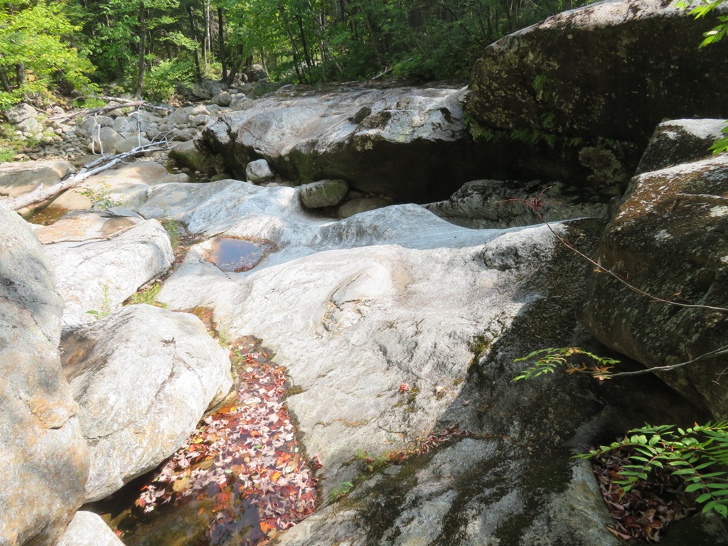
Looking downstream at the second crossing of Moriah Brook, a lovely spot.

Just beyond is this gorgeous pool and cascade.

Thom checks it out.

He brought my attention to the folds in the metamorphic rock, beautifully displayed under the crystal clear water. At the lower right is an aplite dike, a narrow, light-colored intrusion of granitic rock.

You descend this steep but grippy ledge to cross a northern tributary.

Another Moriah Brook cascade.

We left the trail and found the fork where the NW tributary (left) joins the main brook.

Wild woods in the Wild River valley.

The tributary itself was our route for much of the way up the side valley. Along the way we saw many interesting ledge formations.
An endless gallery of rock sculptures.

There were several obstacles to surmount or work around.

When I asked legendary bushwhacker JR Stockwell for some intel on this area, he told me about a flume he had traversed. We found it and admired it, but didn't go through it as the rocks were very slick. Here we made one of several detours up into the woods.

Above the flume was a massive sunny slab of stone.

Hopping rocks up the brookbed, requiring careful attention to footing.

Another neat scene along the tributary.

A miniature slot canyon.

It was after 2:00 pm by the time we reached the first open slabs of the slide.

Stay on the dry rock and off the slime! The ledgy SE ridge of Mt. Moriah, scorched by a forest fire in 1895, appears in the distance.

Thom looks down from a ledge step between the rock slabs.

This huge low-angle white slab was a beautiful spot, with North Carter looming overhead. This slab was exposed before Irene, but the open area was widened and scoured by the slide.


Looking back, Caribou and Gammon Mountains could be seen in the distance.

To access the next part of the slide, we had to duck our way under this blowdown jumble.

A bouldery path of destruction, with birches and other plant pioneers lining the flanks.

First look up to the big bulge of rock marking the widest part of the slide.

Thom waits up for his slowpoke companion.

Zoomed.

Looking across to spurs of North Carter.

We ascended this ramp alongside a wall of bedrock.

Down-look.

A basalt dike runs along the ramp. It's smooth and not as grippy as the metamorphic rock.

Heading up the ramp.

Looking back.

A tricky side move was needed to surmount this steep ledge.

Not going up that way.

Looking down from the top of the bulge at 3420 ft.

A fine place to hang out for a while in mid-afternoon sun. Behind Thom is the left "ear" of the slide, which rises another 500 ft. in a narrow swath of loose rock and gravel. Time did not permit an ascent to the top, and our spot was much wider and more open.

Looking up at the upper forks of the slide, the "ears." (Photo by Thom Davis)

A sweet vista looking down the tributary valley to the sprawling mass of Mt. Moriah, with a distant view to several mid-size peaks in western Maine.

Central in the vista were Gammon, Caribou, Haystack and Speckled Mountains, all in the Caribou-Speckled Mountain Wilderness.


With binoculars, I could see a hiker on the blocky summit of Mt. Moriah, seen here as a dot of red towards the right end of the crest.

Thom takes in the scene before heading down. It's 4:00 pm and we have a long way to go.

Starting the descent.

Looking back up.

The broken log was a key foothold.

Last look at the rock bulge.

One of the lower slabs on the slide was peppered with small intrusions of various shapes.

After descending the slide to its base, and a section of brookbed below, we opted to take to the woods for the the rest of the descent down the side valley. We figured it would be faster and safer than a mile and a half of rock-hopping. After tussling with dense spruce for a while, we emerged in the first of a series of open birch and hardwood glades that made for a generally pleasant descent.

There was plenty of moose poop in places, and I stumbled upon this old antler. With rutting season just starting, we hoped we would not cross paths with an ornery bull. Luckily, no sightings.

I could have lounged in this open maple glade for a while, but no time for that today. We reached the Moriah Brook Trail at 6:15 and hiked the last three miles by headlamp, including that crossing of the Wild River.


I did the Moriah Brook Tr. once in 2008 I think it was. I absolutely loved it and the area. And after reading a blog of yours back then about all that "ledgey goodness" on the other side of where you were on this day, I vowed to return several times to explore. Never made it back. :(
ReplyDeleteJoe, you gotta go back - you would love the whacking on the north side of the valley!
DeleteYou have such fun adventures!!!
ReplyDeleteThis was a good one!
DeleteForgot to mention, awesome report and pictures.
ReplyDeleteThanks, Joe!
DeleteI hiked the Moriah Brook trail, starting at Wild River Campground, in 2014. The bridge was there at the time and the hike to Moriah Gorge was remote and beautiful. We got to Moriah Gorge but could not find where to cross to continue. In spite of that it was an awesome day and a hike to remember. With the bridge gone, I will never, unfortunately, be able to visit that area again but the pictures took and the memory will last.
ReplyDeleteHi Brendan, The crossings on this trail are difficult. We were lucky the water was so low. It is one of the most beautiful areas in the Whites, with an interesting history, too.
DeleteGreat entry! I've never gone in from thay side. If love a day with a geologist in the mountains!
ReplyDeleteThanks, JimmyO - it's the quiet side of Moriah. It's always great to get some geology lessons along the way!
DeleteI am the current trail maintainer for the section of Moriah Brook above the gorge. I’m doing my best to tame the hobblebush and open up the ‘head scratchers’ along the way. It’s one of my favorite areas and a great trial
ReplyDeleteOnce the long days return I would love to check that slide out. Thank you for sharing! As an aside, you pointed out the rocky knob on Moriah, a spot I’m intrigued by. Is there a route (i.e. stream or tributary, etc.) to this spot, or is it a total bushwack?
Hi Dan, Thanks for your work on the trail! It's one of my favorites. As an adopter myself, I know that the hobblebush wars are never really won. The rock knob is indeed a great spot. It's a pure bushwhack, we went up the entire ridge from above Moriah Gorge because the water was too high to cross that day. Would be a shorter whack from farther up the trail. There are many fine view ledges on that side of the valley! - Steve
Delete