For this correspondent, the period between foliage and first snow, known by some as "stick season," is a favorite time for bushwhacking at lower elevations in the leafless hardwoods. As it often does at this time of year, the Paugus Brook valley beckoned. This broad, hardwood-rich trough between Mt. Chocorua and Mt. Paugus features enough off-trail ledges and other destinations to keep a bushwhacker happy for many moons.
After several days of dreary, foggy weather, the forecast promised brightening skies on the day before Halloween. Though it never fully cleared, the fog lifted enough for marvelous views from several ledges on a spur of Mt. Paugus. These vistas, combined with open hardwood forests, historic logging sites, an assortment of boulders and rock formations, and a remote cascade, made for a memorable day in this wild nook of the Sandwich Range.
I set off on the Bolles Trail from the quiet Paugus Road trailhead parking area.
Paugus Brook was running fairly high. I was thankful for the large step stones originally placed here about 15 years ago by the Wonalancet Out Door Club. They were swept away by Tropical Storm Irene in 2011, but were soon replaced in a joint effort by the Chocorua Mountain Club and the Trailwrights.
An important notice regarding the several historic logging sites located along the Bolles Trail.
A short side path leads to the sawdust pile left over from the Paugus Mill operation of the early 1900s. A huge boiler used here was hauled in by a team of 14 horses. Timber was harvested from all the slopes surrounding the Paugus Brook valley.
Late October strolling on the Bolles Trail.
Bronze and green on a hardwood slope.
The trickiest footing of the day was on the wet, slippery ramps of two snowmobile bridges.
Stove parts hidden in the woods near the site of Mason's logging camp.
The Bolles Trail provides many views of Paugus Brook.
Another snowmobile bridge spans Paugus Brook deep in the valley.
Around the bend is a ferny opening marking the site of Bert Mudgett's logging camp from the Paugus Mill days.
A partly swallowed arrow marks the route of the trail through the camp.
There are several trailside artifacts visible here, including this sled runner.
A good-sized tree has grown through this metal hoop.
Stove door.
Not sure what this piece of machinery was.
I started the bushwhack to the Paugus spur ledges by crossing the meandering branch of Paugus Brook that flows down from "Bolles Pass" between Mt. Paugus and Mt. Chocorua.
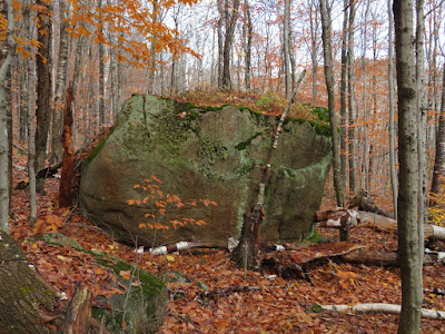
Many large boulders dot the slope beyond.
Rocks of many shapes.
Climbing steeply through a hardwood rock garden.
Weathering to rottenstone.
From the highest of three accessible perches on the first set of ledges, a view across to the hidden upper fold of the Paugus Brook valley with the Sisters and Mt. Chocorua beyond.
Fog was wrapping around Chocorua's peak, and it would soon disappear for the rest of the day.
A close-up of "Paugus View Ledge" on a lower spur of Chocorua, which I had visited a week earlier.
A jutting granite ledge offered a good perch for admiring the views.
A long look south down the scoop of the Paugus Brook valley.
The Ossipee Range on the horizon.
An interesting ledge formation below.
Peering down to the treetops.
There was a late hatching of ladybugs on this ledge.
I continued up the spur ridge, passing a clifftop with a view to the head of the valley where the Bolles Trail crosses "Bolles Pass" in the little cut at the center of the picture.
One of several monster boulders on this ridge.
Blueberry color.
My objective was the middle of three tiered cliffs that form a kind of mini "Giant Stairs" overlooking a broad basin on the east flank of Mt. Paugus. I had first visited these "stairs" in 1997 with longtime bushwhacking buddy, the late Creston Ruiter.
The lower "stair" could be seen below.
Weathering has chopped off the end of this outcrop.
The Paugus Brook valley is seen beyond the mouth of the basin.
Looking up to the headwall of the basin.
This rock-faced 2820-ft. northeastern knob of Mt. Paugus is one of the most interesting features of the Sandwich Range.
The big slab is impressively smooth and steep.
A long, thin cascade could be glimpsed across the valley, perhaps the track of an old slide. I went partway up this a few years ago.
Before heading down, I visited the upper "stair" for another perspective on the valley.
I bushwhacked down to the brook that drains the east-facing basin.
Back down on the Bolles Trail, going a little farther north along the broad, flat floor of the upper Paugus Brook valley.
The "Bolles Pass" branch of the brook slides gently past the trail.
I bushwhacked across to the main northeastern branch of the brook and followed it upstream through exasperating tangles of hobblebush.
I went as far as a cascade that Creston and I had discovered on our 1997 exploration.
After savoring this fine secluded spot, I hobblebush-whacked back to the Bolles Trail for the three-mile return walk down the valley.


