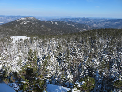
A glorious late winter day for a climb up the Stony Brook/Carter-Moriah
Trail route, combining a pleasant valley approach with a ledgy ridge
walk, providing views beyond counting.
A nice packed powder track made for great snowshoeing on Stony Brook Trail.
A solid snow bridge over Stony Brook.
A gentle stretch on an old logging road.
Climbing up a spur ridge through mature hardwoods.
A ledgy SW ridge of Moriah is a constant presence across the valley. One avid bushwhacker called this "Celebration Ridge."
The summit nubble in sight, way up there.
Nice woods approaching the ridgecrest.
The last pitch up is a chute, almost like a ski trail.
In the Moriah-Imp col.
There's some snow up here.
Junction of two of the best trails in the Whites.
The section of Carter-Moriah Trail from Moriah Brook Trail to Mt. Moriah is one of the most scenic walks in the Whites, with view ledge after view ledge. The first view, peering into the uppermost Moriah Brook valley with the Baldface Range beyond, is reached in less than a minute from the col.
Looking up at the south cliffs of Moriah and a sweeping, ledgy, trailless southern ridge. Grand views await atop those cliffs.
Nice corridor through the firs.
Ridegtop erratic.
First of many views of the Presys.
Ledges!
Wide view to the NW.
Pine Mountain, the Crescent Range and the Pliny/Pilot Range.
Looking south to the high Carter Range peaks.
Middle Carter, Mt. Lethe and North Carter.
Carter Dome and Mt. Hight, trailing off in a long eastern ridge.
Mt. Cabot/Bulge/Horn. The Cabot talus field and the Scar on Black Crescent Mtn. are prominent.
Looking into the remote Moriah Brook valley from the south cliffs.
The Wild River Wilderness, looking wild.
Tracks.
The views just keep coming.
Into the woods. As is the case on all the high wooded ridges right now with the deep snowpack, much of the way there are branches in your face, and in places the trails can be difficult if not impossible to follow. Thanks go to those who tracked this ridge trail section out, on and occasionally off the trail.
The summit knob in sight ahead, still some distance away.
More ledges.
Ghost of a snowshoe hare track.
Closer to the summit, there are views to the NE.
And to the SE.
West and East Royce with Speckled Mountain behind.
Middle and Shelburne Moriah with the snow-cone of Sunday River Whitecap in the distance through the col.
Shelburne Moriah Mountain and its eastern spurs.
View of the Mahoosuc Range just before reaching the summit.
What a pleasant surprise to meet Arlette Laan (Apple Pie) and Rich Gambale (Greenleaf) at the summit. This was peak #30 (via Carter-Moriah Trail from Gorham) for this happy uber-hiker couple as they work towards a single-season winter 48. They were planning a Presy traverse for the next day.
Summit visitor.
Sweet summit vista from Moriah.
Looking east.
Summit benchmark. The carved triangle is probably from the U.S. Coastal Survey in the 1870s.
Getting ready to leave after an hour-long summit stay in the warm March sun with virtually no wind.
Signpost at the Kenduskeag Trail junction just below the summit.
And it's a tall sign!
Walking into the views on the descent.
Shadowed drifts.
Intoxicating...
The "Bugs Bunny Slide" on the Carter Range, courtesy of Tropical Storm Irene.
Neat drifts.
Along a cornice.
Late afternoon light.
Last view of a memorable day.


No comments:
Post a Comment