
A snowshoe adventure on both forks of the old slide on the north flank of Mt. Passaconaway. Firm snowpack made for ideal conditions.
I had hoped to climb Mt. Passaconaway from the Kanc Highway, but after 0.1 mile the Oliverian Brook Trail was a chopped-up disaster of frozen postholes. Two guys who were coming out after camping overnight said it was the same mess for the mile and a half they had gone in. Time for Plan B, the Downes Brook Slide.

I made the short drive over to the Downes Brook trailhead, hoping that 1) There would be a posthole-free snowshoe track on Downes Brook Trail and 2) The Downes Brook crossings would have solid snow bridges. I lucked out on both counts. Though the track was a bit choppy from warm-weather snowshoeing up to the second crossing, after that it was wide and smooth with a thin soft crunchy layer on top - ideal for easy 'shoeing. This track had originally been well-pounded by a crew going in to rescue an injured hiker two weeks earlier.

All four crossings of Downes Brook had solid snow bridges.

The only doubtful spot was this little span at the second crossing, which will likely be gone soon with warm weather in the forecast.

The deep snowpack has created some formidable crevasses in small drainages.

Don't recall ever seeing this sign almost buried.

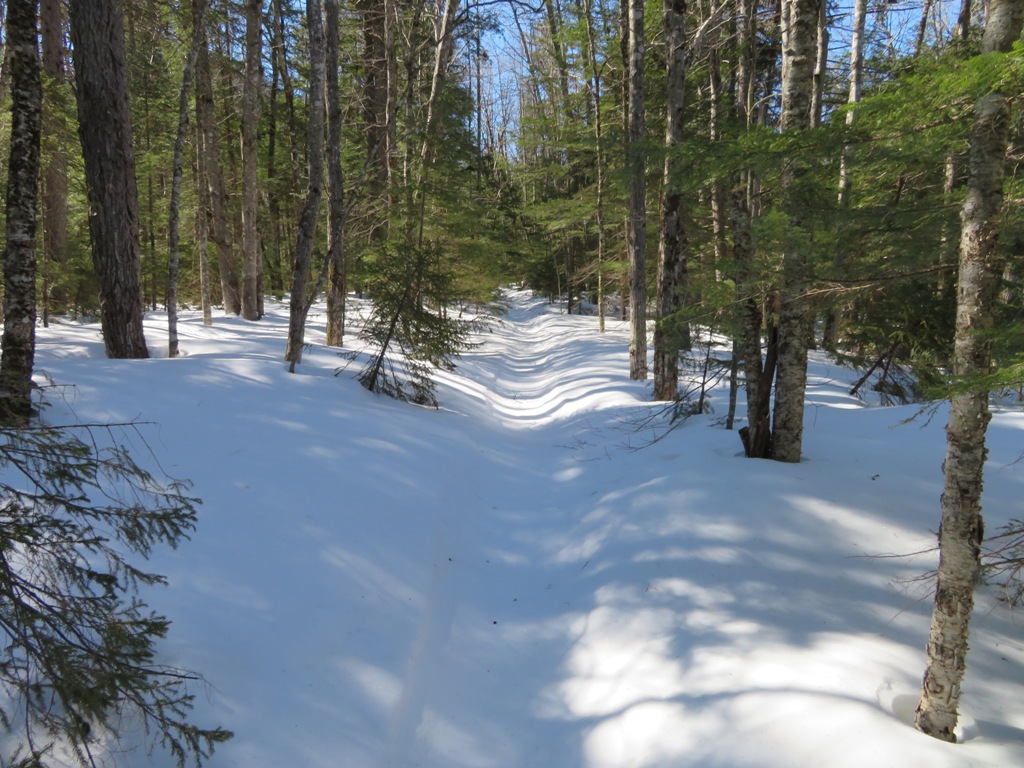
The trail follows an old logging road for a long stretch in a broad part of the valley.
Nice open woods.

Looking up the brook that flows off the Downes Brook Slide.

The snowpack at 1900 ft.

The
Downes Brook Slide, also known as the Passaconaway Slide, fell in the
early 1890s and for many years was the route from Albany Intervale to
the summit of Passaconaway, becoming known as the Downes Brook Slide
Trail or Passaconaway Slide Trail. The ledges of the slide are very
slippery in summer. A warning was added in the 1940 edition of the AMC
White Mountain Guide: “This trail is dangerous, especially
after a rain, and is not recommended to amateur climbers. It is not
signed for this reason.” Because of this danger, and also due to the
very steep, mossy, erodible section in the woods above the slide, the
trail was abandoned in the late 1950s. About 1990 unknown parties
attempted to unofficially reopen the trail, painting blazes on the
ledges of the slide and posting signs at both ends. Subsequently the
USFS, in cooperation with the Wonalancet Out Door Club, obscured the
unauthorized blazes and posted signs noting that while public use of the
area was welcome, unauthorized maintenance of this closed trail was
illegal and subject to fines. With the right conditions, the ledges of
the slide are great for snowshoeing, and there is virtually no impact on
the area.

Small cascades along the brook.

Emerging on the wide lower slabs of the slide, with the northern crags of Mt. Passaconaway looming above.

Old ski tracks from a couple of weeks ago.

View north to Mts. Pierce, Eisenhower and Tremont.

Pierce and Eisenhower.

The lower slabs are overlooked by Potash Mountain (R) and "South Potash" (L).

There are several ledge steps along the slide.

I skirted the steeper spots with bypasses up through the spruce woods.

A bigger ledge step, a cascade and pool in summer.

Various forms of ice.

The open slabs continue.

A solid snowy highway.

Higher up, the brook/slide track turns into a small canyon.

Getting around this section requires a sidehill traverse through the woods.

View back to Mt. Hancock.

Emerging onto the deep snowfield just below "the turn of the slide." At this fork the slide splits into two branches. The first branch - the one followed by the old trail route - turns right here. The main branch of the brook continues straight for another 200 ft. of elevation, then turns right onto the upper fork of the slide.

The lower fork of the slide rises over two large, steep open slabs before losing itself in the woods.

From my route ascending along the left edge of the lower slab, I could peer down at my tracks below.

The lip at the top of this slab afforded the first distant views to the north.

Mts. Monroe and Washington behind Mt. Tremont.

The Nancy Range beyond Green's Cliff. Mts. Field and Willey in back.

The upper slab is higher and steeper. Two winters ago, with wet snowshoe conditions conducive to making solid steps, I had snowshoed a zig-zag route right up the face. With the firm conditions today, I deemed the exposure too great and made a steep whack up through the woods to the right.

A slide-hopping snowshoe hare.

I emerged at the top of the upper slab above a screen of trees.

I worked my way across and down to a comfortable perch with a crystal-clear vista sweeping from the Hancocks across to the Carters, including 20 4000-footer summits.

Wildcats and Carters behind Bartlett Haystack.

The Presys behind Tremont.

Dropping down along the east edge revealed a peek at Franconia Ridge behind Mt. Huntington.

Hancock and Carrigain, with Zealand Mountain visible through the col to the R of The Captain.

With the sun at my back, an hour passed quickly at this marvelous wintry perch.

After descending carefully back to the "turn of the slide," I headed up the main branch of the brook, new territory for me.

Orange-flavored icicles.

Sunlight beckoned above this throat in the firmly-snowpacked slide track.

The upper fork of the slide in sight ahead.

This fork of the slide is longer and higher than the lower fork.

A major ice bulge above, time to make a steep bypass along the edge and through the woods.

View from the top of the ice bulge.

A wide snowy swath rising above, looking like a ski trail. Indeed, there were traces of old ski tracks.

Another view of Washington.

Continuing up to a smaller ice bulge. I was able to skirt this one along its right edge, carefully. The MSRs proved their worth today.

Another nice view above the second ice bulge.

I went a bit farther up to 3050 ft. The slide continues higher, but is more closed in by trees, and it was getting late.

Took a brief sit-down break before heading down.

Church Pond and Church Pond Bog down on the Albany Intervale.

Descending towards the upper ice bulge.

That was a slightly sketchy spot to descend.

Looking down at the lower, larger ice bulge.

Past that one.

Another steep spot, easier ascending than descending.

Homeward bound.

Down past the ice flows.

Looking up the lower fork of the slide to the northern crags of Passaconaway.

The northern outlook, reached by a spur path down off the summit (the uppermost part of the old slide trail), is up there somewhere.

Looking back.

Last sun on the lower slabs.


No comments:
Post a Comment