
A beautiful day to get up on the Carter Range. A slow climb above
Nineteen Mile Brook Trail with plenty of drifted snow to break through
and lots of sidehilling on the Carter Dome Trail.
There
was several inches of new snowfall even on Nineteen Mile Brook Trail.
There were only a few boot tracks in drifted powder on this
sometimes-sketchy spot along the bank of the brook, requiring careful
snowshoe placement. On the way back down near dusk there was a nice
flattened snowshoe shelf from weekenders heading into Carter Notch Hut.

On
the way in I chatted with Andrew, a strong hiker from Twin Mountain and
occasional visitor to the store. At this point he needed only three
peaks to finish his Winter 48 - South Carter, Carter Dome and Jefferson.
He broke trail ahead of me up to South Carter, and I was very grateful
for his efforts. Wouldn't have made it otherwise.

Along Nineteen Mile Brook.

Trail junction where the real work started.

Following Andrew's tracks. Though the "Protean Wanderer" had reported on a South Carter climb the previous day on NETC, the trail had to be broken out anew due to overnight squalls and lots of wind drifting.

One of the nicest parts of this climb is the birch glade section between the two brook crossings.

Kilkenny-like.

The second crossing was well-buried.

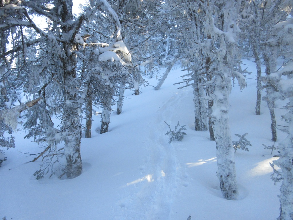
One of the several sidehilling switchbacks between the second brook crossing and Zeta Pass.

I couldn't believe there was this much soft snow atop the old track. Andrew was breaking, and I was "seconding," through 6-12" most of the way to South Carter.


The thing that really slowed the climb was long sections of uneven sidehilling along the switchbacks, with no evident track. Lots of stomping required to make a shelf. I assume this situation was created by the wind drifting. This pic was taken on the way down, after Andrew and I had packed it out on the way up, and a couple I met up on the ridge had packed it further on their descent.

I was happy to reach Zeta Pass and leave the sidehilling behind.

Looking back at Mt. Hight from a blowdown spot off trail.

One of the draws for climbing South Carter was checking out the massive blowdown areas from the October 2017 storm. These are quite visible on the latest Google Earth images. With untracked snow the trail is hard to follow in this particular spot. Andrew did a good job tracking it.

Nice corridor on the Carter-Moriah Trail.

I ran into Andrew as he was heading back down from South Carter. He was thinking of adding Carter Dome, don't know if he made it. That section of Carter Dome Trail has a particularly troublesome sidehill when unbroken. (I later found out that he did reach Carter Dome, going over Mt. Hight en route, then descending into Carter Notch. Congrats to Andrew - only one peak left to complete the winter 48!)

Love the woods on this ridge.

Typical closed-in section encountered on many high ridges right now with the deep snowpack. Above here I met a couple who had come across Middle Carter. They told of a rather arduous journey breaking trail and constantly pushing through branches. They were headed to Carter Notch Hut - a full day! These were the only other people I saw up on the ridge today.

Just below the summit of South Carter the trail climbs steeply through an open blowdown patch.

From here there was a preview of the summit viewpoint, looking back at Mt. Hight and Carter Dome.

Mts. Passaconaway and Whiteface could be seen in the distance through Carter Notch, with Wildcat Mountain on the R.

Andrew had seen a Pine Marten here.

The summit bump of South Carter.

With deep snowpack, the summit area offers a nice view east over the Wild River and Caribou-Speckled Mountain Wilderness areas.

Overlapping ridges.

Looking NE to Shelburne Moriah Mountain beyond the ledgy SE ridge of Mt. Moriah.

From the near-summit viewpoint (a vista available year-round from a small cliff reached via a short side path), you look south to Mt. Hight and Carter Dome.

From this angle, Carter Dome is a giant. The big 1869 slide is especially prominent in winter. The heavily drifted upper ridge along the Carter-Moriah Trail is a spectacular walk this time of year.

The Baldface-Meader Range rises beyond the massive eastern ridge of Mt. Hight.

The snow-cones of the Baldfaces.

I wandered a ways down the north side of the summit through a ghost-tree forest.

A wider view to the NE.

Looking down into the broad Cypress Brook valley. Each of the Carter Range peaks peers into a different valley in the Wild River Wilderness.

Middle Carter looms to the north.

Spooky tree.

Thru-hikers might not recognize this part of the AT in its winter guise.

Homeward bound. The descent took 2:25, compared to 4:30 on the way up.


No comments:
Post a Comment