A snowshoe trek to unique vistas in the Waterville Valley backcountry.
Thanks to the recent rain and re-freeze, Greeley Ponds Trail had a crusty, uneven snowshoe track.
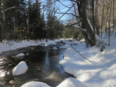
Along the Mad River.
At 1.3 miles I turned left onto the relocated Greeley Ponds Trail, which for the next 0.7 mile ascends gradually on an old logging road that was formerly part of the Timber Camp Trail.
After the awkward snowshoeing on the rough, hard-packed track (which was even worse for barebooting), I was pleased to find the Timber Camp Trail unbroken.
Respectable snow depth out here.
A short way up Timber Camp Trail there is a framed vista of the "K1 Cliff" on the west side of Mt. Kancamagus. Last summer I whacked up there and admired a high-elevation flume towards the left (north) end of the cliff.
Looking back for a first glimpse of East Osceola's Painted Cliff.
A couple sections of the trail were swamped in with bent-over small conifers.
A pleasant open woods stretch.
This large, open slope - a gravel bank in summer - is the prime viewpoint on the Timber Camp Trail.
A fine view of the Tripyramids, with Flume Peak and Scaur Peak (once called the Fourth Pyramid) on the L.
The Tris.
An imposing view of the Painted Cliff, named by Waterville hiker, trail-builder and historian Nathaniel Goodrich for its curiously-colored rock. According to Goodrich in his 1952 book, "The Waterville Valley," his brother Hubert and friends blazed a "Nature Trail" up towards these cliffs and back down to the Mad River. But shortly thereafter the path was obliterated by the 1938 hurricane. In the 1990s two friends and I snowshoe-whacked up to the talus slope at the base of the cliff. The closeup of the cliff was impressive, and the view out to the E was expansive. The whack was quite thick in places and our route took us through some scary terrain with huge boulders and deep holes.
The K1 (R) and K2 (L) cliffs on Mt. Kancamagus. This spot has a real backcountry feel, with wild and unusual scenery.
A clear look at the K1 Cliff and the talus slope below.
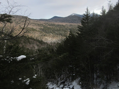
Looking north through Mad River Notch.
As
I was having lunch here, I realized that I had a snowshoe failure in
the loss of a clevis pin, resulting in a flopping useless binding. A
bungee cord came to the rescue, enabling me to continue the hike, though
it did come loose a couple of times. Any thought of a return to the
Painted Cliff talus was out the window.
Making tracks up the valley on the old logging road that the trail follows. An examination of old aerial photos on the USGS site suggests that this area was heavily logged in the 1960s. The floor and south side of this Greeley Brook valley are laced with old logging roads. Two documents found online note that this valley did hold old-growth spruce, but the 1960s logged areas now support a scrubby growth of young birch and conifer.
Deepest snow yet.
The Tripyramids from the upper clearing at the end of the Timber Camp Trail, a place known as "High Camp."
North Tripyramid and the North Slide.
Another angle on the Painted Cliff.
Looking back at the remote headwall of the Greeley Brook valley.
On the way back I made a steep bushwhack diversion down to Greeley Brook, seeking an open swath that shows up on the new Google Earth imagery from June 2018. When I reached the brook I could see that my objective was down below.
Steep and scrappy.
Two open rock perches atop a significant dropoff on the brook.
From one rock, a view across the Mad River valley to the SW ridge of Mt. Kancamagus.
Looking back up the rough-and-tumble stream.
From the other rock, a peek at Scaur Peak, Flume Peak and North Tripyramid.
Looking down the brook from this lofty perch.
One more look at the gravel bank view on the way back down the trail.


No comments:
Post a Comment