A snowshoe trek to two viewpoints in Waterville Valley on a gorgeous afternoon with excellent snow conditions.
The groomed Livermore Trail was smooth sailing.
On to the historic Kettles Path, which dates back to around 1890.
I was pleased to find a nice softly-packed snowshoe track on the trail. After the hike I saw on FB that Beth Zimmer (redline finisher #42) and three redlining friends had gone through here the day before. Thank you for packing it out! With the increasing popularity of redlining, trails that were seldom broken out in winter are seeing more travel.
One of the three "kettles" that the trail passes by. These bowl-shaped hollows were formed when chunks of glacial ice were stranded as the glacier receded. Sediments built up around the ice chunks, and when they eventually melted these hollows were formed.
The Kettles Path has its own "Big Pine."
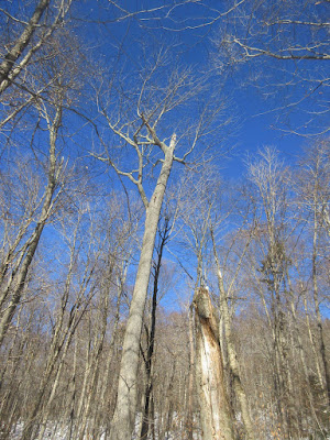
A giant,white ash, battered but surviving.
A great day to be snowshoeing in the woods.
Ledge band at the base of The Scaur.
One of the few traditional black-on-yellow WVAIA signs. This Waterville trail club maintains many trails on the nation's oldest trail network, which dates back to the 1850s.
The Scaur (2230 ft.) is a rocky nubble at the lower end of a long ridge descending westerly from Tripyramid's Scaur Peak.
Snow had filled in this ledgy slot at the top of the trail, which can be quite a little scramble if icy.
Summit ledge.
Low December sun makes for tough lighting looking south to Sandwich Dome and Jennings Peak.
The snow guns were cranking on the new Green Peak area of the Tecumseh ski slopes.
Lost Pass, the mysterious gap between a spur of West Sleeper and Snows Mountain. A long flat spur of East Sleeper peers over in back. The pass was so named by Waterville hiker and historian Nathaniel Goodrich, because trails through the gap built in 1860 and again in the early 1900s were subsequently abandoned and "lost."
Middle & South Tripyramid, with part of West Sleeper behind on the R.
East Osceola and the Painted Cliff, from the west side of The Scaur.
The sprawl of Mt. Tecumseh.
Mt. Osceola and its south slopes. I recently read in a 1948 issue of the Marcalog (a newspaper published by the Marcalus Manufacturing Co., the successor to Parker-Young Co.) that logs cut by crews from the Osceola Camp, located on the lower slope on the L in this photo, were used to build our house in Lincoln. Osceola Camp was also noted for its resident population of handout-seeking raccoons.
Summit of Osceola. The tip of the great Southwest Slide can be seen on the L.
The "Rock of Gibraltar" is a landmark along Irene's Path just east of The Scaur.
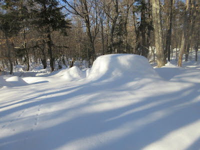
Good snow cover on this ridge.
A forest scene along Irene's Path. This trail was opened in 2014 after the Flume Brook Trail was badly damaged by Tropical Storm Irene and subsequently closed.
This is a wondefrul trail meandering upward along the Scaur Ridge, mostly along the sunny south side of the crest.
The forest is a mix of softwoods and hardwoods.
Snowshoe hare tracks.
Ridgecrest hardwoods at 2500 ft.
After a half-mile the trail drops down off the north side of the ridge, traverses the slope, then plunges steeply into the valley of Flume Brook. This pitch, steeper than it looks, is a magnificent rock staircase in summer, built by the pro Off the Beaten Path crew.
My destination was this unique viewpoint partway down the slope, looking north into Mad River Notch. The dark ridge in the distance is Owl's Head in the Pemi Wilderness. This has become one of my favorite vistas in the Whites - wild and unusual.
A neat view of the Osceolas, revealing the great spread of East Osceola's eastern face.
The
Southwest Cliffs and the K1 Cliff on the west side of Mt. Kancamagus. I
visited both of these on a bushwhack last summer. They are farther
apart than they appear here.
On the return trip I made a short bushwhack foray eastward along the hardwood crest of the ridge. The Tripyramids could be glimpsed through the trees.
A gnarled old beech.
This hardwood draw was inviting, but the hour was late. Time to head back.
A fast-sinking sun.
Serpentine snowshoe track.
From Irene's Path just east of The Scaur, I made a familiar shortcut bushwhack down the slope through open hardwoods and heavy deep powder.
Looking up at the cliffs of The Scaur.


No comments:
Post a Comment