
SABBADAY BROOK/MIDDLE TRIPYRAMID BUSHWHACK: 5/29/15
The long, curving valley of Sabbaday Brook has for many years been one of my favorite places for all-day wanderings. Tucked in among the Sleepers, the Tripyramids and the Fool Killer, it offers a real sense of seclusion deep in the Sandwich Range Wilderness. Today I wanted to explore a tributary of Sabbaday Brook that flows down from under South Tripyramid. Twice in the past year (most recently last week), from the summit of Hedgehog Mountain I had spotted what looked like a potential cascade shining through the trees. Depending on what kind of going I found, I thought I might also continue bushwhacking all the way to the summit ridge of Tripyramid, enjoy the views from Middle Tripyramid, and descend via the Sabbaday Brook Trail.
On a fine summer-like day, I set off a little after 8:00 am from the Sabbaday Falls parking area.

The three big crossings of Sabbaday Brook in the first mile were not difficult, as water levels were fairly low.

The gateway to the Wilderness.

For 1.5 miles the trail follows a straight old logging road from the early 1900s, high above the brook on the east slope.

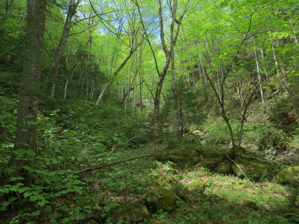
At the fourth crossing, the trail and brook swing to the west into the secluded upper valley, a sort of Magic Kingdom of the Sandwich Range.
In here the forest seems lusher.

A mini-meadow along the trail....

...carpeted with a profusion of purple violets.

Between the 5th and 6th crossings of the brook, the destruction of Tropical Storm Irene is evident. Care is required to follow the trail in this section.

Through the trees I spotted the junction of Sabbaday Brook with the tributary I wanted to explore.

At first I bushwhacked alongside the stream, but soon the valley walls closed in.
The lower part of the tributary was bone dry, but I figured there must be some water in it higher up.

This scene of rubble and dead trees looked like the runout from a slide.

Sure enough, this fresh-looking slide soon appeared on the left.

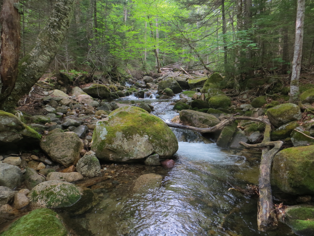
From here on up there was water in the brook. It was slow going up the ravine, alternating between hopping slippery rocks in the brookbed and sidehilling along the adjacent slopes.

Small cascades began to appear more frequently.


Higher up, I came to this steep mossy waterslide.

I made my way carefully up along the edge of the slab.

More mossy slabs.

This could be quite a cascade in high water. Of course at such times it would be difficult to get in here due to the big crossings on Sabbaday Brook Trail.I never did figure out exactly which spot I was looking at from Hedgehog.

High in the ravine I came to this beautiful emerald green sluice.

I parked myself on a flat rock at the base to take in this idyllic scene for a while.

Moving on, I climbed past this side view of the sluice.

Streamside lushness at 3000 ft. elevation.

Looking back down at this inner sanctum.

A peek at the Fool Killer. Here I left the brook and began climbing up and across the slope to the broad crest of Tripyramid's east ridge.

Partway up I chanced upon this surprise view out towards the Moats from an opening created by a blowdown.

From the same spot, the imposing cone of Mount Passaconaway.

After traversing across two steep little drainages, I climbed to the crest of the ridge through an unusual high-elevation hardwood forest.

At 3150-3200 ft., this is about as high as I've seen hardwood glades in the Whites.

Just above the hardwoods I came upon an old contouring sled road from the Conway Lumber Company logging operation of a hundred years ago.

From here I headed up the ridge through wonderfully open woods similar to those I've found on two bushwhacks on the slopes of the nearby Sleepers.

There were still some red trilliums in bloom up here.

The open woods went on for quite a ways.

I took a break at 3600 ft., where the woods were a mite thicker for a short distance.

This ridge was steep at times, but the footing was not rough, and the woods soon opened up again.

There are plenty of moose in this area.

Remarkably, I continued up through generally open balsam fir woods right to the Mount Tripyramid Trail on the south shoulder of Middle Tripyramid.

A short climb got me to the top of Middle Peak. Poking around the summit, I found this marvelous view down to the floor of the Sabbaday Brook valley.

Chocorua and Passaconaway.

The western view from Middle Tripyramid, with Mount Tecumseh seen across the Waterville Valley.

Mount Moosilauke is nicely framed through Thornton Gap.

The Osceolas, backlit in the late afternoon sun.
The Franconia Range.

Mount Whiteface and the Sleepers, with the Ossipee Range beyond.

A blackpoll warbler took a bath in a small water-filled pothole at the summit.

Wonder who put this wacky sign up here?

After a long summit stay, during which only two hikers came by, I headed north to the top of Sabbaday Brook Trail. Here I met a third hiker, Steve from the Albany, NY area, who had been into my store earlier in the spring. He was doing a two-night backpack on the Sandwich Range.

The upper half mile of Sabbaday Brook Trail is a classic "steep and rough"White Mountains descent.

Near the bottom of this section you must negotiate some tricky slabs from an old slide.

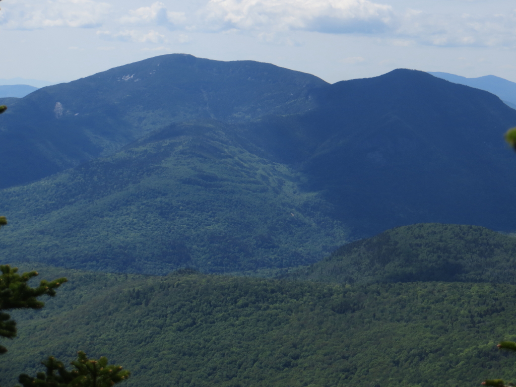
On the way back down the valley I made a short side trip off-trail to a familiar open gravel patch from an old slide on the Fool Killer. From here I could look up at the ridge I ascended earlier in the day. West Sleeper is seen on the left.

The beautiful upper valley of Sabbaday Brook. I hustled back down the lower several miles and made it out just at dusk, after a full day of adventure in the valley and on the ridge.

A GPS track from the day's adventure, displayed on Google Earth.

Great hike. Thanks for sharing it with us Steve.
ReplyDeleteThanks, Jim!
DeleteSteve
Steve, thanks for taking us along on another one of your classic bushwhack adventures that you so expertly document with your narrative and excellent photos.
ReplyDeleteHere are just a few of the many aspects of this venture that I found interesting:
_ the blackpoll warbler taking a bath in a small water-filled pothole. (With my limited knowledge, I don't know if this bird is uncommon, but do know that I've never seen one!)
_ hardwood glades being present at 3150-3200 ft is indeed interesting!
_ your photo of Mt. Moosilauke nicely framed through Thornton Gap was especially nice!
_ your experience of bushwhacking through generally open balsam fir woods right to the Mt. Tripyramid Trail on the south shoulder of Middle Tripyramid (I experienced something similar several years ago when bushwhacking up the headwall of the Little River Valley to intersect the Twinway trail.)
John
Thank you for your thoughtful comments, John! Blackpoll warblers are fairly common at higher elevations, but are far more often heard than seen. I was amazed at both the high hardwood glades and the open woods all the way to the ridge. I remember your report about that great Little River whack.
DeleteSteve