PLATEAU MOUNTAIN TRAVERSE: 5/6/15
With a cooler, crisper day in store, I opted for a traverse along the Devil's Path over 3840-ft. Plateau Mountain, unique among Northeastern mountains for its nearly level two-mile long summit ridge. With several viewpoints along the way, I knew I would be rewarded with some far-reaching vistas on this clear spring day.
The plan was for Mike to accompany on the short walk into the deep gap between Plateau and Sugarloaf Mountains via the old, officially abandoned (but still well-used) northern section of the Mink Hollow Trail. He would then head out for a day of R & R and pick me up in the evening at the trailhead on Rt. 214 in Stony Clove Notch.
The approach from the end of Mink Hollow Road was at mostly easy grades along an old roadbed.
In just 0.7 mile we reached the junction with the red-marked Devil's Path, perhaps the most famous trail in the Catskills, noted for its steep, rugged ups and downs.
First we checked out the Mink Hollow lean-to, tucked under the steep slope of Plateau Mountain.
To the east Sugarloaf looms through the woods. From this notch the Devil's Path climbs 1200 ft. in a mile on either side.
We climbed 200 ft. in elevation on the Sugarloaf side to find a geocache. This slope is full of rugged rock scenery.
It was an unusual cache container, some kind of survival kit bucket. The last recorded visit was in August of 2014.
An overhang on the trail.
Mike headed back down to Mink Hollow Road and I started up the stiff climb to Plateau, soon running into Laurie Rankin, Secretary of the Catskill 3500 Club, which I hope to join some day. Laurie had already climbed Plateau and was going for a second hike up Indian Head as part of her Catskill grid effort. And the next day she climbed Halcott!
Looking back at Sugarloaf through the trees.
Ascending through some rugged terrain.
Typical scramble on the Devil's Path.
The woods became sprucier above 3000 ft.
Along the last steep pitch there was a vista back to Sugarloaf and Katterskill High Peak.
A chimney scramble near the top.
The trail abruptly levels out at 3800 ft., and here a ledge provides a vista to the northeast, again featuring Katterskill High Peak. The nearly indistinguishable high point of Plateau is not far beyond this viewpoint.
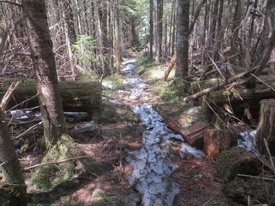
I was concerned there might be a lot of monorail and ice lingering on the long, level, spruce-wooded Plateau ridge, probably one of the last places in the Catskills to melt out. There were a few patches here and there, but thanks to the recent warm weather the ridge traverse was 90% dry.
One of the occasional patches of lingering monorail.
A half-mile along the ridge is the junction with the recently built section of Warner Creek Trail (aka Daley Ridge Trail), which ascends Plateau from the south.
I dropped down 0.2 mile and 200 ft. to a nice south-facing vista on this trail.
The Slide Mountain Range could be seen beyond Daley Ridge.
Then it was back up to the Devil's Path for a long stretch - more than a mile - of gentle spruce-lined ridge walking.
Towards the northwest end of the ridge the trail emerged into some hardwood glades carpeted with trout lilies.
Near the end of the ridge I acme to the rocks of Danny's Lookout.
This offered a great view of the northern part of the Escarpment, from North Mountain across to the Blackhead Range.
The Blackheads and "Arizona."
Zoom on the distinctive Blackheads: Thomas Cole, Black Dome and Blackhead.
Another tenth of a mile brought me to Orchard Point (sometimes called Orchid Point), the best viewpoint on Plateau. This big flat open ledge has a great view down Stony Clove to many distant peaks. It was a great place to kick back in the late afternoon sun.
Hunter Mountain is close by to the west.
Southwest Hunter, with West Kill just peeking over. The next day this would be the site of a major forest fire.
The Southern Catskills on the horizon. Between Orchard Point and Danny's Lookout I could spot 25 of the other Catskill 3500-foot peaks.
On the far left I could see out to Ashokan High Point and the far-off Shawangunks.
A good scramble was required to exit the Orchard Point ledge.
The Devil's Path makes a relentless descent of 1600 ft. in 1.3 miles down to Stony Clove Notch. The upper part of the descent is quite scenic with rocky terrain and gnarled birches and hardwoods.
There was even a brief leveling on a shelf with wildflowers.
From there on down there wasn't much level ground. In this section the trail crossed some interesting rock slides. The Devil's Path is certainly one of the most entertaining trails in the Northeast!


Steve, it has been a super treat to read the blog reports you've posted over the past few days regarding yours and Mike's adventures in the Catskills. You were so fortunate to be blessed with terrific weather. And, I feel certain that upon returning home, you had several days of delightful basking in the afterglow of such a wonderful trip.
ReplyDeleteYou got some magnificent photos, and as always, your narration did a marvelous job of taking your readers along for a vicarious experience.
John
Thanks, John - we really lucked out with the weather! Would love to get back down there in late fall.
DeleteSteve
'Always great to read of your Catskill adventures and so well illustrated with your photos! Thanks!
ReplyDeleteThanks, Catharus - we had a great week!
DeleteSteve