
On a beautiful spring morning I headed back down to the western NH section of the Appalachian Trail for a climb up another of the interesting smaller peaks dubbed the "Middle Connecticut River Mountains" in the AMC White Mountain Guide. At 2,110 ft., Holts Ledge is the smallest of the major summits in this loosely affiliated group.
Holts Ledge is named for the great bands of cliffs on its east face. For a number of years this has been a nesting site for Peregrine Falcons. The view of Holts Ledge seen here is from the NE, along the Lambert Ridge Trail on Smarts Mountain. The trails of the Dartmouth Skiway are seen on the R.

I like the southern approach on the Holts Ledge Trail better than the northern route, as it has more variety and better views. This end of the trail starts at a small parking area on Goose Pond Rd., 3.7 mi. from NH 10 in the town of Lyme.
 At first the trail descends gradually to an interesting beaver-dammed wetland, with a view of the southern face of Holts Ledge ahead. There are cliffs on this side of the mountain also, though they are much smaller than those on the east side.
 The beavers are still active in this area.
 The first part of the climb is through a piney forest that presumably was pastureland in days gone by.
 Farther up, the trail passes by some neat quartzite ledges.
 The trail cuts through a stone wall at an elevation of 1400 ft.
 Nice sunny hardwood forest in here.
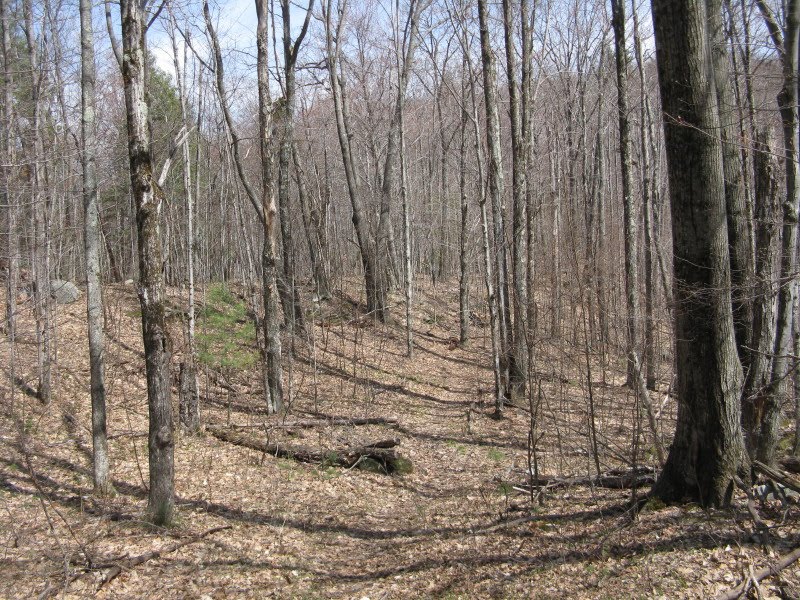
After crossing a snowmobile trail, the Holts Ledge Trail climbs through a gorgeous grassy, open hardwood area.

There had been little in the way of flowers up to this point, but here the spring beauties and trout lilies were starting to pop out.
 Some fine old trees in these woods.
 Where the trail swings L up the east edge of the ridge, a side path leads out to a grassy ledge with a fine view south. Goose Pond and Sunapee Mountain can be seen in the distance.
 Looking more to the east, Mt. Cardigan comes into view.
 Farther up there was some early saxifrage blooming right on the trail.
 The trail passes under a natural arch.
 I bushwhacked across through hardwoods to an opening atop one of the south-facing cliff bands, and found a nice view of Moose Mountain. North Moose is the prominent pointed peak, with rounded South Moose peeking out behind on the L.
 This was right next to the boundary markers for the AT corridor.
 Returning to the trail, I soon climbed into a serene ridgetop spruce forest.
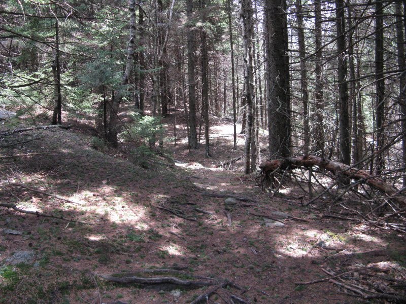 This trailisde ledge appears to be the high point on the wooded summit of Holts Ledge.
 The trail breaks back out into hardwoods and descends to a great east-facing viewpoint. This spot was not posted against access to protect the Peregrines, as the cliff underneath is fairly small and is some distance from the nesting site. I did see one of the magnificent falcons sail by, and even here visitors should refrain from loud talk or other excessive noise so as not to disturb the birds.
 Looking south towards Goose Pond.
 The wide eastern view out towards Cardigan.
 Trailless Winslow Ledge, much of which was added to the WMNF a few years ago, is nearby to the NE.
 Another 100 yds. north along the trail there is another (stand-up) outlook, facing more to the north, but this one is closer to the nest site and is posted until August 1 this year.
 Where the Holts Ledge Trail/AT turns L, a side path continues ahead alongside a fence; the area behind the fence is posted, both to protect the Peregrines and also to prevent trampling of a very rare plant community. According to the wonderful new book, The Nature of New Hampshire, the clifftop at Holts Ledge is one of only two locations in New Hampshire where the "Circumneutral rocky ridge" plant community is found.
 From behind the fence, Smarts Mountain can be seen to the north.
 The view SE from behind the fence.
From this viewing area I followed a path down to the top of the ski trails of the Dartmouth Skiway.
 Just below the ski building shown above, a memorial bench is positioned for viewing to the north.
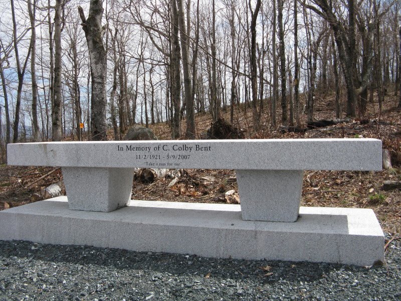 A nice view along the Middle Connecticut River Mountains. Mt. Cube on the L, then Lambert Ridge and Smarts Mountain. The white patch in the foreground was the only snow I encountered all day. Yay!
 I returned to the AT and continued a bit farther north, then bushwhacked through open woods towards Bear Hill, a western spur of Holts Ledge.
 A random quartzite outcropping in the forest.
Nice hardwoods in the Holts Ledge-Bear Hill col. The AT once passed through here.
 On the west side of the col stood this stalwart warrior tree.
 Though scarred by many battles with the fierce mountain weather, it still sends branches and budding leaves reaching for the sky.
 I took a winding route up the rather steep slopes of Bear Hill, and in a stand of red pines came upon a framed vista of North Moose.
 The 1948-ft. summit of Bear Hill is right along the AT land boundary and is marked by a cairn.
 A grassy oak glade covered the west knob of Bear Hill.
 Near here was a more open view of North Moose, extending out to the southern horizon.
I bushwhacked back across the broad saddle and up to Holts Ledge near its summit, then headed south on the Holts Ledge Trail. With a high gray cloud deck moving in, the lighting was very different from the sunny morning at the southern outlook along the trail.
 This was a rewarding spring trek with a lot of variety. Round trip from the southern trailhead over the summit and down to the fenced viewing area and top of the ski slopes is 4.6 mi. with 1600 ft. of elevation gain.

Steve, you're covering all my favorite local ground! Bear Hill is a neat place. Between the oaks and red pines, and the blueberry carpet, I bet the bears love it up there!
ReplyDeleteI forwarded your report to the boundary coordinator for DOC (Nichole Hastings) as she is working on making an assessment of conditions along the boundary in the DOC region.
Hi Jason,
ReplyDeleteI agree - Bear Hill is an interesting spot, that was my second visit there. Saw some leaves stirred up that could have been sign of a foraging bear. The boundary was pretty well-marked up there, and also where I saw it on a couple of short whacks off the Holts Ledge Trail near and south of the summit.
Steve