Saturday, November 6, 2021

Sunny Side of Tripyramid: 11/5/21

Sunshine all day, endless hardwoods, no ice on the trails, and crisp views from two slides - what more could I ask for on a day in early November? I had just been up the 1869 South Slide on Mount Tripyramid Trail to South Tripyramid in mid-October, but today was much sunnier and some hardwood bushwhacking beckoned en route to both the 2011 and 1869 South Slides. On a clear day this flank of Tripyramid has sun pretty much all day long.

Livermore Trail was sunlit and peaceful. Saw just two people, out for a stroll. It's a pleasant way to easily get out into the Waterville backcountry.


White Cascade on Slide Brook was flowing nicely. I think I'm close to gridding this spot out.


This pipe is the only artifact I've ever been able to find from the first Avalanche Camp near the junction of Slide and Avalanche Brooks, in use during the 1910s and 1920s. Perhaps the site was mostly obliterated when the gravel road followed by Livermore Trail was built in the 1940s.


The crossing of Avalanche Brook at the start of Mount Tripyramid Trail was pretty easy, using slightly submerged small rocks.


Snazzy new sign this year.


A fine day for wandering in the Wilderness.


Slide Brook.


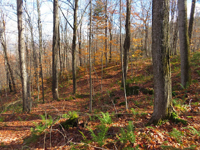
November is a favorite time for hardwood bushwhacking. I left the trail about a mile in from Livermore Trail and spent the next hour or so ambling up through the open hardwoods on the slope to the north of the trail. No particular destination, just the pleasure of climbing through some of the 400 acres of forever-wild hardwood forest on the west slope of Tripyramid, between the south and north links of the Mount Tripyramid Trail.


Sunny hardwood bliss.


November log art.
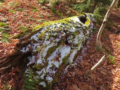


Pretty tough whacking.


This appeared to be, at ~2900 ft., one of the higher tote roads of the mid-1900s logging operation on the west flank of Tripyramid.


Back to the trail after nearly a mile of leisurely rambling.


From the base of the 1869 South Slide (the slide followed by the trail), I cut across to the runout track of the smaller 2011 South Slide dropped by Tropical Storm Irene, and followed the brush-grown gully upward.


One bit of brush in a shady spot was encased in ice.


Breaking out onto the slide.


Not a long slide, but a pretty impressive gouge.


Nice spot for a late lunch in the sun. Sandwich Dome sprawls to the SW.


Side view, with Mt. Tecumseh in the distance.


Cracks in the bedrock provide footing for tiny conifers.


There are several of these thin-stripe intrusions in the mozonite bedrock. Hiker-geologist Thom Davis says these are "aplite dikes."


View from higher up on the slide.


I climbed nearly to the top of the 2011 slide, then bushwhacked up and across through dense scrub to the trail on the 1869 slide, at the top of the lower open area (3440 ft.). Views were really sharp, here looking over the wild Lost Pass region.


Expansive views as I descended the trail along the slide. In the distance I could spot several Vermont peaks, including Dorset Peak and snow-capped Killington Peak.


Looking back through the hardwoods to the ridge on the way down the trail. Because of the good footing and easy grades on Mount Tripyramid Trail and Livermore Trail, it takes this fairly slow hiker only two hours to exit 4.5 miles from the bottom of the slide. Didn't even have to pull out the headlamp.


Tuesday, November 2, 2021

Owl's Head (Cherry Mountain): 11/1/21

After waiting for early morning clouds and showers to dissipate, I made the stiff climb up the Owl's Head Trail to the ledges of Owl's Head (the north spur of Cherry Mountain), one of the great viewing perches in the Whites. Views were spectacular on this clear, crisp, breezy afternoon.

Owl's Head Trail is an "outlier" (away from Randolph) maintained by the Randolph Mountain Club. 


After an initial mucky stretch, the trail follows an old logging road through a regenerating forest. The first 1.1 mile is on private land.


After crossing Stanley Slide Brook, which is also the revegetated track of the famed 1885 Cherry Mountain Slide, the trail enters the WMNF and ascends through open hardwoods. 


This section is a long, stiff climb, ascending 1,000 ft. in 0.8 mile.


The upper part of the trail used to follow the overgrown track of the 1885 slide, with steep and eroded footing. In 2000 the RMC cut a relocation that gains the ridge by a long switchback, a much more sustainable route. Before heading up that way, I made a short bushwhack to check out the old slide track.


Just before cresting the NW ridge of Owl's Head, the relocated trail passes an obsolete WMNF boundary sign. About 450 acres around the Owl's Head Trail, below this former boundary, were added to the WMNF in 2006.


Attractive stretch of trail ascending the NW ridge.


The trail is steep again as it zigzags up the sharp cone, then it eases in mossy conifers at the top.


The 3,258-ft. summit is a wooded ledge.


There is a limited NW outlook towards Vermont's Northeast Kingdom at the summit.


By descending just a few yards south on Martha's Mile you come to a ledge with a vast westerly view.


On this crystal-clear day Roundtop in Quebec could be spotted through Willoughby Gap, between Mt. Hor and Mt. Pisgah.


The prize ledges of Owl's Head are just a few yards down from the west-viewing ledge.


Here is perhaps the best of all views of the Presidentials, with every peak in sight, from Madison to Webster. The Dartmouth Range is in the middle distance, and in the foreground are "The Humps" on a spur of Cherry Mountain. Below The Humps is a remote, trailless little basin known as Walker Valley.


Mt. Washington had a light topping of frost.


The Northern Presidentials, featuring a good look into Castle Ravine.


Peering down into the seldom-visited Walker Valley. One bushwhacker who passed through there in May found Dutchman's Breeches blooming along Streator Brook - sign of an enriched hardwood forest.


The ledges also offer an interesting angle on Mt. Chocorua sighted through Crawford Notch.


I went over for a look at the short but very steep drop of Martha's Mile off the summit.


Parting shot - a hard place to leave.


In the summer of 1885, three weeks after the fall of the Cherry Mountain Slide, AMC member
M. V. B. Knox ascended the slide and made a number of observations, which were published in the March 1886 Appalachia.. Just a couple hundred feet below the summit of Owl's Head, he noted a large ledge next to which was the apex of the slide. I wondered if this trailside outcrop was that ledge. It's located at the point where the old route of the trail - which followed the slide track - appears to join the top of the relocated section.


Partway down the trail, this champion yellow birch stands proudly a short distance to the west.


Now that's a burl!


Farther along, I made a steep bushwhack down to Stanley Slide Brook and the gouged track of the 1885 slide. In his examination of the then-new slide, M.V. B. Knox reported that "the ravine and track at the bottom of the course were sometimes as much as sixty feet below the highest deposit of the debris." Though commonly called the Cherry Mountain Slide, it was also known as the Stanley Slide, after Oscar Stanley, whose farm at the base of the mountain was devastated by the avalanche of debris. One of his hired workers, Donald Walker, was fatally injured in the slide. It seems possible that his name was applied to Walker Valley on the other side of the mountain.


In this section the track of the slide was wider.


I wondered if these ledges were exposed by the scouring of the slide. The slide was a major tourist attraction for some time after it fell; special excursion trains were run to the site and thousands came to view the scene. A good recounting of the Cherry Mountain Slide tale is found in the book Shrouded Memories, by Floyd Ramsey.