The weather was perfect on this Easter Sunday: in the high 60s, clear and sunny, only a slight breeze. Carol and I decided to spend most of the day outdoors and close to home, rambling around the easy trails at Lincoln Woods with a little bushwhacking thrown in for good measure. The combination of record-setting warmth in recent days and deep snowpack up in the mountains had the East Branch of the Pemigewasset raging as we set out late morning.
Looking south from the footbridge at the start of the Lincoln Woods Trail.

Looking north from the bridge.
 There were only a few people out on the trail. Conditions were excellent -- dry with no snow or ice and very little mud.
A couple of sled runners could be seen at the clearing of logging Camp 8, on the left just after the Osseo Trail junction.
 We took a break where the trail comes by the river just past Camp 8, with a view of West Bond upstream from one spot.
 A few yards farther is the classic East Branch and Bondcliff view. This open spot is a great desitnation for an easy short hike, giving even non-hikers a glimpse of the grandeur of the Pemigewasset Wilderness.
 Another logging camp, probably Camp 7, is found by the junction with the Black Pond Trail. Tucked in amidst the shovel blade and pail were remnants of old loggers' boots.
Right by the junction a twisted bedframe was on display.
 The entrance to one of the nicest little trails in the mountains.
 The first part of the Black Pond Trail follows a short railroad spur.
Just off to the left is the Ice Pond, where Birch Island Brook was dammed by J.E. Henry's crews to make ice for refrigeration in the logging camps. Across the pond/meadow are spurs of Whaleback Mtn. (L) and Mt. Flume (R). Many wood frogs were giving forth amorous croaks in the shallow pond.
 Mt. Flume with its distinctive NE ridge.
 Not far beyond the Ice Pond is the site of a smaller camp; the trail passes right through it.
 Hidden in the brush was what might be part of the top of an old cookstove.
The Black Pond Trail meanders alongside Birch Island Brook for a while. This cascade can be seen just before the trail and brook part ways.
 Approaching Black Pond on the mellow woodsy path.
The great southern spire of Owl's Head rears up as you pass by the outlet area of the pond.

You also get a good look at the wild SE cliffs of Owl's Head.

Black Pond is a supremely peaceful place, with a view across to Bondcliff and its sharp southern spur. There is a fine spruce-shaded sitting rock from which to take in the scene. This side of the pond was still iced over.

A closer look at Bondcliff.
 We followed the muddy Owl's Head peakbagger's herd path partway around the pond, then a less-used fisherman's path around to the north shore....
....where a sun-warmed sitting rock awaited.
 Open water - a welcome sign of spring! As we sat here, two winter wrens dueled it out with their tinkling and trilling odes to the forest.
Farther around the shore is another rock with a vista of Whaleback and Flume.
 Springtime, and the livin' is easy...
Following nap time, we bushwhacked up a steep slope behind the pond.
 I dropped down another slope to peek at a desolate beaver swamp nestled in the woods just NW of Black Pond.
A happy bushwhacker makes her way through open hardwoods.
 We came down to the "fisherman's path" along Franconia Brook, at a point where the stream splits around a large island. This path is sometimes used to avoid the big brook crossings en route to Owl's Head, but it is rough, muddy, obscure and strewn with blowdown.
 The brook was roaring from snowmelt - you would not want to slip and fall in!
 During calmer times there is a placid pool under this overhanging ledge.
 The brook races around the bend.
 From the stream edge at the top of Franconia Falls, North Hancock rises in the distance, marked by the big Cedar Brook slide.
 We found a safe spot to admire the watery chaos of Franconia Falls. No way would you want to venture out on the granite ledges today; most of them were underwater. Hard to believe it hadn't rained for five days.

After being mesmerized by the falls for a while, we headed down the spur trail to the Lincoln Woods Trail, and stepped out onto the footbridge for a look up Franconia Brook towards Mt. Flume.

We then followed an old side path down for an intimate look at the confluence of Franconia Brook and the East Branch. Alot of water surging through here.
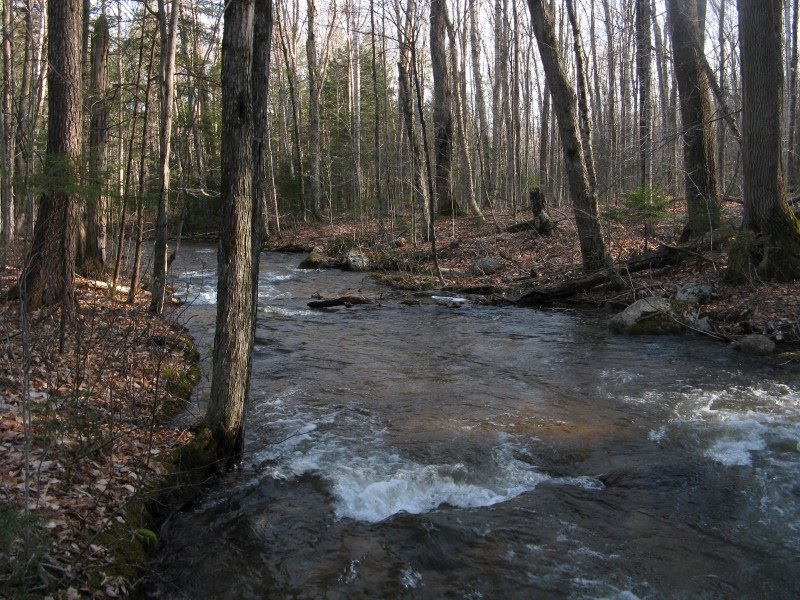
 During our homeward trek on the Lincoln Woods Trail I made a brief probe up along Birch Island Brook. It's a pretty little stream, and someday I hope to follow it up through its long valley to its headwaters, high on the eastern flank of Mt. Flume.
 Where Birch Island Brook empties into the East Branch, we enjoyed an impressive view downstream to Mt. Osceola and its Middle and West Peaks. If you're not in a hurry to get to some distant peak(s), Lincoln Woods is a wonderful place to tarry, and to explore. Our 7 1/2 miles of mostly easy walking had revealed a tremendous variety of scenery and interesting features. We feel blessed to have a place like this just four miles from our home.