
Not to be confused with the better-known Basin of Franconia Notch (a pothole in the Pemigewasset River), New Hampshire's "other" Basin is a beautiful, low-elevation glacial cirque carved out of the east side of the Baldface-Royce range on the south side of Evans Notch. The grand scenery at Basin Pond - which can be reached by car when the side road off Route 113 opens later in the spring - makes this one of the premier picnic spots in the Whites.
Looking for a mostly snow-free trek with a wide variety of scenery, I planned to walk up to Basin Pond, then follow the Basin Trail up through the hardwood-cloaked cirque, past picturesque Hermit Falls, and on up the steep, dramatic headwall climb along the base of a great cliff. There would be views over the Basin to savor along the "Basin Rim," and if conditions allowed, a search for an off-trail ledge with a vista over the Wild River Wilderness.
An easy walk up the side road brought me to Basin Pond on a gorgeous spring morning. Out on the mostly ice-free pond I saw common and hooded mergansers.
 I could see that the headwall of The Basin was mostly free of snow, except for a small strip along the base of the cliff - which, given the steep terrain, could prove problematical.
 The Basin Trail leaves from the pond parking area and runs through the woods above the south shore.
A view back across the pond to Long (left) and Sugarloaf (center) Mountains, where I had enjoyed a sunny bushwhack two weeks earlier. Basin Pond was created by a dam in 1969; the embankment can be seen on the right side of the photo.
 Just west of the pond the trail passes a wetland with several beaver lodges and a striking view across to cliffs on a SE spur of West Royce Mountain. Most likely there were beaver ponds here before the manmade pond was created.
Another wetland along the trail.
 These cliffs look inviting, but the bushwhack would be rather steep!
 A look back at Blueberry Mountain.
 There are several brook crossings on the floor of the cirque; the main stream, Basin Brook, is crossed via this footbridge.
 The flat floor of The Basin is nearly all hardwood forest, bright and cheery on a sunny spring day.
It's an easy walk up to the side loop to Hermit Falls.

This is my favorite cascade of the many found in the Evans Notch region. A lovely spot in a hemlock ravine, with flat sitting ledges at the base.
 The loop trail climbs steeply alongside the falls, providing a sideways perspective.
 A down-look from a nearly flat ledge at the top, accessed by a careful rock-hop.
A small cascade above the falls.
 Above Hermit Falls, the Basin Trail climbs steadily through a fine hardwood forest.
 Interesting boulders litter the woods as you approach the headwall cliffs.
 The last quarter-mile follows a rather precarious shelf along the base of the big headwall cliff - a unique and memorable stretch of trail.
 The footing is a little tricky along this steep sidehill.
 Nearing the top of the cliff-base section.
 The final pitch up to the Basin Rim was buried under a layer of hard old snow, with the potential for dangerous postholing into spaces between rocks. Slow and careful was the mantra here.
 A look across the cliff with the West Royce spur beyond.
 The trail abruptly tops out on the ridge, and a few steps left a viewpoint opens out over The Basin.
 As expected. there was still plenty of snow up here. Time for the MSRs. Only in spring would I be carrying both snowshoes and Crocs.
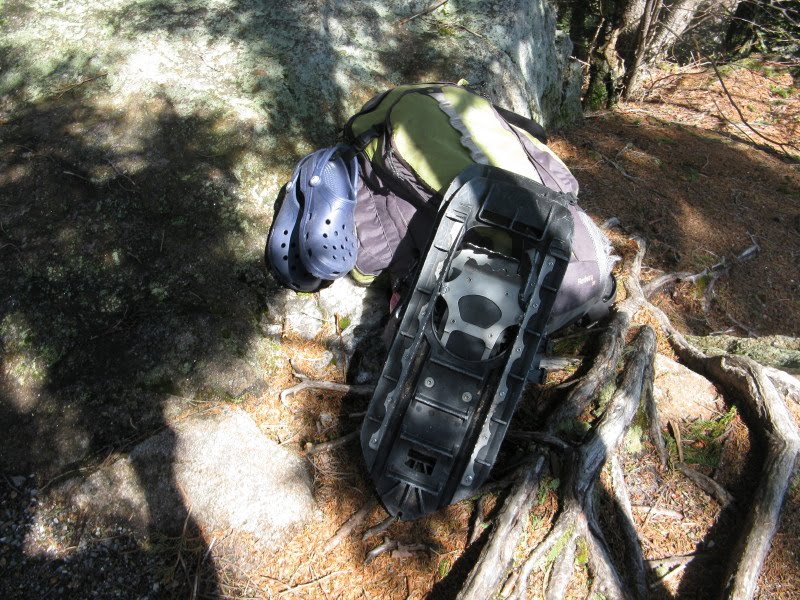
There are several trail signs at the five-way Rim Junction.
 The Wild River Wilderness begins on the other side of the junction.
 The Black Angel Trail leads down into the Wilderness, an area that sees few winter adventurers due to its inaccessibility.
I headed north along the Basin Rim Trail, passing this view of the West Royce cliffs.
 The snow was patchy in places on this section, and the snowshoes took a bit of a beating.
One of the nicest spots along the Basin Rim is this ledge, fringed with grass and gnarled old oaks.
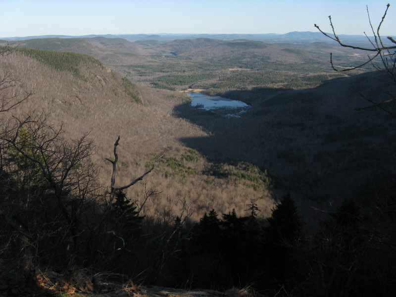
 The view down to Basin Pond and out to the eastern horizon.
I spent some time here relaxing in the sun. The dark mass of Mt. Meader looms to the south.

After a nice break I continued north along the Basin Rim Trail; from here on the snow cover was continuous. The goal was to find an off-trail ledge to the west of the trail, which had shown up as a white patch amidst the woods when viewed from Mt. Hight a couple weeks earlier.

I headed into the woods at a bend in the trail and began contouring across at what I thought was the correct elevation. Despite temperatures in the 60s, the deep snow was firm and provided good spring snowshoeing. But after 45 minutes of searching, including a steep climb through scrubby growth higher up the slope, there was no open ledge in sight.

From the scrubby area I did find a few framed vistas through the trees, including this one of Carter Dome and Mt. Hight...

...and another of Middle and North Carter.
 A small ledge offered a view south to North Baldface and westerly spurs of Meader Ridge.
I returned to the trail, resigned to the fact that I was skunked in my search for the open ledge. Then, I decided to spend a few minutes looking lower and farther south along the slope. A short way down I came to a dropoff with a framed view of the Moriah Brook valley. Hmmm...this looked promising. I heard a junco singing off to the left - maybe from a more open spot?
 Yes! The ledge had been found. A wonderful spot looking across the Wild River valley to the Carter-Moriah Range, even if it was backlit late in the day.
 Perhaps the best perspective I've seen on the spacious Moriah Brook valley.
 Mt. Moriah, showing some of the many ledges on its upper eastern slopes, lots of birch woods below. This area was burned in 1895 during the massive Wild River Railroad logging operation.
 A closeup of Shelburne Moriah Mountain.
The long Bull Brook valley, trailless except at the bottom, enclosed by the three Moriah peaks.
 The Carters seen over a nameless spur that rises above the Blue Brook valley.
Middle and North Carter above the long eastern ridge of Middle Carter.

After an hour spent lounging on the snowy ledge in the balmy late afternoon sun, it was time to head for home. As I returned along the Basin Rim, the shadow of Mt. Meader was spreading across The Basin.
Back down by Basin Pond, the evening residents were stirring: a beaver slapped its tail in warning, a woodock gave its nasal "peent" call, and a barred owl hooted, over and over. A nice conclusion to a fine spring day spent in and around The Basin.

No comments:
Post a Comment