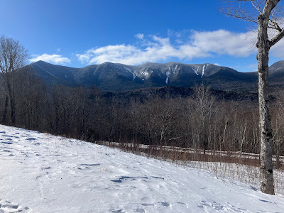
A view over the frozen North Fork of Hancock Branch to the south ridge of Mt. Hitchcock.
Plenty o' snow out here.
If you look closely, in the center of the photo you can just make out the top of South Hancock peeking over the treetops.
Beautiful open spruce woods abound out in the North Fork valley.
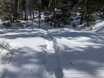
Turning onto the Cedar Brook Trail. It looked like no one had headed out to Hancock Notch in quite some time.
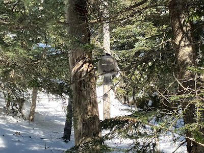
The perils of barebooting in a deep snow winter.
Semi-open bog country approaching the Hancock Loop Trail junction. A palpable sense of remoteness out here, just 2.5 miles from the road.
A view up to North Hancock and its slides near the loop junction. The famed Arrow Slide is on the right. To the left is "Little Arrow Slide," which I visited last summer.
At the loop junction, the established track veered left towards North Hancock. Only some random tracks heading towards South Hancock.
A great look at the Arrow Slide as the trail descends to a flat spot at the base of the steep climb to North Hancock. Before the Hancock Loop Trail was cut in 1965-1966, the slide was the preferred route for climbing North Hancock. A description of the slide remained in the AMC White Mountain Guide through the 1972 edition. The Arrow Slide was used as the ascent route by two AMC groups - the first led by noted winter trip leader Robert L. Collin and the second including the renowned mountaineers Robert and Miriam Underhill - for the first known winter circuit of the Hancock peaks on March 6, 1960. “There were ice cliffs in the middle of the slide,” wrote Nancy L. Collin in Appalachia. “In places the snow-cover over base rock and ice was thin and the footing tricky. A few ice steps had to be cut and many steps were whacked through the crusty snow.”
Just past the Arrow Slide view I ran into the only other hikers out on Hancock this day, snowshoeing up to the junction - two familiar faces, as it turned out. Phil McAfee (R), an avid hiker who lives in Ellsworth, was a teammate during my years on Pemi Valley Search & Rescue. Don Lester (L) is the longtime owner of Northern Lakes Veterinary Hospital in Ashland, who is retiring at the end of this month. About ten years ago Dr. Lester saved the life of our cat, Minnie (who was rescued from the Beaver Brook Shelter on Mt. Moosilauke in December 2007 by Cath Goodwin, but that's another story). The delicate surgery gave Minnie several more years of happy life in our home.
The climb up North Hancock is one of the steepest in the Whites - 1100 ft. of vertical rise in 0.6 mile. It starts out at a relatively moderate grade.
But soon enough it shoots up a long, relentlessly steep pitch that had been buttslid into a trough. The televators were a key aid in ascending this stretch.
Farther up the climb finally eases off in open firs.
Tunneling through scrubby conifers.
What a sky!
Just below the summit the trail passes through an open fir wave.
With deep snowpack this patch opens a beautiful view to the south.
Barebooters beware!
It took me more than an hour to complete the steep climb to the summit. The start of the trail heading towards South Hancock looked like it would be a maelstrom of drifts and spruce traps.
I immediately headed along the side path to the south outlook. The sun was brilliant, there was little wind, and the clear air provided 100-mile visibility. A fair reward for the effort!
The high peaks of the Sandwich Range - Passaconaway, Whiteface and Tripyramid - rise behind South Hancock.
The Osceolas and Scar Ridge sprawl beyond the North Fork valley. Far to the SW I spotted Stratton Mountain and Mount Snow in southern Vermont - the latter 105 miles away.
One of the finest views of the O's.
Looking SE over Middle Hancock to Mt. Paugus and Mt. Chocoura. With the sun and lack of wind, I was able to spend an hour up here savoring the views from this remote peak, which I had to myself on this afternoon.
Heading back through the fir wave, I had a glimpse of Mt. Carrigain.
Last look at the view.
The steep descent was slow and tedious. I'm not a willing buttslider, especially alone on a long steep pitch, four miles from the road and late in the day. So I slowly tiptoed down, trusting the traction on my MSRs to keep me upright, which it did.
Approaching dusk on the Cedar Brook Trail.
Thanks to my long summit stay, the last easy mile on Hancock Notch Trail was done by headlamp. It was worth it!


Terrific day out there! It was great to see you Steve!
ReplyDeleteGreat to run into you guys, Phil! It was a fine day, the views were superb.
Delete