Taking advantage of a rare partly sunny day with low humidity, I enjoyed an 8 1/2 mile loop on the slopes of Mount Adams, using portions of six trails. Along the way I visited two 1927-vintage slides in Cascade Ravine and spent an hour plus enjoying the remarkable views from the crag known as Emerald Bluff.
Normally I would approach this area via the lower Castle Trail, but having concerns about a possible high-water crossing of the Israel River, I opted for the slightly longer approach via Lowe's Path and The Link. I parked at Lowe's Store (where parking seems fine in summer as long as one stays away from the construction staging area at the east side of the lot) and walked along busy Route 2 to the start of Lowe's Path.
The historic Lowe's Path.
This heavily used path has received lots of trail crew attention over the years. Even so, the lower section had extensive muddy sections - not a surprise given our monsoon summer, but curiously, none of the other trails I walked had any significant mud.
The Randolph Paths guidebook designates this as "Whale Rock."
Fine hardwood forest surrounds the lower section of Lowe's Path.
On to The Link, one of several fine trails laid out by the great trail builder, J. Rayner Edmands. The original six-mile length of this connecting trail angling across the slopes of the northern Presidentials dates back to 1893.
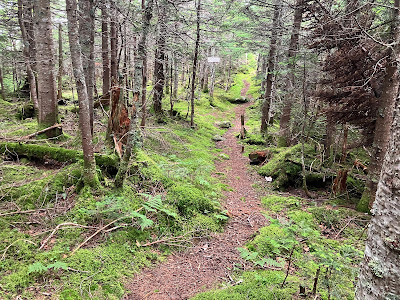
The Link has a certain notoriety among hikers based on its extremely rough section between the Castle and Caps Ridge Trails. That 1.6 mile segment was not part of the original route, but was laid out in 1955. Much of the original route of The Link provides delightful walking at easy grades on a lightly-trodden footbed, such as the section shown here.
As it approaches the Israel Ridge Path, the trail becomes a rougher sidehill route, more akin to the dreaded Castle to Caps section.
Upon turning onto the Israel Ridge Path, I was immediately presented with this spicy scramble. The trail traverses some gnarly terrain as it climbs steeply alongside Cascade Brook.
The Link and Israel Ridge Path coincide for a short distance, then The Link drops down to the top of the First Cascade - well worth the quick side trip.
A ledge shelf atop the cascade provides a view up to Mt. Bowman.
A pair of ladders aids in the ascent to the Second Cascade.
Broad sloping ledges flank the Second Cascade.
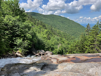
A wonderful spot for a break on the slabs, with the cascade surging beside you.
Sweet summer skies over Mt. Bowman, with a peek out to Vermont's Northeast Kingdom.
A big thanks to the Randolph Mountain Club, which maintains all six trails I walked on this day.
There's a tricky crossing of Cascade Brook just above Second Cascade. I put on my Crocs and waded knee-deep through the pool on the left. As I was putting my boots back on at the far side, a younger guy deftly hopped across. He had come up the Castle Trail to Israel Ridge Path, and said he had waded the Israel River crossing without much trouble. Before starting my hike, I had checked out the trailhead at Appalachia, which was overflowing with cars out on Route 2. As it turned out, on a fine summer day this was the only hiker I saw all day on these less-used trails.
One of my objectives for the day was to visit the mostly revegetated track of an old slide that fell a short distance to the west of the Israel Ridge Path, where the trail begins its climb up Israel Ridge. This slide, along with several others in both Cascade and Castle Ravines, fell during the great rainstorm of November 1927. This particular slide has some historical significance in that it destroyed the shelter known as Cascade Camp, which was located on this side of Cascade Brook between the First and Second Cascades. It was originally built as a birchbark shelter by J. Rayner Edmands and several associates in 1892, and the great trail-builder welcomed many friends as guests there in the ensuing years. As recounted in Peaks & Paths, Judith Maddock Hudson's excellent history of the Randolph Mountain Club, Edmands was particular about things at Cascade Camp and his other camp, The Perch: guests should remain in bed until Edmands had eaten his breakfast of oatmeal and coffee, and dishes were to be washed with sand, not soap, and dried with moss. Edmands passed away in 1910, and two years later his niece donated Cascade Camp to the Randolph Mountain Club. The RMC immediately repaired the structure, and that September 38 people attended the RMC annual picnic at the camp. The next year over 80 hikers attended the annual picnic at the camp. A photo of that event is seen on the cover of Peaks & Paths.
The popular shelter was totally destroyed by the 1927 landslide, and was never rebuilt. A short bushwhack brought me to the remnants of this slide, which is mostly filled in with a dense growth of small spruce of varying heights. On parts of the slide the growth is small and sparse enough to still permit good views out to the north, nearly a century after it fell.
A nice spread of the Pliny Range, including Mt. Starr King, Mt. Waumbek, South Weeks and North Weeks (with Middle Weeks in front). Mt. Cabot peers over between the Weeks peaks.
Ledges at the head of the slide.
The spruces are taking over.
Trigger point at the head of the slide. This was one of 30 slides visited and documented by Edward Flaccus for his authoritative 1958 Duke University dissertation, Landslides and Their Revegetation in the White Mountains of New Hampshire.
Sheep laurel was blooming on both of the 1927 slides I visited.
The sun highlights the long, narrow track of a slide that fell during Tropical Storm Irene in 2011. A dozen years later it is almost completely revegetated.


No comments:
Post a Comment