With a forecast for sunny skies, I wanted to climb one more high peak with deep snow views before snow conditions go south with next week's big warmup. The summit of almost-4000-footer Sandwich Dome (3992 ft. by the recent LiDAR survey) is one of those spots where late-season snowpack lifts you to wider vistas. At such times the view north from the Dome is one of the best in the Whites. Since the summit is mostly wooded, it would be possible to enjoy the views for a while despite the predicted high winds (up to 100 mph on Mt. Washington). With a late morning start at a temp of 44 degrees (warmer than predicted), I hoped there would be a reasonably firm snowshoe track on the Drakes Brook Trail, and that the crossing of Drakes Brook would be passable.
I didn't like the looks of the rutted entrance to the trailhead parking lot (especially since I was driving my wife's car), so I parked at the entrance to Waterville Campground and did a 0.6 mile road walk to the trail. As I snowshoed up the first part of Drakes Brook Trail ( a groomed XC ski trail in winter, though not open for skiing at this time), I encountered two hikers heading back out. They had scouted the Drakes Brook crossing and felt it would not be feasible to get across with dry feet. When I got there, I found the brook was wide open, its snow bridge long gone. After removing my snowshoes I was able to cross using a few underwater rocks.
The grades are mostly gentle in the lower part of this nice secluded valley.
After a section of steady climbing, the grade eases again where the valley broadens in its upper reaches. Along here I met a descending snowshoer who reported that the track was firmer up on the ridge.
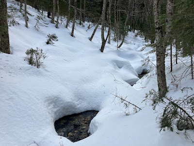
Close to a three-foot snowpack here.
Along one especially nice stretch the trail follows the brook closely.
The wind was whipping through the scrub at the summit clearing, but I could immediately see that the views would be phenomenal. In the 19th century the summit was more open, with views all around, prompting Moses Sweetser, editor of the comprehensive The White Mountains: A Handbook for Travelers, to call this “one of the grandest and most fascinating panoramas in New England.”
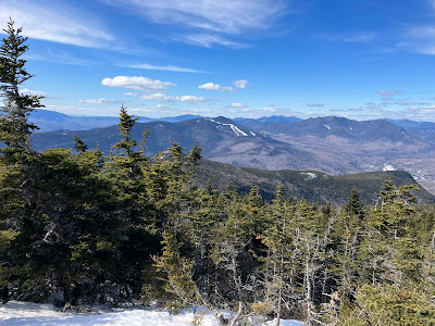
Tree growth now obstructs the view to the south, but the northward vista reveals a remarkable array of White Mountain peaks, including the summits of 35 4000-footers.
Looking over to the eastern edge of the view, including Mt. Washington, the Tripyramids, the Sleepers, and the tops of Mts. Passaconaway and Whiteface.
The Osceolas are flanked by the Franconia Range on the left and South Twin and the Bonds on the right.
Before heading down, I made a short bushwhack to a fir wave with a view towards the Ossipee Range. By alternating stints in the open with respites in the sun back in the trees, I was able to savor the summit views for an hour.
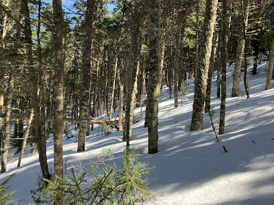
On the way back down the ridge I made a few off-trail forays through the firm snow, weaving through the open woods. With snow conditions bound to deteriorate badly in the coming week, this was likely my last snowshoe excursion of the season. Here is a link for everything you did (and didn't) want to know about Sandwich Dome.


Enjoyed your post! Thank you for the report. It was very helpful in deciding in advance to not to even attempt to cross Drakes Brook when we hiked to Jennings Peak on 14 April. We used highway 49 bridge to cross the raging brook and easily found the trail. No snow until about half way up, then microspikes required. Snow still deep above Noon Peak.
ReplyDelete