
I had been waiting for good firm snow for bushwhacking all winter, and recent freeze/thaw cycles had set up a solid snowpack in the woods. A potential objective was the "Checkmark Slide" on the north side of Peak Above the Nubble, but a scan with binoculars from a parking lot along Route 3 in Twin Mountain revealed that the slide was bulging with ice flows. Nope. My backup was a bushwhack up the NW ridge of Mount Hale, a trip I had done several times back in the 1990s. I knew there would be several view ledges and birch glades galore, and the possibility of continuing to a seldom-visited slide on the north side of the mountain.
I parked at the Seven Dwarves Motel on Little River Road, left $10 on the windshield, and hoofed it 1.5 miles to the start of the North Twin Trail by the same route I had used the previous week to climb Mount Hale. The North Twin Trail was a solid 'spike highway for the short distance I followed it.

At my bushwhack launch point, the snow in the woods had a solid-looking sheen. The first steps in my snowshoes confirmed that conditions were excellent.

The first of several sets of tracks seen in the overnight dusting of snow. Fisher?

My snowshoes were barely denting the surface of the snow. These were "go anywhere" conditions.

It looked like a moose convention had recently been held here.

Open hardwoods and firm snow on a crisp sunny morning - what more could you ask for?

An open glade behind the first view ledge of the day.

The ledge was well-guarded by clinging conifers, but the reward was great, looking across the Little River valley to North Twin and Peak Above the Nubble.
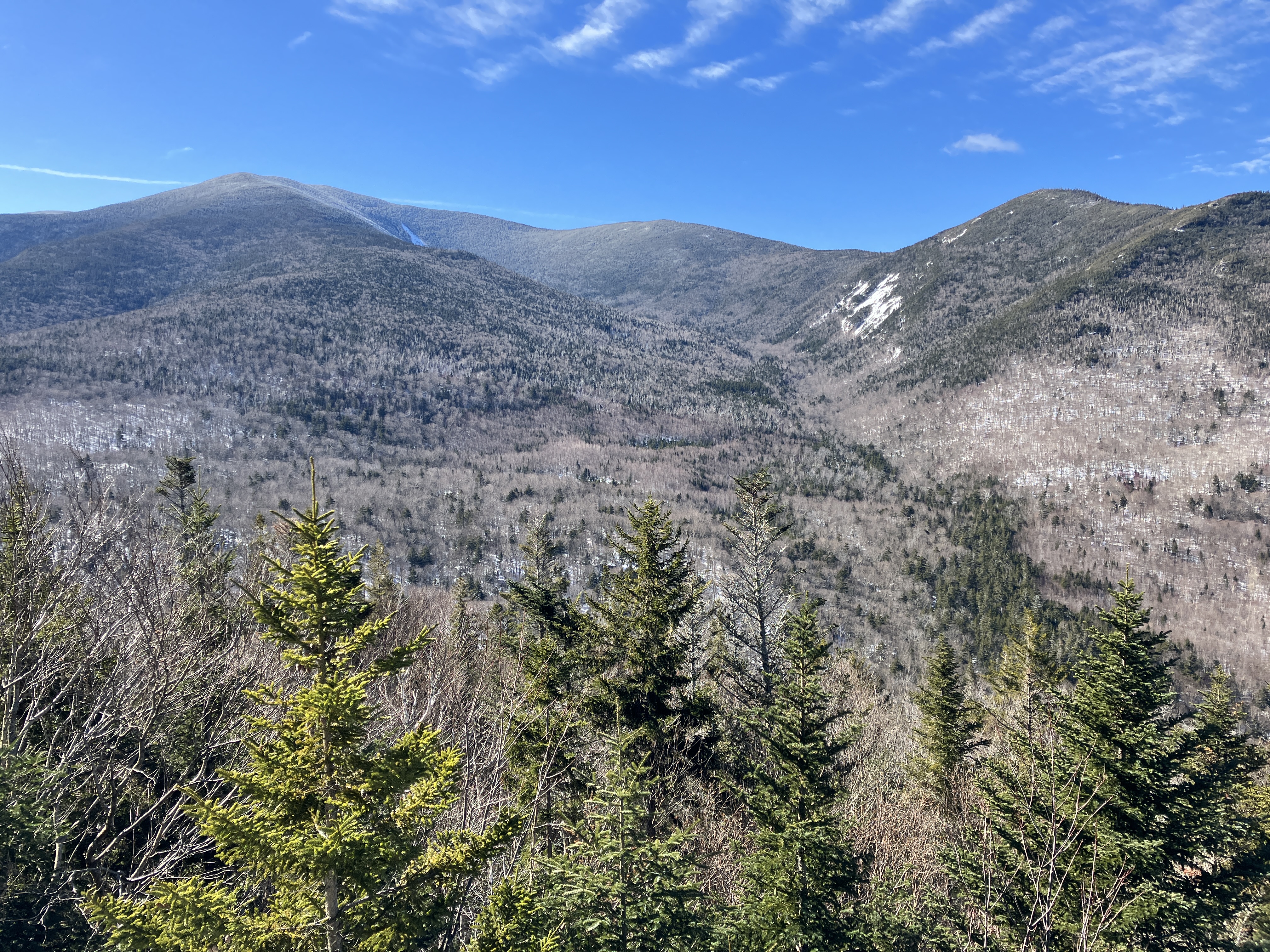
Zoom on PATN and its east-facing slides.

This flat perch also offered a long view out to Vermont, with whitened Mount Mansfield on the horizon.

Continuing up the ridge past what appeared to be deer tracks.

Into the birch glades under a deep blue sky.

Pretty good snowpack out here in the open.

Nice.

Easy meandering.

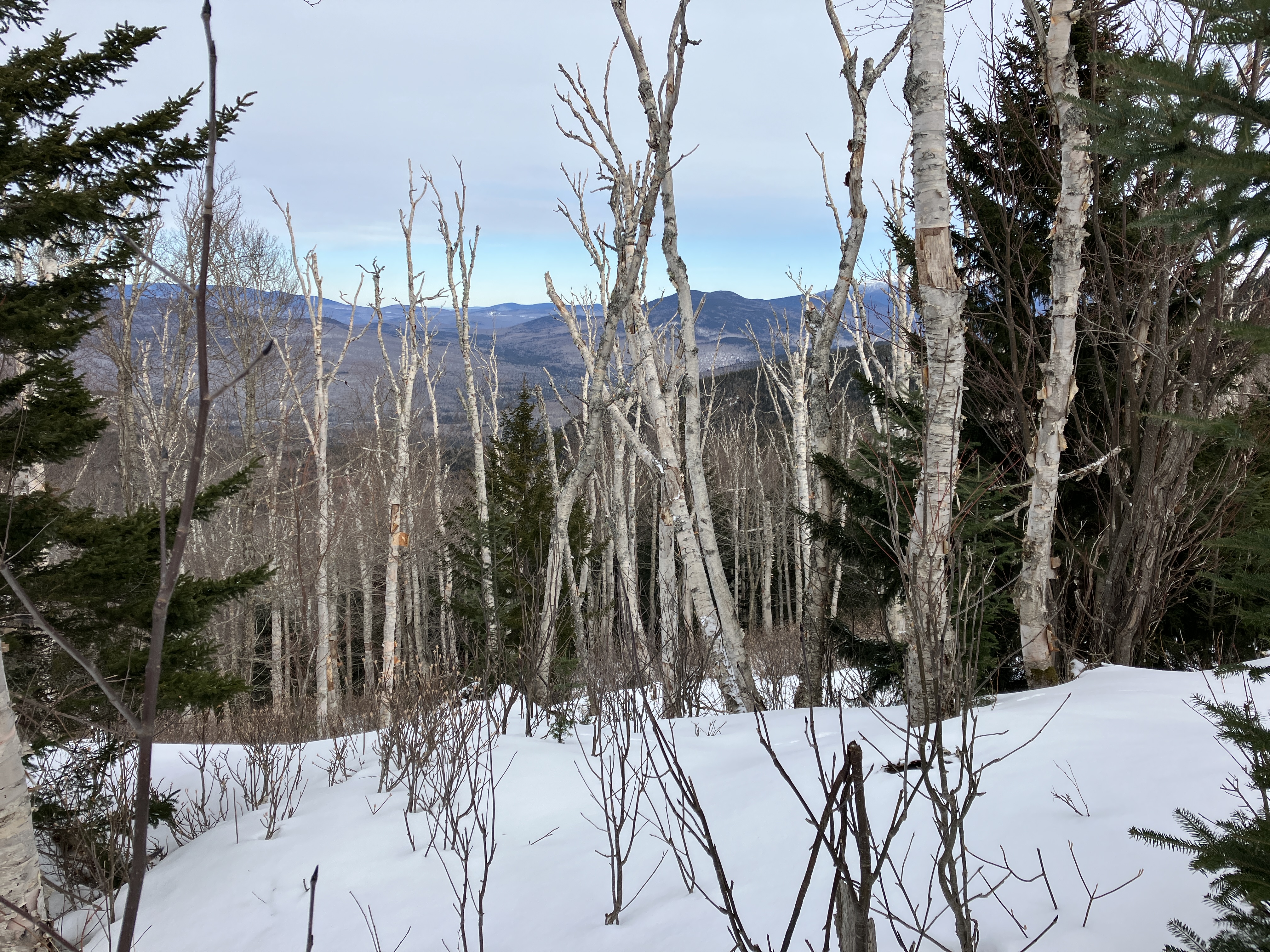
Farther up the ridge, I pushed out and down to a ledge with a long view up the Little River valley to Zealand Mountain and Mount Guyot at its head, with the Twins to the right.

Another angle on North Twin and PATN.

The roadbed of the Firewarden's Trail could be seen in the valley below.

The west ridge of Mount Hale closes the Firewarden's valley in on the south side.

The glades on the ridge were as sweet as I remembered from a quarter-century ago. They are the legacy of a massive 1903 forest fire.

A multi-trunk red maple.

Can you really call this bushwhacking?

Another view up the Little River valley. In contrast to the open birch glades on the crest, the ledges on the south edge of the ridge were hidden amidst a dense tangle of conifer and deciduous scrub.

Glacial erratic.

Birch graveyard in an open col.

A snowfield that is probably a fern garden in summer.

Screened views out to the north.
The North Peak of Mount Hale rises ahead.

The birches extend to ~3200 ft., then it was into the conifers, but still fairly open with just a few thickets.

A steep sidehill approach, strenuous with the crusty snow, was required to get to the slide I was seeking. Luckily the woods were open.

There's the slide!

I emerged just below the top of the slide. A short climb on crusty snow lifted me to a relatively level spot for a view and second lunch.

Top of the slide, just above.

Looking down the slide and out across the lowlands to distant peaks in northern Vermont. This is one of two adjacent slides that are prominent in a 1939 aerial photo of Mount Hale. It's possible they fell in the November 1927 storm or the September 1938 hurricane. The other slide, lower and just to the west, is revegetated except for a large slab at its top. This relatively small slide is still mostly open and appears to be composed of wet slabs in summer. It is about 425 ft. long with a vertical drop of 240 ft. and an average slope of 29 to 30 degrees.

Another angle, from the eastern edge.

From the western edge, Cherry Mountain and part of the Middle Sugarloaf cliffs can be seen.

Side view.

Back across the sidehill.

On the way back along the ridge, I stopped at a blowdown patch with a view of the tops of the Little River slides, in a remote ravine between South Twin and Mount Guyot.

Passing through a split boulder.

A wan sun over the Twins, portending an overnight snowfall.

A peek back at the slide.

Birch forest reaches high up on the flanks of Mount Hale, up to ~3500 ft. on the Firewarden's Trail..

Twister.

Back along a favorite stretch. Best trip of the winter.


No comments:
Post a Comment