The Gale River valley is usually considered merely a routine route to access Galehead Hut, Galehead Mountain and South Twin via the 4-mile long Gale River Trail. But the upper valley is a wild backcountry nook, holding multiple cliffs and several slides that offer interesting off-trail explorations. My objective on this long snowshoe ramble was the remaining open patch of a slide that fell on the headwall of the valley during the 1938 hurricane. I thought it might yield some interesting views, and I was not disappointed.
After approaching via the Beaver Brook Ski Trail and Gale River Loop Road/snowmobile trail, I was pleased to find a nice snowshoe track on the Gale River Trail, leading through the vast hardwood forest on the lower mile and a half.
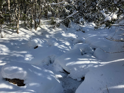
The recent cold snap had partially locked in the North Branch of the Gale River.
This spruce grove is one of the nicest spots on the 2012 relocation that keeps the trail on the west side of the river.
I always pause to get a shot of this Giant Stairs-like formation on a spur of North Twin.
Garfield Stream in quiet repose. There was a good snow bridge for this crossing.
This couple, bound for Galehead Mountain, were the only hikers I saw in 9 miles round trip on the trails.
Another spur of North Twin, seen from an open spot 3.2 miles up Gale River Trail, at the base of a slide that fell during Hurricane Carol in 1954.
Farther up the valley, the snow was deeper, as expected.
At my chosen point for launching the bushwhack to the old slide, I descended to the floor of the valley through open woods.
First I crossed a small brook. These can be problematical in winter as they are often in the form of mini-crevasses with steep soft snowbanks on either side.
Just beyond, I came to the main branch of the river.
I was able to fashion a fairly stable crossing.
After pushing through a band of thick stuff, I emerged in an open conifer forest that cloaked a broad trough leading gently up the valley. Yay!
I soon crossed tracks with a wandering moose.
The snow was fairly deep in here....
...and it was heavy and unconsolidated, making for slow progress up the valley.
To reach the slide, I now had to traverse to the south, crossing five little but challenging drainages en route. These mini-brooks were full of mounded snow with hidden holes beneath, and choked with blowdowns. This traverse was a time and energy sink.
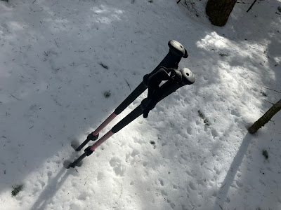
This crossing was particularly sketchy, as probing with my pole didn't hit bottom in some spots.
Finally, two hours from the trail, I came to the edge of the slide, where a major spruce trap awaited.
That was fun!
But oh, my - what a beautiful spot - well worth the effort. On the left is the ledgy hump of "East Garfield," aka "Mt. Pam," and on the right, the cliffs of Flat Top Mountain.
Zoom on the Flat Top cliffs.
A pristine wintry scene. For some reason, perhaps due to the northern aspect, the trees here were caked in snow, while those on the higher ridges were not.
Long view down the Gale River valley and out to northern Vermont.
Approaching the top of the open patch.
From the upper end was the prize view, gazing up at the massive western ridge of North Twin, with its cliffs, slides and fir waves. The summit was visible way up to the right.
Zoom on the cliffs. What a wild spot! Likely not easy to get to, as they are guarded by dense cripplebrush above.
Zoom on the slides. In 1929 the AMC opened the North Twin Loop, which climbed from the Gale River valley up a side valley, then ascended one of these slides and followed the west ridge to the summit. A study of old aerial photos suggests that the trail climbed the right-hand slide, which apparently fell in the November 1927 rainstorm. The left-hand slide is not seen in a 1939 photo, and may have come down during Hurricane Carol in 1954.
Both the slide I was on (lower left) and the North Twin Loop slide (top center) are seen in this 1939 USGS aerial photo. The part of the Gale River slide I went to is the wide section just below (south of) the bend to the left (northwest).
As seen in the aerial photo, the Gale River slide had two upper prongs, each ending a short distance below the Garfield Ridge Trail, not far from Galehead Hut. I went over to check out the western prong. Looking down.
Looking up...wouldn't want to go that way.
Heading back across to the open patch.
Departing this marvelous spot after an hour's sojourn.
On the steeper upper part - ascending tracks on left, descending on the right. A few inches of powder atop firm crust. A fairly low angle slide, ~25 degrees, on a day of low avalanche danger.
Parting shot.
Back through the spruce trap.
I followed my tracks partway down, then took a more direct line to avoid the multiple drainage crossings and their ups and downs.


No comments:
Post a Comment