It was gloomy up north and the Kanc Highway was closed, so back to Waterville Valley for excellent backcountry snowshoeing on the SW side of Mt. Tripyramid. Broke trail up the Mount Tripyramid Trail to the base of the South Slide and then bushwhacked to less-visited slide terrain to the SE.
After the easy 2.6 mile approach on the Livermore Trail, I turned onto the unbroken south section of the Mount Tripyramid Trail. There was a good snow bridge over Avalanche Brook.
I was surprised at the amount of new snow atop the old snowshoe track - anywhere from 6 to 10 inches. It was slow going, but rewarding to make first tracks.
Slide Brook was buried. In summer there's a small mossy cascade here.
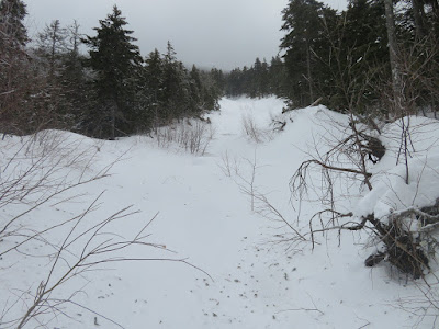
An old posthole, with debris drifted in from the high winds of the previous day.
Looking up Cold Brook at the trail crossing.
Looking down from the top of Black Cascade on Slide Brook.
Snowshoeing along Slide Brook.
Lots of debris dropped by the wind.
At 2600 ft. I left the trail and wandered up the slope through open woods to the north of the trail. Bushwhacking conditions were excellent, with a solid base under the new snow. It was easier traveling than the trail, which in places had an uneven surface under the new snow.
Good snowpack in these woods.
Marshmallow.
Nature's sculpture.
Expansive hardwood forest is the rule on this western slope of Tripyramid.
Bushwhacking dream woodland.
The hardwoods - largely sugar maple - extend up to 3000 ft.
Standout yellow birch leaner.
Back to the trail, briefly, just below it turns up to the South Slide.
A short bushwhack to the SE led to the runout from the "third South Slide," which was triggered by Tropical Storm Irene in 2011. The first two South Slides, both much longer, fell in 1869 (the slide the trail ascends) and 1885 (the top of this slide is crossed by the Kate Sleeper Trail).
Looking up the 2011 slide.
A glimpse of the upper end of the 1869 slide.
Bent-over alders - possibly from an earlier snow slide?
Wind debris on the slide.
I headed partway up the slide, but veered off below the steepest part as the snow was hard and crusty.
View up the slide from the high bank along the edge.
Weaving up a small open patch from the 1885 slide.
I popped back out on the edge of the 2011 slide for a look down, and out to the ski trails on Mt. Tecumseh.
A side view shows the steepness.
Ascending through the woods to two open patches on the 1885 slide. A hundred years ago this was likely open rock and gravel.
Emerging on the snowy swath of the first open patch.
Cloud-shrouded vista from the top of the opening.
Plenty of snow even on this south-facing slide.
A narrow swath, lined with spruces, at the bottom of the next open patch.
Inviting snowfield.
Accepting the invitation.
The top of this patch (3320 ft.) was the high point and finest spot of the day. Above here, the 1885 slide is almost completely revegetated up to the open patch crossed by the Kate Sleeper Trail at nearly 3800 ft. I sat on my pack here for a while to savor the vista over the wild and remote Lost Pass region.
Brighter light ahead on the way back down through the hardwoods.
Parting show before leaving the Wilderness.


No comments:
Post a Comment