
NW SLIDE, MT. PASSACONAWAY: 6/10/13
In the summer of 1998 I bushwhacked to a large rock slab on the NW flank of Mt. Passaconaway, part of a slide that had fallen many years ago. It was a fairly difficult bushwhack, but turned out to be a very impressive spot, with a tall, thin waterfall rivaling Arethusa in height, and a comfortable perch at the top with a wild view out to peaks near and far.
A recent climb of Mt. Passaconaway kindled a desire to revisit this remote spot high above Downes Brook. The forecast for the day was high clouds with showers moving in late, perhaps not til evening. I figured it was worth a try if the crossings of Downes Brook were manageable.
I set off mid-morning on the Downes Brook Trail from a surprisingly empty UNH/Potash/Downes parking lot. At the first crossing it seemed the water was slightly high, but doable without resorting to the Crocs.

The second crossing is very wide and involved lots of rock hopping.

After two more crossings, it was into the Wilderness.

After an up-and-down relocation, a long section of good walking.

The trail crosses the brook that comes down from the Downes Brook Slide, the route followed by a trail that was abandoned around 1960 due to the potentially dangerous slippery slabs of the slide.
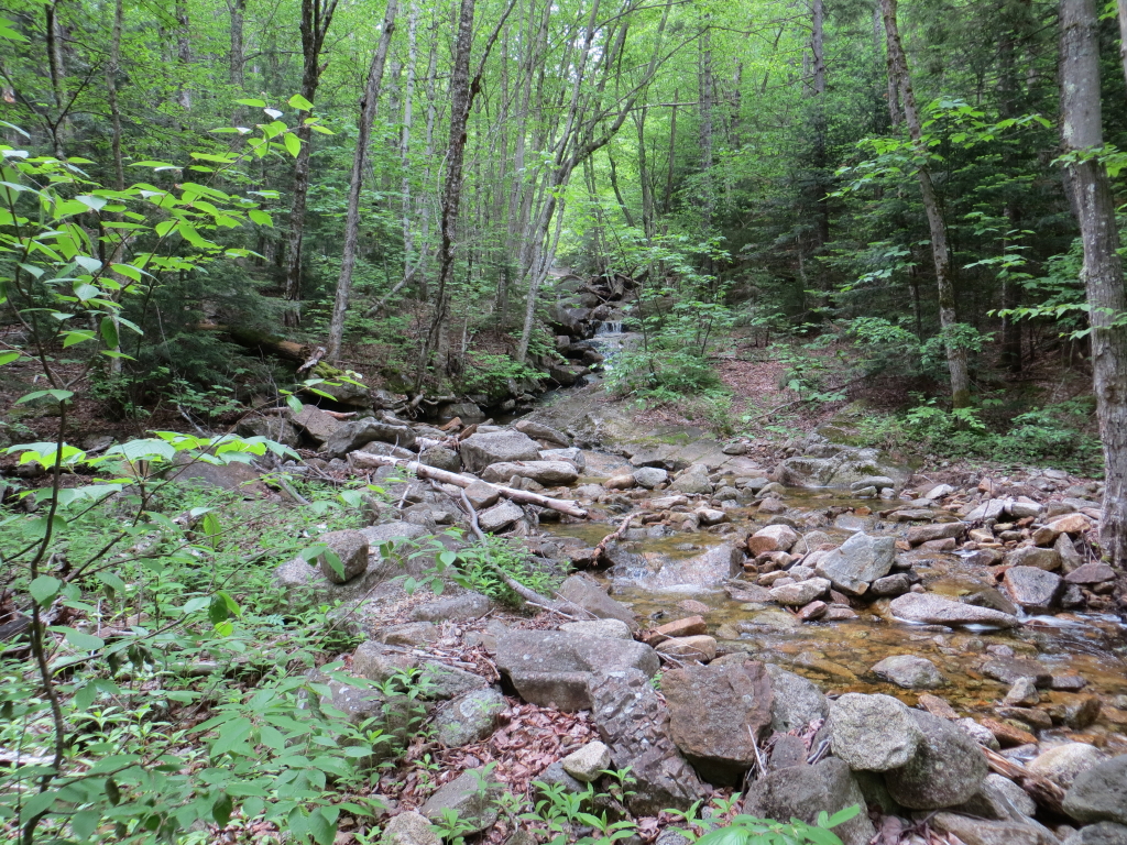
These ledge slabs along the main brook are always inviting for a break.

A view of Downes Brook before the 5th crossing.

A mini-flume just below the 6th crossing.

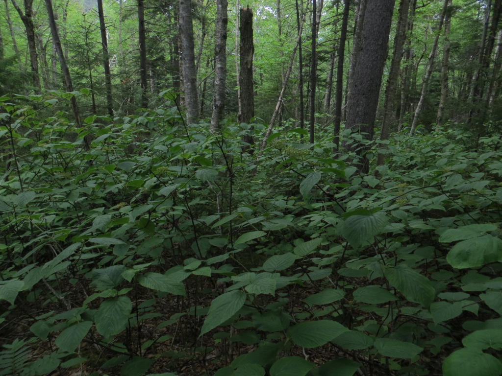
I soon launched into the bushwhack, and it was a scrappy one, mainly involving a prolonged wrestling match with hobblebush.

Higher up there was one nice hardwood glade where the moose had browsed the hobblebush, keeping it at a more manageable height.

A big old sugar maple.

Near here I picked up the brook that drains the slide. It does not flow in the direction that looks likely on the USGS topo map.

Approaching the slide, the brook was quite scenic, starting with a nice sluice cascade.

Cascade and pool, a common theme on "slidey" streams.


Then I worked my way around and down to the base of the big waterfall, which has a lower and upper drop.

This would be mighty impressive after a couple inches of rain, though the Downes Brook crossings might be impassable at the time.

I continued up through the woods beside the waterfall and came back over for a closer look at the upper drop. Click here for a Facebook video.

At the base of the upper drop, I was about 50 ft. in elevation above the bottom of the lower drop.

Looking downstream from the base of the upper waterfall.

This is a huge rock slab! In the course of a winter bushwhack, J.R. Stockwell once came down this way off the summit of Passaconaway and said this was a giant ice cliff.

I continued up through the steep and dense woods beside the slab, popping out to the edge for an occasional view across.

I circled around to the top of the slab, where I could see the slide/brookbed continuing up ahead as a slippery-looking ledge swath. According to my GPS altimeter, this was nearly 200 ft. in elevation above the bottom of the lower waterfall.

This dry and comfortable perch was as far as I was going. The view included (L to R) North Tripyramid, the Fool Killer, Mts. Lincoln & Lafayette, Mt. Huntington, the Hancocks, Mt. Carrigain and Vose Spur. In the foreground was the darkly wooded dome of "South Potash."

A zoom on Franconia Ridge beyond Mt. Huntington.

From the right edge I could see Middle and North Tripyramid and the flat-topped Fool Killer.

Another angle on the view.

Not a bad spot to hang for a while.

Looking down at my perch.

Streamside vignette.

The slide is bordered by a dense growth of mountain holly and other shrubs/small trees.

Late afternoon, time to head out before ending up whacking in the rain. For a little while, I followed the trace of a century-old tote road, but it soon petered out in a tangle.

Hobblebush was the name of the game most of the way down, though there was an occasional breathing space.
I took a break along Downes Brook on the way back, and beat the rain by a couple of hours.


Very impressive, Steve! It appears to me that the rewards from this trek were worth the sporadic skirmishes with the hobblebush.
ReplyDeleteJohn
It was definitely worth it! If whacking was through open hardwoods all the time, it would get boring, wouldn't it?
DeleteSteve
Fantastic!
ReplyDeleteA great trip report and photos as always. So many wonderful treasures in the Sandwich range! Thanks for this blog and the inspiration.
Hobblebush, ugh. Recall a major proliferation of the stuff soon after the Ice Storm of "98 due to much more sunlight hitting the forest floor at certain elevations...
I am blessed to be just 20 minutes from the Ferncroft trailhead, yes? Yes!
-Mark at Silver Lake/Madison
Thanks, Mark - you are blessed indeed! There does seem to be a lot more hobblebush around since the ice storm.
DeleteSteve