
A selection from hikes through the four seasons.
WINTER
John Compton admires the view of South Hancock and "Juno Peak" from "Hancock Bog."
 A Gray Jay gets a bird's eye view from Mt. Jackson.
 A wintry Mt. Washington seen from Cloudland Bog along the Webster Cliff Trail.
 After a long wait, the fog lifts at Kinsman Pond.
 Ice cliff on a slide on the flank of Mt. Whiteface, the objective of a snowshoe bushwhack in The Bowl.
 An ice cliff towers above Carol at Bridal Veil Falls.
 The snow-caked cone of Chocorua from First Sister.
 Five feet of snow in a birch glade on a shoulder of Chocorua.
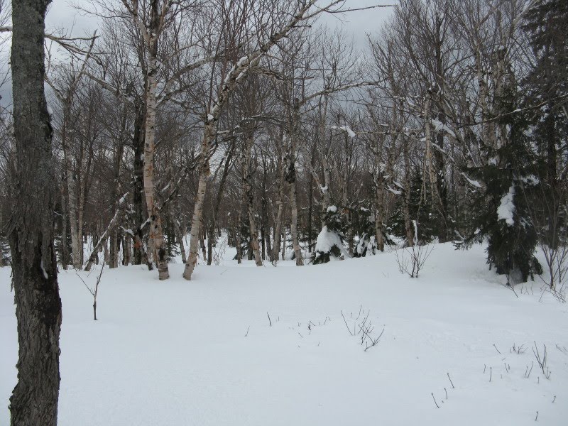 John and Marty enjoy a bluebird day on South Kinsman.
 A bushwhack to Harrington Pond (on the south side of South Kinsman) culminates with this view from a nearby cliff.
Mud Pond and the slides on Mt. Clough from the Glencliff Trail on Mt. Moosilauke.

John faces into the wind and Mt. Washington on the summit of Mt. Hight.
 A view of the remote Cypress Brook valley, deep in the Wild River Wilderness, from the edge of Zeta Pass.
 Spring fever on Sugarloaf Mountain in Evans Notch; snowy South Baldface in the distance.
SPRING
Mt. Flume from a talus slope high in the Flume Brook valley.
 An off-trail ledge on the flank of West Royce opens a view across the Wild River Valley.
 The East Branch of the Pemigewasset running high with snowmelt; Bondcliff in the distance.
 Wachipauka Pond from Webster Slide Mountain; Carr Mountain on the horizon.
 Quartzite ledges on the south summit of Mt. Cube open a great view south to Smarts Mountain.
 View southwest from a slide on Smarts Mountain.
 The south cliff of Mt. Whiteface, from a ledge near the McCrillis Trail.
 My brother Drew checks the map at The Pinnacle on Connecticut's Metacomet Trail.
Open bushwhacking in the Catskills - near the summit of Lone Mountain.
 A small ledge on Lone Mountain offers a big, wild view.
 Giant Ledge, one of the premier Catskill perches.
 Back in the Whites, open hardwoods in the Gordon Pond Brook valley.
A sneak peek at Flat Mountain Pond from the NE summit of Sandwich Dome.
 John tackles a scramble on the Madison Gulf Trail.
 Star Lake and Mt. Adams.
SUMMER
Looking down Castle Ravine from the First Castle on the Castle Trail.
 A view into Jefferson Ravine from Dingmaul Rock on the Gulfside Trail.
Looking up the Snyder Brook valley to Madison and Adams on the Inlook Trail.
 Relaxing at the south viewpoint on Wonalancet Hedgehog, accessed by a side path off the Walden Trail.
 A view from a ledge on shoulder of West Tecumseh, looking at ledgy ridges descending into the trailless valley of Haselton Brook.
 The Lost Pass area and Sandwich Dome from the South Slide of Tripyramid.
 South Tripyramid from a beaver meadow at the base of Sleeper Ridge.
 A long view up Flat Mountain Pond to the Sleepers and South Tripyramid.
 A southbound thru-hiker crosses the alpine bogs on Mt. Success in the Mahoosucs.
 Cath Goodwin and Pam Bales go caving in Mahoosuc Notch.
 Taking in the view of Mahoosuc Notch from a spectacular ledge on Mahoosuc Arm.
 A gorgeous meadow along the Upper Ammonoosuc River at the end of the Landing Camp Trail, with Mt. Weeks in the distance.
 The view from Rogers Ledge sweeps all the way out to the Presidentials.
Carol takes in the vast view of the Wild River Wilderness from a ledge just off the Kenduskeag Trail east of Shelburne Moriah.
 John ambles through the open fir woods on North Weeks, en route to the mountain's trailless east knob, where we found partial views.
 An idyllic beaver meadow at the SE base of Hutchins Mountain.
 The view south along the Pilot Range from a ledge on Hutchins Mountain.
A slide on Mt. Nancy opens a view into the Pemigewasset Wilderness.

Kilback Pond, a peaceful place in the heart of The Kilkenny.

FALL
A view of Mt. Paugus from the top of Square Ledge.

A short, thick bushwhack on Middle Terrace Mountain rewards with a view across Willard Basin to Mts. Waumbek and Starr King.
 The fern meadow viewpoint just down from the summit of South Terrace.
 Rick Neville relaxes on Allen's Ledge, partway through a trail work trip along the UNH Trail on Hedgehog Mountain.
 The Brown Brook Marshes and Mt. Kineo, seen from a vantage just off the Donkey Hill Cutoff.
 A lunch break at Middle Pond during the annual White Mountain CROPWALK, a fundraiser for the anti-hunger programs of Church World Service.
 The view east over Province Pond from a fire-scarred ledge on the shoulder of Mt. Shaw (north of Kearsarge North).
 John checks out the views from Pine Hill, along the Conant Trail south of Evans Notch.
 Keith D'Alessandro and Katahdin take a break by a beaver meadow east of Haystack Notch, looking at Caribou Mountain.
 Keith spots something from a clifftop ledge on trailless Haystack Mountain, high above Haystack Notch.
 John rambles across the southern ledges of Caribou Mountain.
A canoe paddle on Lonesome Lake.

A cascade at Paugus Falls, a series of ledge slabs and waterfalls on the side of Mt. Paugus, described by Frank Bolles in his 1892 book, At the North of Bearcamp Water.
 Lower Greeley Pond has the November look on a Thanksgiving Day hike.
A mossy waterslide on Slide Brook, below the South Slide of Tripyramid, found during a search for the small flume known as "the V."
 Thanks for looking, and I wish you good hiking in 2011!
