
With the Mt. Washington Observatory reporting 130-mile visibility, John Compton and I shelved plans to bushwhack to some ledges on Tyler Mountain at the edge of the Caribou-Speckled Wilderness, and instead opted for a trail hike to its higher neighbor, 2850-ft. Caribou Mountain, whose open ledgy top reveals views better than those from many of the 4000-footers. Below is a shot of Caribou taken from Durgin Mountain to the south, at a ledge just off the Red Rock Trail. (For a full description of Caribou, including history, trail routes, and views, click here.)

We chose the northern approach via the Caribou Trail from Bog Road over the more popular loop from Rt. 113. I hadn't been up this route in 10 years, and it was a new route for John.
 The first mile or so of the trail was gentle, at first on a logging road, then old woods roads. Here John picks his way across Bog Brook.
Small cascades on a tributary of Bog Brook.
 The Caribou Trail is a pleasant, moderate route. This birch-lined section was especially nice.
 Higher up there are some larger, older trees, such as this tall sugar maple.
A fungus triple-decker.
 At 2000 ft. you enter the Wilderness area in a beautiful hardwood ravine.
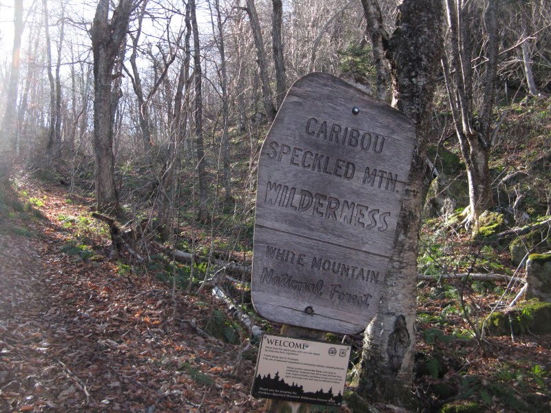
A tree with character, survivor of many winter storms.
 John checks out the forest scenery as we ascend towards the pass between Caribou and Gammon Mountains.
 A mossy little stream tumbles down the crease of the ravine.
 The last pitch leading up to the pass.
 A fine hardwood glade in the Caribou-Gammon col, where the Mud Brook Trail takes off for the summit of Caribou.
 On the moderate climb to the summit, we passed some gnarled old paper birches.
The final stretch to the summit ledges led through a darker conifer forest.
 The ledges greeted us with warm, windless, sunny conditions under brilliant blue skies - a true gift from the weather gods!
 A USGS marker adorns the northern of two rocky knobs that are about 0.1 mi. apart.
 Endless vistas today, such as this northern look towards the Mahoosucs beyond the ledgy flank of Peabody Mountain.
 Distant NE horizons in Maine. We could see far-off 4000-footers such as Mt. Abraham, Sugarloaf and Saddleback.
 Looking NW to the Pilot Range - Mt. Cabot, the Bulge and the Horn.
 The Pliny Range - Mt. Waumbek and the three lumps of Mt. Weeks.
 Caribou has a terrific view across the Wild River Wilderness to the Carter Range and the tops of the high Presidentials.
Looking NW, a vast rumpled landscape.
 Local legend holds that in 1854 two brothers shot the last caribou in this area on the mountain, and carved their names in the rock at the top. John examines a carving near the summit benchmark.
We took pictures of the carving and tried to make it into "JOHN" or something similar. When I showed the picture to Carol, she suggested rotating it 180 degrees. When viewed this way it looks like "HOB,"perhaps part of "HOBSON"? That name belonged to someone prominent in the lumber and mill industries in this region during the 1800s.
 John relaxes in the balmy sunshine, with Kezar Lake and Pleasant Mountain visible on the southern horizon.
 Looking south along the crest of Caribou.
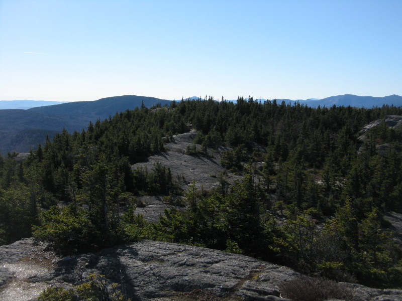 After an hour of viewing, we headed across to the south summit knob for a different perspective. Care must be taken to follow the trail across the summit plateau. Small cairns mark the way in places. Hikers should step only on bare rock to protect the fragile and in some cases rare plant life.
Looking back at the rocky face of the northern knob.

Was Bigfoot snowshoeing up here?
 More wide views from the southern knob.
 Looking SW to Speckled Mountain and the Baldfaces.
 My favorite spot on Caribou is a dramatic perch at the brink of an eastern cliff, overlooking the broad hardwood valley of the West Branch of the Pleasant River. This is easily accessible by walking 80 yards east across bare rock from the trail. John called it the "Bondcliff of Caribou." Beyond my boots is the Butters-Red Rock Mountain range.
 Looking down to the treetops.
 Vast eastern horizons beyond Farwell and Albany Mountains.
 Several of the little dark slashes in the valley below flat-topped Butters Mountain are beaver meadows. Keith D'Alessandro and I had visited the one on the lower L a week earlier, and from its edge had gazed up at the rocky crest of Caribou.
 John takes in the NE panorama. The ledges on Tyler Mountain can be seen to the R of center.
 A parting shot in the low November sun.
 John heads back across the ledges to the trail.
 On the way up to Caribou, we had spotted a clifftop ledge on the steep flank of Gammon Mountain. On our way back down we made a brief bushwhack foray in an attempt to find it. We ended up at the base of an impossibly steep slope below the cliff, with not enough daylight to spend time working a route up and around. We did find some limited views from a small lower bluff, making our diversion worthwhile. The photo below shows the summit of Tyler Mountain with Pickett Henry Mountain to the L.
 We also got a look at the ledgy south knob of Tyler Mountain, rising above little-known Tyler Notch. There are many interesting nooks in the Caribou-Speckled Wilderness!

Steve, the views late last week were incredible! I was on Moosilauke on Thursday, and could see Giant in the Adirondacks, which is far enough away that it isn't detailed in Scudder's viewing guide looking W from Moosilauke! Saturday, I did Mt. Hunger in Waterbury, VT and again...amazing views!
ReplyDeleteHi Jason,
ReplyDeleteI figured there would be "Adirondack days" on the higher summits last week. Sometimes from the Moose you can see Dix, Marcy, Algonquin and Whiteface, too. From Caribou we could see the Camden Hills on the Maine coast. I've never been on the Worcester Range - they must have some great perspectives.
Steve
Steve, I should have went this way. I took the Caribou Mt. trail from 113 on Thursday (11/11) with my 10 year old pup Maggie. Forgot about the many stream crossings - managed most until Kees falls. Fell in real good (literally sat down in the stream). Smashed my stream fording confidence for the day. Will have to try this route. Thanks for posting!
ReplyDeleteHi Chris,
ReplyDeleteSorry to hear about your dunking. The crossings on Morrison Brook can sure be tricky. The northern route is definitely easier in that regard. It's a very pleasant route.
Steve