Tuesday, February 22, 2022

Lafayette Brook Forest and Ledges: 2/21/22

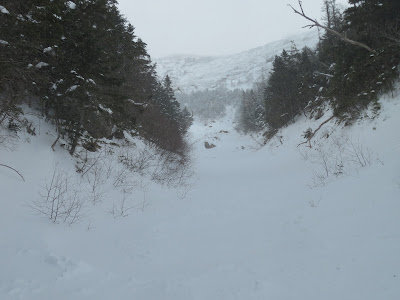
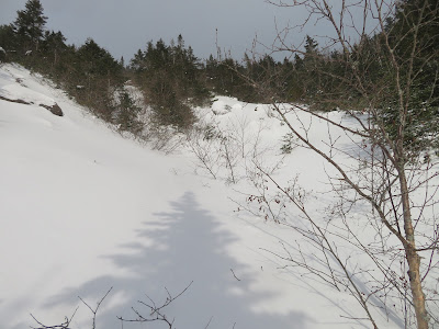
Rain/thaw and refreeze had set up the first good, firm bushwhacking snow of the season. On a warm almost spring-like day I headed to the Lafayette Brook Scenic Area. Endless open woods and four viewpoints on the ridge north of Lafayette Brook make this a favorite snowshoe bushwhack.

The Governor Gallen Memorial Bridge (formerly a highway bridge for US Rt. 3) offers a great view of Mt. Lafayette rising above the Lafayette Brook valley. The ridge I ascended to the viewpoints is on the left.


Open hardwood and birch right from the start.


The only spruce trap I fell into all day.
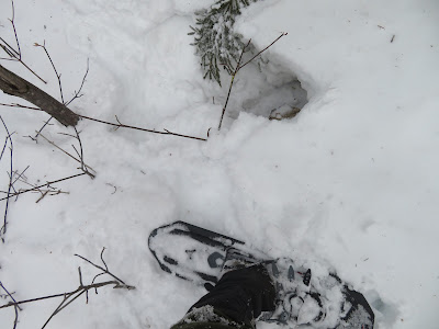


Firm snow - no sinking into bottomless powder today!


This large opening in the forest is a birch graveyard.


Twisted tree.


Tracks.


Beautiful open glade.


Well-preserved nest.


A steep descent through dense brush brought me to the day's first viewpoint, opening a wild view up the valley.


Looking across the valley to the wooded backside of Eagle Cliff.


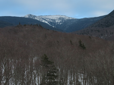
Zoom on Lafayette at the head of the valley. One of the earliest accounts of using a slide as a pedestrian route on a peak - in this case for descent - was written by geologist and Amherst College President Edward Hitchcock in the American Journal of Science and Arts. In August, 1851 Hitchcock and two companions climbed Mt. Lafayette by a “very wretched footpath.” As they descended from the summit, down to the right of the path Hitchcock spotted “the commencement of a slide; and the large amount of rock laid bare at its upper end, incited a desire to visit the spot.” The trio descended the slide, at first down a “mass of naked gneiss rock” that was “steep and smooth.” Hitchcock estimated the slope near the top to be 38 degrees. Farther down they navigated loose piles of debris along the edges, or the dense scrub behind. Along the way Hitchcock noted both lateral and terminal moraines of debris. Below the slide they followed the brook for several miles, hoping it would bring them near the “Notch House Hotel” where they were staying (presumably the Lafayette House, located near the base of Eagle Cliff). But they missed their mark and ended up three miles past the hotel at a farmhouse, whose occupant gave them a ride back to their lodging. Although historic sources suggest that this slide was in Walker Ravine, based on that route, it seems likely the slide was instead located in the Lafayette Brook ravine. Traces, perhaps, of that ancient slide can be seen here on the right side of the valley headwall, under the main summit of Lafayette. Hitchcock later learned that the slide had fallen in June, 1850, “in consequence of a powerful shower of rain.”


From here I had a good look at the uppermost ledge I would be visiting.


Circling around to the north side of the ridge, I came upon some old ski tracks. Shortly after that there were fresh snowshoe tracks, which I would follow off and on the rest of the way up. The solo snowshoer looped back down via a different route so we never met.


Looking out to the NW from another birch glade. The birches are the legacy of a 1903 forest fire that burned 3,000 acres in this area.


At 2900 ft. I meandered through one of my favorite birch glades.


Even after the thaw, there's a respectable snowpack up here.


Open corridor followed by skier and snowshoer.


Postholing moose.


Open woods persist at 3100 ft.


Bare rock on the ledge! A great perch.


Nice view back down the lower Lafayette Brook valley and out to Vermont, with a number of Green Mountain peaks visible on the horizon..


Cannon Mountain behind Eagle Cliff.


Eagle Pass.


The summit of Lafayette just peers over the next bump on this long ridge.


How often can you do this in February? After layering up, I spent a comfortable hour hanging out on the ledge.


Heading back down through the birches. With temperatures in the high 30s, the upper layer of snow was becoming wet and soft, but thankfully the base held firm.


Scene along the ridge.


On the way down I visited two more ledges hidden in rough, spruce-thick terrain along the crest of the ridge. This one has a nice perspective on Lafayette buttressed by its massive western shoulder.


Typical terrain in this area.


The last ledge of the day provided a fine profile of Cannon behind the Eagle Cliff ridge.
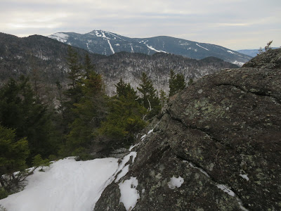


Descending steeply off the crest.


Late afternoon view of Lafayette from the bridge. One of the neatest roadside vistas in the Whites.


Thursday, February 17, 2022

Downes Brook: 2/16/22


Most every winter in recent years I've made a snowshoe excursion out to the ledges of the old (late 1800s) Downes Brook Slide on the north side of Mt. Passaconaway. It's one of my favorite places to snowshoe. This trip is only feasible if there are snow bridges over the four crossings of Downes Brook on the Downes Brook Trail. A cold January set up some excellent snow bridges on the streams, but a forecast of warmth and heavy rain the next day prompted me to get out there while the getting was good. After the rain, the snow bridges would likely be history.  

I started the trek at 1:00 pm, which would give me time only to visit the broad, open slabs on the lower part of the slide.  Snow conditions were a little tough today, starting with a half-mile of frozen postholes beyond the junction of the well-packed Mt. Potash Trail. This brought me to the first crossing, which was well-bridged, as were the other three crossings.


From here on I was following a narrow track laid down perhaps the previous weekend by a couple of backcountry skiers bound for the slide. The track was not very firm, so I was essentially breaking a wider track through 6-8" of dense, mealy snow atop what was likely an old snowshoe track beneath. Frequent snowshoe lurching and twisting made for tedious going.


Looking back at my tracks.


Into the Wilderness.


Following the ski tracks up the buried side brook to the slide, through a corridor of slender yellow birches.


Emerging onto the open slabs, with the craggy northern spur of Mt. Passaconaway looming above.


A wide open, low-angle snowfield, a fun place to snowshoe or ski.


A good twenty inches of snow on the slabs.


Looking back at Potash Mountain, with Mts. Pierce and Eisenhower hazily visible in the distance. Nice spot to hang out for a while before heading home.


Following my tracks back down the brookbed. I had this whole big valley to myself on this midwinter day.


Wednesday, February 16, 2022

Walker Ravine Slides: 2/15/22


A cold day with persistent snow showers provided the setting a for snowshoe adventure into the ravine of the south branch of Walker Brook, on the NW side of Mt. Lincoln. I ascended to 4300+ ft., almost to the icy chute of Lincoln's Throat. It was a remarkable experience, though I must confess I didn't fully earn it as a fine packed track left by backcountry skiers made it much easier to access the open slide swath of the upper drainage. I did earn some extra (sunset) views with a side trip breaking trail up onto a slide on the north side of the ravine. The ravine is well-displayed in this view from North Kinsman.


After hiking 1.2 miles up hard-packed Old Bridle Path I bushwhacked down a steep slope to the floor of the ravine, where I found the aforementioned skiers' track. This part of the route follows an old logging road through nice open woods. So far the day was sunny, but that would soon change.


Emerging alongside Walker Brook.


Heading up the south fork. This was my third trip snowshoeing in this ravine, but the first time I'd gone more than a short way up the south fork. With warmth and heavy rain in the forecast, I figured this was the time to try it. I lucked out with the packed track, which may have been initially set by climbers in snowshoes headed in to climb Lincoln's Throat - hard to tell. I stepped lightly in my snowshoes to preserve the track, though probably a moot point after the rain.


There's a section of tedious travel on the lower part of the south fork, weaving around boulders and holes with some sidehilling.


Low bridge.


Slides in sight ahead!


Below the open slides the drainage is brushy in places, with many alder thickets.


Snow showers had moved in, obscuring early views back to South Kinsman.


Only a few open water spots were showing higher up in the drainage.


This is a low angle climb up until the first slides are reached.


Luckily, only once did I punch through to the small brook below, gaining a snowshoeful of slush.


At 3400 ft. I reached an open slide on the right (south) side of the ravine.


I went a short way up, but the snow seemed a little sketchy and there wouldn't be any views anyway.


Back to the main track to continue up.


Lots of slidey terrain in here.


A major fork at 3650 ft. The left fork leads to the upper part of a large slide from 1927. The right fork leads up to Lincoln's Throat.


Gateway on the right fork. Getting steeper. The firm windpacked (and in places skipacked) snow with a thin layer of powder on top made for good snowshoe climbing. Avalanche danger rated Low today.


Looking back.


Heading up the long open chute. Probably about a 30 degree slope on average up here.


Zoomed. With conditions good, I hoped to make it up to the fork visible several hundred feet higher.


Wide open.


Approaching the fork at 4250 ft.


Skier's view.


This boulder at 4310 ft. was my turnaround point. It was cold (about 5 degrees) and windy, and from studying the Lidar 2-foot contour map I knew there were steeper pitches ahead, which might be uncomfortable to descend.


In this view from Old Bridle Path, my turnaround point was a short way up the left fork high up under the summit of Mt. Lincoln. As slides do, it looks impossibly steep when viewed head-on.


Steep enough for me!


Close by to the south rose the striking ledgy west spur of Mt. Lincoln known as Carpenter's Ridge, with the faint orb of the sun above.


A zoom on Lincoln's Throat - a well-known ice climb in winter and a tricky rock scramble/climb in summer.


As I headed back down, the sun briefly emerged....


...lighting up the alpine amphitheater at the head of the ravine.


The Old Bridle Path ridge came into view below.


Scouring by slides.


Slowly and carefully descending to the 3650-ft. fork.


Here a trail-like corridor provided a route up to slides on the north side of the ravine.


The snow was deep and unconsolidated here. These views would be earned!


Several slide tracks converge here.


Tough sledding.


Skies are clearing - gotta get up there for some views.


The upper ridge in sight.


The slide widens out. Took more than a half-hour to gain 150 ft. of elevation.


I believe this is the the "sunless gorge" on the west ridge of Mt. Lincoln descended in 1880 by AMC explorer Charles E. Fay and a companion, and described in Appalachia. Lincoln climber Chuck Woodman and a friend ascended this in April 2019.


Alpine vista.


And, finally, the clouds lifted from the Kinsmans.


Yikes!


Golden mist veils the Kinsmans.


Descending into a ball of fire.


Looking back.


Mount Doom.


Afterglow.


Following my tracks back to Old Bridle Path for a moonlit descent.