Spent a long summer day enjoying this generally unloved mountain. Took
ample time for relaxing at its three fine viewpoints, and bushwhacked to the tops of
two slides for more views.
On the Greeley Ponds Trail.
From the Mount Osceola Trail, a glimpse of the impressive cliffs on East Osceola's NE spur.
Trailside boulder cave.
The
trail climbs steeply beside this huge slab at ~3300 ft. This was part
of a major slide that fell off East Osceola in 1891 or 1892. Before the
trail was opened alongside it in the 1930s, this slide was sometimes
used by Waterville hikers as a descent route into Mad River Notch.
The climb beside the slab is one of the more rugged spots on this steep section of trail.
The trail crosses the upper ledges of the early 1890s slide at 3700 ft.
These
ledges offer outstanding views, with Upper Greeley Pond seen down on
the floor of Mad River Notch, under the K2 Cliff of Mt. Kancamagus.
Mt. Carrigain and many other peaks are seen in the distance. The cliffs of the NE spur are seen below.
The Tripyramids and Mt. Passaconaway are seen to the SE.
The very steep climb to the East Osceola ridgecrest ends at "The Chute."
At
the top of "The Chute" a side path leads a few yards right to an
excellent western viewpoint, with ridge after ridge sweeping down from
the slopes of Osceola and Scar Ridge.
Looking up at the main summit of Osceola.
The Split Cliff, in profile, and Osceola's West Peak.
The peak of East Osceola looms close at hand.
A nice easy section of trail on the shoulder of East Osceola.
I
made a thick bushwhack loop down, across and up to visit both tops of a
two-pronged slide that fell to the south of the early 1890s slide,
perhaps during Hurricane Carol in 1954. This upper part of the slide is
all loose rock and gravel.
More good views here.
Stacked rocks at the very top of the slide.
The whack across the steep slope to the other fork of the slide was slow going. It took 25 minutes to cover less than 0.1 mile.
Another
great viewpoint. The visit to these slides was "research" for a Slide History of the Sandwich Range project I've been working on.
Upper Greeley Pond, 1700 ft. below.
The view here extended more to the SE.
Mt. Chocorua, Mt. Passaconaway, and North Tripyramid.
The K1 Cliff on the west side of Mt. Kancamagus. The sharp flume-like cut in the cliff can be seen on the left edge.
The K2 Cliff. Both of these cliffs were reached by short-lived paths cut by Waterville hikers in the early 1900s.
A dead birch reaches for the sky.
Not a bad spot to hang out for a while.
Down below, the slide has been gouged out where it turns a corner.
From here I made a steep whack back up to the trail near the summit.
In
one area there was widespread evidence of illegal cutting by
backcountry skiers opening up easier access to the slides, which are
regularly skied in good snow years.
The cairn at the wooded and viewless summit of East Osceola.
There
is a decent view east from a "fir wave" area about 50 yards north of
the cairn. This vista will likely be overgrown within a few years.
I
descended the Mount Osceola Trail halfway to the col with Mt. Osceola
to visit this trailside ledge perch with fine views NW and north
Looking along the range to Scar Ridge and Kinsmans/Cannon.
Wide vista to the Franconia Range, Owl's Head, Mt. Garfield, South Twin and the Bonds. Mt. Hitchcock in the middle distance.
I
continued down to the col and made another prickly bushwhack in search
of a tiny pondlet on a thickly-wooded plateau. Avid bushwhacker "Old Man
and the Saw" had stumbled on this a few years ago while attempting to
trace the route of the long-abandoned Ravine Path, also known as the
Osceola Brook Trail. This steep route was opened around 1900 by
Watervillean Arthur L. Goodrich, and his description of it mentioned a
"mountain meadow" near the col. The trail was abandoned in the 1940s,
and I saw no trace of it.
Treading
carefully to avoid trampling moss, I made my way to a rock with a view
across the "pond" to the impressive cliffs above the col.
Osceola is a rugged mountain that is full of surprises.
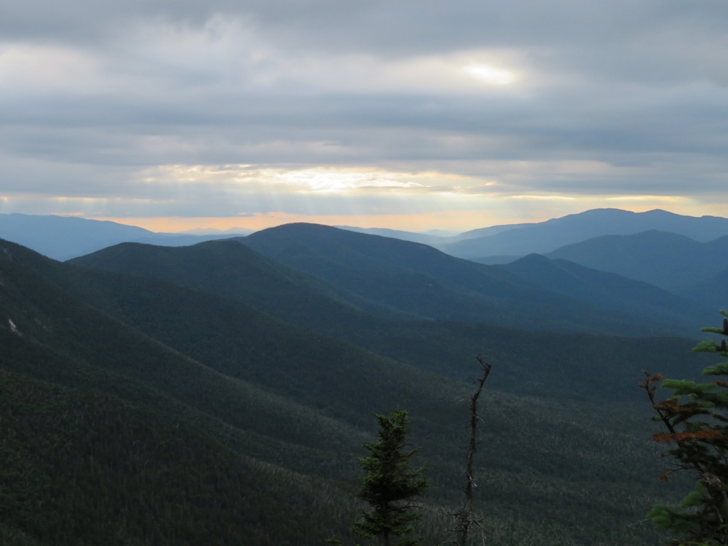
Evening vista at the west outlook, back along the trail.
Last sun on Tripyramid.
Slow
going on the descent to Greeley Ponds Trail - it always seems harder going down than going up. On the walk out through
the valley I was serenaded by a chorus of Swainson's Thrushes.