Monday, February 12, 2018

LONESOME LAKE: 2/9/18

Great packed powder conditions for an afternoon snowshoe, before the weekend rain soaked it.

Respectable snow depth in Franconia Notch.


Open woods on the Lonesome Lake plateau.


Scene along the trail.


A group heads across the lake towards the Kinsmans.


Coppermine Col.


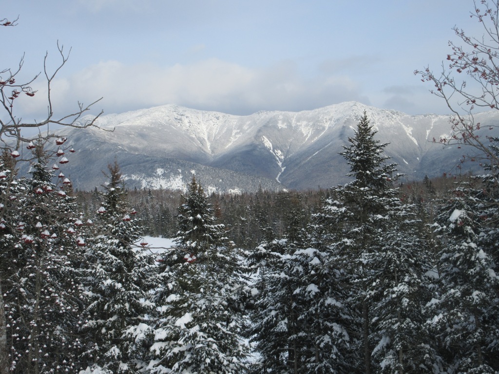
Snowshoe track and Franconia Ridge.


At the west shore.


Mountain ash adorned with snow ornaments.


View from the deck at Lonesome Lake Hut.


An excellent snowshoe track for a quick trip down.


Friday, February 9, 2018

GOODRICH ROCK TRAIL: 2/6/18


I enjoyed an afternoon snowshoe on one of the best short trails in Waterville Valley, maintained by the WVAIA.

Nice hardwood forest on the floor of the Mad River valley.


Slogging along the flat Greeley Ponds Trail.


The Mad River, which rarely freezes all the way across.


A favorite spot where the Goodrich Rock Trail goes through a split boulder complex.


Looking out the exit.


Looking back in.


Another of what are known as the Davis Boulders, named after J.W. Davis, a summer resident of Waterville Valley who discovered these big rocks on the lower slope of East Osceola and cleared the first trail to them in the 1890s.


The "ocean liner" boulder.


A wintry scene along the upper part of the Goodrich Rock Trail.


A steep pitch approaching Goodrich Rock.


The trail wraps around the base of Goodrich Rock, one of the largest glacial erratics in New Hampshire. It was discovered in the 1890s by Watervilleans Arthur L. and Charles L. Goodrich.


An old-fashioned WVAIA sign.


After getting a "first to find" on a geocache placed here in December by "barefoot gal," I reached the upper back side of Goodrich Rock. The top is accessed by a 20-foot ladder.


I took my snowshoes off and climbed to the top of the ladder, but I always chicken out in winter due to ice-under-snow on the sloping slab at the entrance, and more importantly, exit point for the top of the rock. A bolder hiker who I had passed on the way up did go up on top for a fogged-in view of Sandwich Dome.


Side view of the ladder.


On the return trip I bushwhacked down to some nice hardwood forest below Goodrich Rock.


I went over to check out a minor tributary of Osceola Brook, with a large tree growing in the streambed.


An old bear tree.


Back on the trail, I took a sit-down break under a cool rock overhang at one of the Davis Boulders.


From the Depot Camp clearing, brooding skies over Mt. Osceola.


Saturday, February 3, 2018

NEIL LUCKHURST'S "PROJECT 100" IN THE ADIRONDACKS

Hikers familiar with the Adirondacks can follow an amazing peakbagging/fundraising effort going on over there this winter. With a little help from his friends, Adirondack hiker/bushwhacker extraordinaire Neil Luckhurst is attempting to hike all of the 100 Highest Adirondack peaks this calendar winter as a fundraiser for the ADK High Peaks Foundation. The mission statement for this non-profit is: “to provide financial assistance to individuals or organizations whose activitiesprovide a benefit to the New York State Forest Preserve and the people that use it. The Foundation has a particular interest in funding wilderness zone and environmental protection, safe recreation, public education and biological research.” The ADKHPF is a longtime sponsor of the ADK Summit Steward Program, and recently donated $5,300 to Lower Adirondack Search and Rescue, raised by Neil’s “Project Full Deck” 48-peak hike in 2016. ADKHPF website: http://www.adkhighpeaksfoundation.org/adkhpf/

In addition to the rugged Adirondack 46 High Peaks, Neil’s “Project 100” includes numerous difficult bushwhack ascents and traverses. Last Saturday, Neil and his hiking partner for the day came to the aid of an injured hiker during their descent of Giant Mountain at the end of a grueling three-peak trek and kept her warm and safe until DEC rangers arrived for the carryout.

After climbing Sawtooth #4 and Sawtooth #2 yesterday, this noontime Neil summitted Sawtooth #3, the 53rd peak in his quest, and it looks like he’s heading for yet another peak in the wild, trailless Sawtooths (#5 or #1), which are reputed to harbor some of the densest tree cover in the Northeast. You can follow his progress on Spot Follow Me at https://share.findmespot.com/shared/faces/viewspots.jsp…

Neil is also maintaining a Project 100 blog at https://project100singlewinter.wordpress.com/

Good luck, Neil!

Thursday, February 1, 2018

A DAY IN MAD RIVER NOTCH: 1/31/18


On a fine winter day Mark Klim and I snowshoed in from the Kanc, crossed both Greeley Ponds, then bushwhacked to a talus slope with interesting views on the western flank of Mt. Kancamagus.
 
A split boulder along the Greeley Ponds XC Ski Trail.


Heading up to Mad River Notch in morning sun. We wore snowshoes to navigate the variable and uneven hard-packed track on the XC trail, along with many crevassed washouts.


Morning at Upper Greeley Pond.


Mark takes in the view of the East Osceola cliffs and slides.


The west knob of Mt. Kancamagus and the K2 Cliff from Lower Greeley Pond. A century ago Waterville Valley hikers named two cliffs on the west side of Mt. Kancamagus "K1" and K2" and blazed rough paths to them. Those trails must have been very steep, and have long since been swallowed by the forest.


Looking north through the U-shaped gap of Mad River Notch.


Heading across Lower Greeley Pond. The ice on the ponds was almost smooth enough for a hockey game.


Broadside of East Osceola.


View from SE corner of Lower Greeley Pond.


Last week we were on a ledge perch above these cliffs, gazing down at the ponds.


Side view of the Painted Cliff.


We started our whack to the talus a half-mile south of Lower Greeley. Here the slope briefly leveled after an initial steep pitch.


 The middle part of the whack featured some good woods.


An old maple and an old beech.


Taking a break before heading into the difficult upper part of the whack.


Into the dark, boulder-filled steeps.


Up we go.


Steep, thick & nasty. It took nearly an hour to climb the last 300 feet of elevation, with lots of weaving around boulders, blowdowns and holes.


A tricky sidehill traverse at the end.


It was a struggle to find a passable route out onto the talus, but we made it. A wild spot!


The K1 Cliff loomed close above us.


 An impressive view of East Osceola. We could see the full length of a slide that fell in 1897, and partly filled Lower Greeley Pond.


 A good view of the Painted Cliff across the valley.


Looking SW to the Greeley Brook valley (Timber Camp Trail) and Waterville ski slopes. The light spot seen in the center is the gravel bank viewpoint on the Timber Camp Trail.

 
 Cheers! We were happy to find a platform where we could sit in the sun for a while.


Mark makes a careful exit off the talus.


Crazy terrain.


A key spot in our ascent was finding a route around this rock wall.


Downward in the sugary snow.


 On the way down we visited a towering chunk of rock, two stories high, that juts above the trees. This formation we call "The Beak."


There is a serious dropoff on either side of its narrow crest.


The Beak provides a great view up to the K1 Cliff.


View south down the valley to Sandwich Dome.


Back down to the good woods.


Heading back across Lower Greeley Pond...


...and Upper Greeley Pond, finishing off a rewarding day in this scenic backcountry notch.


This view from the Timber Camp Trail shows the K1 Cliff, the talus slope (we came out on the far R edge) and, below it, The Beak jutting out from the trees.