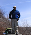
Mark Klim and I found deep snowpack, great snowshoeing, a winter wonderland forest, and terrific views on the northernmost peak of the Willey Range. It was a gorgeous winter day with temperatures up into the 20s after our recent cold snap.
Blue skies greeted us at the top of Crawford Notch.
The Avalon Trail featured a nice packed snowshoe track with a soft layer on top.
Crossing the buried Crawford Brook low down on the Avalon Trail.
A good snow load on this duck-under blowdown.
Climbing out of the steep, deep gully on the A-Z Trail just above the Avalon Trail junction. The A-Z Trail had seen far less traffic and was only partly broken, most recently by a solo snowshoer we met on her way down. Slower going on this mile.
Respectable snow depth at 3000 ft.
Climbing along the A-Z Trail in open sunless forest on the south side of the Crawford Brook valley.
There are many gnarled old yellow birches in here.
Sidehill section approaching the upper brook crossing at 3300 ft.
Climbing up and across the steep headwall of the valley. Above here we met two descending snowshoers who had broken trail across from Mt. Field, and at the Mount Tom Spur junction we chatted with longtime AMC trip leader Tim Kennedy. All three said the going was tough across the ridge in deep soft snow, and a few steps in that direction convinced us to head to Mt. Tom and forget about Mt. Field for today. The couple had even taken a stab at the traverse to Mt. Willey but retreated after plunging into chest-deep snow. Thanks to the recent cold snap keeping hikers home, this was like the "good old days" of winter peakbagging when unbroken trails were frequently encountered.
A tunnel-like section of the Mount Tom Spur.
Snow-caked firs along the Mount Tom Spur.
Meandering along the Mount Tom Spur.
Snowshoe hare tracks.
Mark breaks trail through deep snowpack out to the southern viewpoint.
Mount Washington.
A sweeping view over the Pemigewasset Wilderness, dominated by Mount Carrigain and sprawling Mount Hancock. Mount Tom's views, which are obtained from scrubby fir wave areas, are best with winter snowpack. Wild western spurs of Mt. Field are in the foreground.
Passaconaway & Whiteface through Carrigain Notch.
Mount Field, close by to the south.
Bond, Guyot and Zealand.
The gleaming Presidentials.
The Webster Cliffs and the lower Montalban Ridge peaks.
Fellow Lincoln resident Matt Trigo came by to check out the views.
No Mount Tom hike is complete without a visit from the local residents.
Always willing to take a handout.
The Bond-Twin Range from Tom's western viewpoint, near the true summit. With comfortable temps, we were able to spend an hour and a half at the summit.
The Twins beyond the Zealand Valley and its frozen beaver ponds..
North Twin and Mt. Hale, with Camel's Hump and Mt. Mansfield on the horizon.
Heading back from the western outlook.
Ghost forest at the summit.
Descending the Mount Tom Spur.
A spill into a snow hole along a steep section of the A-Z Trail.
Mount Tom at day's end.