
Thursday, November 8, 2018

COLD RIVER BUSHWHACK: 11/7/18


Late fall is a great time for bushwhacking at lower elevations. This trek led into the Cold River drainage on the south side of Sandwich Dome, visiting roaring cascades, two old logging camps, open birch glades and a remote beaver pond.


One of several excellent rock waterbars on the Flat Mountain Pond Trail above the Bennett Street trailhead.


Leafy strolling on the Guinea Pond Trail, following the grade of the old Beebe River Railroad, a logging line that operated from 1917 to 1942.


The Cold River.


The site of Camp 7 of the Beebe River Railroad.


Ironware from the logging days. These logging artifacts are protected by law and it is illegal (and inconsiderate of other history buffs) to remove them from the WMNF.


 Leafy bucket.


Looks like part of a harness used for the horses.


Remains of an old glove.


The cascades were rocking.


And frothing.


 Multiple drops.


A hidden cascade.


 My favorite waterfall in the Cold River drainage.


Triple decker.


Hobblebush haze. Which can leave bushwhackers in a daze.


Nice hardwood whacking on a remote plateau.


Looking back towards Mt. Israel.


Gorgeous birch glades at 2500 ft.


Moose bed?


Reminiscent of The Kilkenny and Rocky Branch Ridge.


Great sky.


Boot shot for the day, in the comfy low 50s.


After some searching, on a tip received from a fellow Sandwich Range wanderer, I found the site of a high mountain camp of the Beebe River Railroad, a good two miles from the railbed.


A tree has grown through these bedframes.


An array of wood stove pieces.


The "Iron Clad" wood-burning cookstove was manufactured by the S.W. Gibbs Co. of New York.


Old tote road running across the slope.


Approaching the beaver pond through open hardwoods.


Black Mountain, the rugged SW shoulder of Sandwich Dome, is seen to the NW.
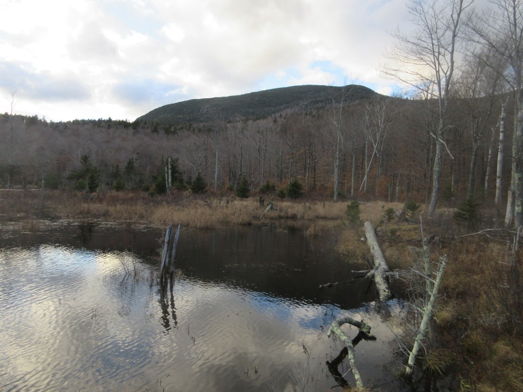


Late afternoon at the beaver pond.


The confluence of the two forks of Cold River.


Thursday, November 1, 2018

Goose Pond & The Sugarloaves: 10/31/18


A ramble around the several trails in the scenic Goose Pond-Sugarloaves area on the west side of Newfound Lake. The trails here are in Wellngton State Park and on the 418-acre Goose Pond-Sugarloaf Conservation Area, owned and managed by the Lakes Region Conservation Trust. The pond and the 'loaves are fine destinations for short hikes in the 2 to 4 mile range.

The trailhead for this area is a parking lot on West Shore Road, at the start of the Elwell Trail - a lengthy footpath with many destinations.


Goose Pond, from a peaceful spot along the Pond Loop Trail.


Trail map at an LRCT kiosk at a trail junction.


The start of the Backwoods (Blue) Trail, one of several routes that follow old woods roads. Some double as snowmobile trails in winter.


On the north side of Big Sugarloaf, the Elwell Trail climbs steeply through a beautiful open forest of red pine and hemlock.


The flat, ledgy summit of Big Sugarloaf (1370 ft.).


Newfound Lake vista.


A clifftop perch near the Elwell Trail, south of the summit.


Bird's eye view of Goose Pond.


Signage.


Rock crevice on Elwell Trail between the two Sugarloaves.


Prime perch at the summit of Little Sugarloaf (1002 ft.).


Nice vista over Newfound Lake. The Franconia and Twin Ranges can be seen in the distance from this spot.


Hardwood gold.


ACTEON PEAK LOOP: 10/30/18


A cloudy, chilly day for a reprise of a bushwhack loop on Sandwich Dome's Acteon Ridge.

An unofficial mountain bike trail provided a pleasant approach to these lower ledges.


Nice spot for a break.


Approaching higher ledges.


Late oak foliage frames the Campton Range.


Twisted oak.


Granite ramp.


The two Black Mountains are especially dark on this gray day.


Late blueberry color.


A cluster of acorn-like fungi.


Cliff in the woods.


Open forest on Acteon Ridge.


A favorite view ledge.


Some oak color on the valley floor, with the Campton Range beyond.


Sandwich Dome and the upper Black Mountain beyond the Smarts Brook valley.


Frosted summit of the Dome.


Open woods in the Acteon Peak-Sachem Peak col.


Neat boulder.


Same boulder from the other side.


There are several big rocks in this neighborhood.


I did a sort of reverse "blueline" of a tributary stream of Smarts Brook, following it from its headwater below the col...


...down through golden hardwood forest...


...alongside small cascades...


...past a little granite waterslide...


...and a pool on the floor of the valley...


...to its confluence with Smarts Brook.


Pool in Smarts Brook seen while whacking back to the mountain bike trail.