Sunday, August 12, 2018

RAVINE OF AVALANCHES: 8/10/18


On a glorious summer day I enjoyed a leisurely bushwhack up the ravine on the north side of North Tripyramid, exploring remnants of a series of slides that fell in 1885 - during the same August storm that triggered the huge and famous North Slide. A total of 8 smaller slides fell in the ravine, and it became known as Avalanche Ravine, or the Ravine of Avalanches. Thanks to Carol for watching the store on its 20th anniversary!


Goldenrod was blooming in profusion at the Depot Camp clearing near the start of the Livermore Trail.


I made a short side trip to see the pretty Norway Rapids on Slide Brook. This brook was originally called Norway Brook, after a type of bedrock, but was renamed after the first Tripyramid South Slide fell in 1869.


Long corridor on the Livermore Trail, which provided an easy 3.6 mile approach to the north end of the Mount Tripyramid Trail.


This is the trail that leads to the steep, slabby North Slide.


Where the trail turns right away from Avalanche Brook and starts climbing to the base of the North Slide, I headed off trail and continued up along the floor of the ravine through lush forest.


This little weedy meadow marks the runout of the eastern fork of the North Slide.


The same spot in winter.
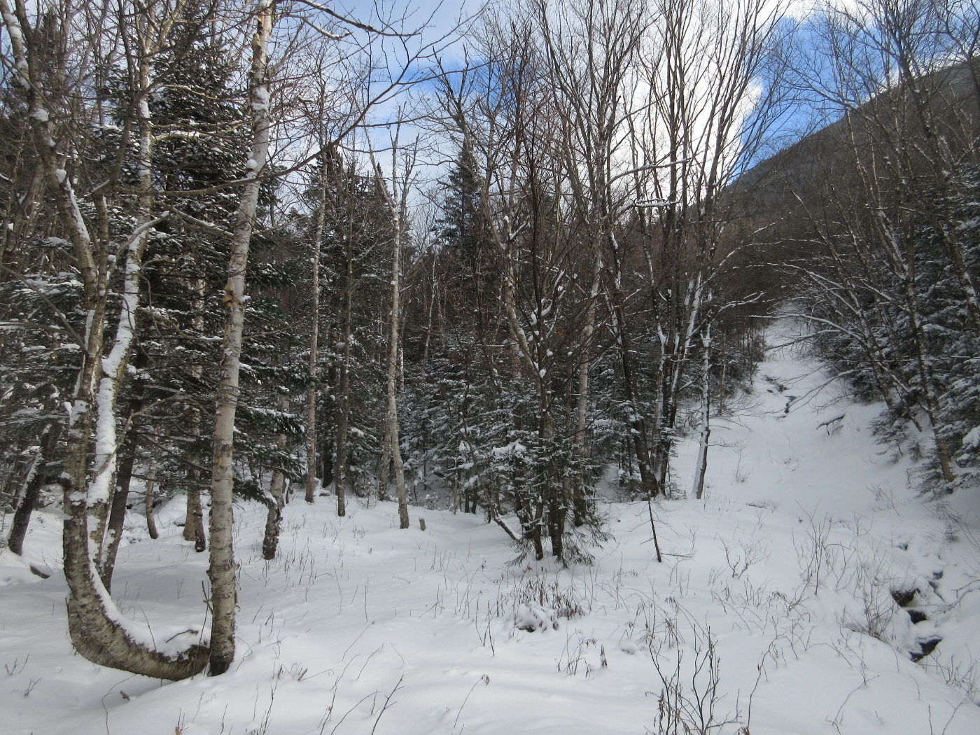

A small stream runs down the lower slabs of the eastern fork of the North Slide. This fork is almost completely revegetated 133 years later.


Mossy bed on Avalanche Brook.


I brook-whacked slowly up the ravine, stepping carefully to protect both me and the streambed moss and plants.


Turtlehead blooming in the brookbed.


One of many pretty scenes along the nearly-dry brookbed.


I climbed up to a remaining open patch of an 1885 slide on the south side of the ravine. This was my third visit to this spot, most recently on snowshoes.


Beyond the SW ridge of Scaur Peak I could see Mt. Osceola, Breadtray Ridge and Mt. Moosilauke.


Another open patch nearby, separated by a band of dense spruces.


Mt. Moosilauke seen through Thornton Gap.


Farther up the ravine I visited this open gravel patch from an old slide on the north side.


The top of North Tripyramid peers down above the trees.


This spot has a nicely framed view of Mt. Tecumseh down the Avalanche Brook valley.


Above here the brookbed was too gnarly and choked with blowdown to provide passage, so I took to the slopes on the north wall of the ravine.


Next came a traverse across the head of the ravine, where a large area of the slope looked like the vestiges of a big old slide.


I emerged on the largest remaining open strip of the slide that fell at the head of the ravine in 1885. A fascinating article, "The Tripyramid Slides of 1885," was written by Alford A. Butler for the March 1886 issue of "Appalachia." Butler paid four visits to the Ravine of Avalanches and wrote about the North Slide and the eight smaller slides in great detail. This article can be read on Google Books.


This partly-revegetated slide provided a fine open view and a comfortable place to lounge in the sun.


The Osceolas front and center, with Mt. Moosilauke on the left and the Kinsmans on the right.


Steep but open woods heading up to a higher slide patch.


The uppermost part of the old slide on the headwall. Based on the descriptions in the 1886 article by Alford A. Butler, I thought there might be smooth bedrock up here, but instead there was soft gravel.


Distant summits could be seen on either side of Tripyramid's Scaur Peak.


West Bond over Bondcliff, South Twin, and a head-on view of the Hancocks.


The full spread of Hancock, with Mt. Carrigain on the right.


The mighty Carrigain.


Parting shot from the very top of the slide.


From the top of the old slide I continued up to the Pine Bend Brook Trail.


View north to the Presidentials and Nancy Range from an open glade near the Scaur Ridge/Pine Bend Brook junction.


Lushness along the Scaur Ridge Trail.


Farther down the Scaur Ridge Trail I bushwhacked down to the floor of the little valley to visit this fine open glade of sugar maples, then followed an overgrown old logging road out to the Livermore Trail.


Artifacts at the site of Avalanche Camp, the second and later of two camps by that name along Avalanche Brook. This one is a large clearing beside the Livermore Trail.


A stop at White Cascade on Slide Brook breaks up the long walk out on Livermore Trail.


An archival photo of the North Slide and Ravine of Avalanches shows the extent of these vast slides shortly after they fell. (Photo courtesy of the Waterville Valley Athletic & Improvement Association.) — in Waterville Valley, New Hampshire.


This 1993 Google Earth image/aerial photo shows how much the slides had revegetated in a little more than a century. Who knows if renewed slide activity will take place on these steep slopes in a future rainstorm.


This 1925 version of Arthur L. Goodrich's map of Waterville Valley shows the approximate location of the slides in the Ravine of Avalanches.


Tuesday, August 7, 2018

DOG DAY HIKE TO NOON PEAK: 8/6/18


Hot and oppressively humid, truly the dog days of summer. Got out for a half day hike to Noon Peak and ledges farther along the Sandwich Mountain Trail.

After dropping down to cross Drakes Brook, the Sandwich Mountain Trail begins a mostly relentless climb to Noon Peak. It is an old trail, having been opened in 1879 by volunteers from the AMC, including Waterville guidebook author, mapmaker and trail-builder Arthur L. Goodrich.Well up on the climb it passes these glacial erratics in an area of open spruce forest.


The Sandwich Mountain Trail climbs 1550 ft. in 1.6 miles to the Noon Peak outlook, and one section is somewhat like the climb to East Osceola from Greeley Ponds Trail.


Hazy vista through Mad River Notch from the main Noon Peak outlook.


Major dropoff into the Drakes Brook valley.


From the second Noon Peak vantage point, South Flat Mountain peeks over the wild col between North Flat Mountain and Sandwich Dome.


The section of trail threading the ridge south from Noon Peak is a wonderful walk. Whenever I hike here, I think of the classic quote from Waterville trail-builder and historian Nathaniel Goodrich: "Beyond Noon Peak it passes through an area of curious elfin beauty.......


"....Gray ledge and grayer reindeer lichen, green moss and low green spruces, long vistas into mystery, utter quiet, a feeling of remoteness, of simplicity, pervade this spot......"


"...Go slowly here."


Approaching Jennings Peak, the trail briefly breaks out onto open sunny ledges.


Fine perches are accessed by following the ledges down to the left.


Cliffs drop off into the upper Drakes Brook valley.


View to the high peaks of the Sandwich Range, from Tripyramid across to Whiteface, behind the northern Flat Mountain.


Overlooking the secluded upper valley..


The double-domed summit of Sandwich looms close by. The original route of the Drakes Brook Trail (opened in 1922) ascended the slope under the summit and emerged near the top after crossing the headwaters of Drakes Brook. The current route of the trail comes up to the ridge much farther to the north, near Jennings Peak.


On the way back, better light on the vista from the main Noon Peak outlook ledge.


Zoom on Tripyramid, with a good angle on the South Slides.


Friday, August 3, 2018

NEIL LUCKHURST'S "PROJECT 100" eBOOK


Last winter I was one of many avid followers of "Project 100,"an epic three-month journey through the Adirondack 100 Highest peaks accomplished (with a little help from his friends) by peakbagger/bushwhacker extraordinaire Neil Luckhurst. If you've done any bushwhacking through dense snow-covered conifers, you will appreciate what Neil and his companions endured on these many long, arduous treks. Neil has just made his Project 100 ebook available online for free, in the hope that readers will make a donation to the ADK High Peaks Foundation. It's a terrific read!


In Neil's words:

The Project-100 ebook is now available for download! In it I share the more intense hikes and my preparation. I think you'll get a sense of my increasing confidence that gave way to certainty after I endured the project's climax weekend in the Sawtooths. The book is heavily spiced with pictures. I also discuss my training regimen.

http://adkhighpeaksfoundation.org/adkhpf/project100.php


The ADK High Peaks Foundation is making the book available to you as a gift. We hope you will make a donation in order that we may continue in our efforts to educate the hiking public and preserve the mountains we all love.

http://adkhighpeaksfoundation.org/adkhpf/project100.php

Neil


CHIPPEWA TRAIL: 8/2/18


On a muggy morning Carol and I went partway up the Chippewa Trail on Black Mountain in Benton to find a couple of geocaches.

Sign at the trailhead on Lime Kiln Rd.


The first geocache was at the Lime Kilns, reached by a short side trip near the bottom of Chippewa Trail. These were in use from 1838-1888, making lime from the extensive beds of limestone in the area. They are located on private land but are open to the public; the site is maintained by the Heritage Commission of the Town of Haverhill.


Black Mountain looms above the lime kiln site.


We went 0.6 mile up the Chippewa Trail to an old cellar hole, then followed a route using an abandoned trail and a bushwhack to the second geocache site.


A happy geocacher.


This site is at a rock known as "Indian Profile" that was mentioned in 1930s editions of the AMC White Mountain Guide.


This rock is where the geocache was found. I thought it a stretch to see a profile here. Maybe it will be obvious to other viewers.


To my eye, this smaller rock a few feet away looked more "profile-y."


From the Indian Profile we bushwhacked across to the Chippewa Trail. Carol headed down and I continued up to a side path to the first view ledges. Chippewa is by far the steeper route to the ledgy top of Black Mountain, but also has several fine views on the way up. It climbs through attractive woods of spruce and red pine.


A faint side path leads to this fine ledge perch at about 2100 ft. No time today to go to the summit - one of the best on the 52WAV list.


Sugarloaf Mountain rises nearby, with Piermont, Cube and Smarts in the distance.


Piermont, Cube and Smarts (R to L).


Across the Connecticut River valley to Vermont's Signal Mountain Range under ominous skies.