
Friday, June 9, 2017


WATERVILLE BACKCOUNTRY: 6/8/17

On a sunny summerlike day I enjoyed a varied ramble in the fine backcountry NE of Waterville Valley. Highlights included forest rambling both gentle and steep, views from The Scaur and along Irene's Path, a stop at the Waterville Flume, and a bushwhack to a "lost" cascade. I also snagged three rather challenging geocaches recently placed by my wife,  NHDaylily.

When heading up Livermore Trail, I usually make a quick stop to see The Boulder in Slide Brook. One of the geocaches is near here.


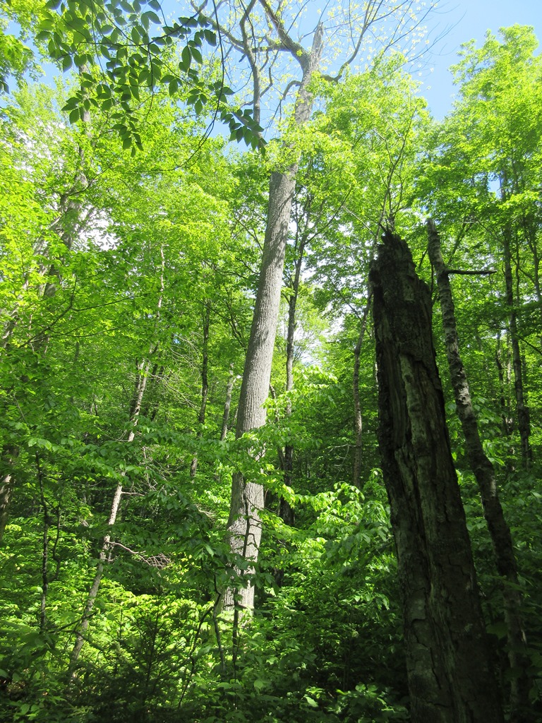
From Livermore Trail I headed up the Kettles Path, a longtime favorite that features good footing, lovely forest, and the three glacial hollows for which it was named. This huge white ash is one of the landmarks along the way.

The rock outlook known as The Scaur, which is reached by a burst of steep climbing at the top of the Kettles Path, is one of our favorite short-hike destinations.


Sandwich Dome and the sharp nubble of Jennings Peak loom large across the valley to the south.


Middle and South Tripyramid are seen over the trees to the east.


Mt. Tecumseh, with the new Green Peak ski trails seen on the left.


A huge prow-like rock rises in the forest along Irene's Path. This delightful trail was opened in 2014, replacing the Flume Brook Trail, which was closed after it sustained severe washouts during Tropical Storm Irene in 2011.


Irene's Path provides an enjoyable half-mile trek along the wooded Scaur Ridge before dropping into the Flume Brook valley. This was the first time I traversed Irene's Path in its summer lushness.


Impressive rock work on Irene's Path, constructed by the Off the Beaten Path pro crew.


Partway down towards the Waterville Flume, Irene's Path offers a unique vista looking north into Mad River Notch. This has become one of my favorite views.


There's a great look at the Osceolas here.
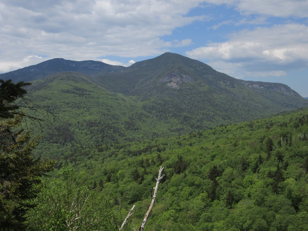

From this spot you look directly across the valley to the wild Painted Cliff on East Osceola.


Fresh greenery on the floor of the Flume Brook valley.


Mosses thrive in this cool microclimate.


Red Trilliums were still in bloom here.


Volunteers from the Waterville Valley Athletic & Improvement Association cleared debris from Tropical Storm Irene and placed rock steps, making views of the Waterville Flume much more accessible.


Looking up through the Flume. The path that once ran along the right edge was swept away by the floodwaters of Irene.


The cascade at the head of the Flume.


A fractured rock wall towers on the north side of the Flume.


A lower perspective reveals both rock walls.


There is much damage from Irene visible downstream.


The Old Skidder Trail is another interesting route in this area. In its lower part it passes beneath this stark rock slab.


After visiting the Flume, I bushwhacked to the Green Cascade higher up on Flume Brook.This cascade was briefly mentioned in the 1892 and 1904 editions of A.L. Goodrich's guidebook to Waterville Valley, and was shown on the accompanying map. Guarded by dense conifer forest, it is not an easy place to find or get to, and I placed my footsteps carefully both for safety (dangerous holes) and to minimize impact on the mossy forest floor.


A bear tree on the way back along Irene's Path.


A weathered rootball, location of an older NHDaylily geocache.


A rock with a topknot, in a field of ferns.


Monday, June 5, 2017


OLIVERIAN BROOK RAMBLE: 6/1/17

This trek took me on a long, gentle walk through the Sandwich Range Wilderness with a bit of bushwhacking added in. Being a bit under the weather from a lingering cold, I found the mellow grades of the Oliverian Brook Trail appealing. This section follows the old grade of the Swift River Logging Railroad (1906-1916).


Painted Trilliums decorate the sign at the Passaconaway Cutoff junction.


The confluence of Oliverian Brook with its West Branch.


Nice hardwood walkin'.


A lazy bend in Oliverian Brook at a trail crossing.


 An old route of the trail continued ahead here into a swampy area. The current trail stays to the east on higher ground.


This trail has its share of wet spots.


Oliverian Brook meanders along the broad floor of this quiet, remote valley.


An off-trail cascade, which I first visited eight years ago with John "1HappyHiker" Compton.


The junction with the Square Ledge Branch Trail.


While bushwhacking towards an isolated cliff on the east side of the valley, I passed this fallen forest giant.


Pleasant woods.


A small slide led up to the base of the cliff.


The perpetually wet cliff from below. This was my third visit here.


Just to the right of the cliff was this shaly slide.


A steep bushwhack got me up around the end of the cliff band.


There is no accessible open rock on this clifftop; mountain holly and other shrubs grow right down to the edge, so the views are of the "stand-up" variety.


But what views they are, featuring an intimate view across the valley to Square Ledge and Mt. Passaconaway.


Whenever I look at the great sheer cliff of Square Ledge, I think of this quote from the 1901 WODC Guide to the Sandwich Range: "The rock splits in great rectangular blocks and breaks away from below so that the upper part of the cliff overhangs the base. Facing the east it is dazzlingly beautiful in the morning."
Square Ledge is frequently a nesting site for Peregrine Falcons, and with binoculars I spotted a Peregrine circling around in front of the cliff.


From another spot I could look up at the green humps of Nanamocomuck Peak and Wonalancet Hedgehog, two more eastern spurs of Passaconaway.


Looking north down the Oliverian Brook valley.


Potash, Hancocks, Hedgehog and Carrigain, with Mt. Lowell on the far right.


Looking down from the top of the shaly slide, possibly a basalt intrusion?


The spot where I hung out for a while.


In the Paugus woods.


I continued up the Oliverian Brook Trail to Paugus Pass, passing this tiny pond along the way.


The four-way junction in Paugus Pass, the low point between Mts. Paugus and Passaconaway.


I went a little way south down the Kelley Trail to see an interesting geologic feature. Here, at just 2100 ft., there was still a remnant patch of snow on June 1st.


In its upper section. the Kelley Trail passes through three small box canyons, steep bowls carved out by huge waterfalls when this ravine briefly served as the outlet for glacial Lake Albany to the north. The largest of these basins is shown as the "PPP," or "Pleistocene Plunge Pool," on the current WODC trail map.


Now only a tiny stream trickles down from Paugus Pass.


A semi-open area in Paugus Pass.


Gentle grades in hardwood forest descending north from Paugus Pass.


A sugar maple of great girth, next to the Oliverian Brook Trail.


On the way out I bushwhacked to another cascade, one of many rewards on this 10-mile ramble.