
Saturday, July 12, 2014


WAPACK TRAIL: 7/10/14

Carol and I enjoyed a scenic ridge walk on a section of this great trail in southern New Hampshire, visiting Barrett Mountain, New Ipswich Mountain, Stony Top and Pratt Mountain. In the evening I also hiked up to Burton Peak, the southern summit of Temple Mountain. Kudos to Friends of the Wapack for their excellent stewardship of this 21-mile route.

We parked on the shoulder of busy Route 123/124 a few miles outside of Peterborough and headed up the driveway into the Windblown Ski Touring Center. The owners graciously allow hiker access on the well-marked Wapack Trail route along the western edge of the property. (No parking on the Windblown property, please.)


There are numerous intersections with Windblown X-C trails, but the Wapack route is amply signed and blazed. Hikers are requested to stay on the marked route.


The first 1.3 mi. of the route is on grassy ski trails. But we saw nary a tick this day.


Follow the yellow triangles.


The route narrows down to a hiking trail and passes through some amazing fern gardens as it ascends Barrett Mountain.


The trail leads through beautiful spruce forest on the broad, gentle crest of Barrett Mountain (1852 ft.). This was Carol's favorite part of the hike.


After dropping to a col and ascending partway up New Ipswich Mountain, we were rewarded with our first good viewpoint of the day at 3.0 mi. This was a great spot to stop for an early lunch and admire Mt. Monadnock.


Trekking along a semi-open area along the crest of New Ipswich Mountain (1881 ft.). A hundred years ago most of this ridge was pastureland.


One of many picturesque scenes along the trail.


Nice ridge walking.


Descending to the next col, we could see Stony Top and Pratt Mountain ahead.


Stony Top is a neat ledgy area with several viewpoints. Here we could look back and see New Ipswich Mountain.


This outlook is on a turn in the trail along the west edge of the ridge.


The entire Monadnock-Sunapee Greenway is in view here.


The unmistakable profile of Monadnock.


At the actual summit of Stony Top are plaques marking the Wapack Wilderness, a 1400-acre parcel of "forever wild" land protected by the Northeast Wilderness Trust and Hampshire Country School. It includes the summits of Stony Top and Pratt Mountain.


Our progress along the ridge was delayed by frequent stops for blueberry pickin'.


A view east over Pratt Pond.


Approaching the summit of Pratt Mountain (1817 ft.).


This overlook side path is 0.2 mi. south of the summit of Pratt.


This open perch has a beautiful view of Binney Pond and Mt. Watatic.


This scene adorns the cover of the excellent "Wapack Trail Map" produced by Friends of the Wapack.


A grassy section of trail in oak forest above the overlook.


View west from the summit of Pratt.


Expansive view south and west from large open ledge area on west edge of Stony Top.


Another neat section of trail.


A glimpse north to Temple Mountain and South Pack Monadnock.


Heading back through the spruces on the crest of Barrett Mountain.


Around 6:10 pm I headed out on a short second hike from Temple Rd. at the south end of Temple Mountain. In the first half-mile there were two SE-facing viewpoints on the Sharon Ledges reached by side paths. This one is called the Roger Myrick Outlook.


The second outlook has a wider view, including Kidder Mountain. Mt. Watatic in the distance, and New Ipswich and Barrett Mountains.


Nice path through the ridgetop forest.


A well-crafted cairn.


Wide western view on Burton Peak, opened a few years ago by a logging cut.


The summit of Burton Peak (2010 ft.). The stone wall marks the Temple-Sharon town line.


GPS track of the Barrett/New Ipswich/Stony Top/Pratt section of the Wapack Trail - one of the nicest ridge walks in southern New Hampshire.


Tuesday, July 8, 2014


AL MERRILL LOOP: 7/7/14

Took a Monday morning off to hike a mellow 5+ mile loop on the east side of Mt. Moosilauke, following the Asquam-Ridge Trail and Al Merrill Loop. Saw some iome interesting sights along the way. Thanks to Carol for watching the store for half a day!


A cluster of tall meadow-rue near the start of the trail.


The railing on this bridge over the Baker River on the Ridge Trail was battered by high water in late June, during a storm when 7 inches of rain was recorded at nearby Lost River.


I believe this weedy opening along the Ridge Trail is the site of the Champlain Realty Company's Camp 3, used during a logging operation around 1920.


This was the only artifact I found with a few minutes of poking around the site.


Severe erosion on the Ridge Trail from the late June cloudburst.


The Baker River, flowing out of Jobildunc Ravine.


Nice pool in the river.


Old boards at the site of Parker Young Company's Camp 3 along the Ridge Trail. Under the direction of P-Y boss Sherman Adams, this was the base for a big logging cut in Jobildunc Ravine in the 1940s.


An old bottle that was lying half-buried in the woods.


Some kind of medicine bottle?


This bed frame is visible from the trail, if you look carefully.


A glimpse of Moosilauke's East Peak from near the Ridge Trail/Al Merrill Loop junction.


Very pleasant walking on the Al Merrill Loop.


Weaving through the ferns.


Into the fir forest, approaching the trail's high point at 3500 ft., near the crest of the Blue Ridge between Mt. Braley and Mt. Kirkham.


Sign marking the outlook just past the high point on the trail.


A vigorous growth of young fir is blotting out the views from this cleared outlook. Standing on a rock, you can still see the South Peak, East Peak and main summit of Mt. Moosilauke.


From here you can also see the 1927 slides in Gorge Brook Ravine. The old Gorge Brook Slide Trail followed the biggest slide.


I made a brief bushwhack foray to the wild crest of the Blue Ridge.


Coming down the Al Merrill Loop, I went slightly off-trail to admire this lush forest glade.


I checked out Dartmouth Outing Club's John Rand Cabin, built in 1983 and available for rent by reservation through the DOC. It was unoccupied today (I checked ahead of time on the DOC wesbite).


The cabin is named after one of the outstanding persons in the annals of the DOC.


Summertime, and the livin' is easy...


The view from the chair.


No hike from this trailhead is complete without a visit to Moosilauke Ravine Lodge.


There's always a friendly welcome inside from the youthful DOC staff.


The view from the front of the lodge.


Major changes - renovation or a complete rebuilding - are in store for the lodge, which was built in 1937-38 from virgin spruce cut off a nearby slope and 75 years later is showing its age. It's still a wonderful place!


Thursday, July 3, 2014


BEAVER BROOK CASCADES: 7/2/14

Waterfalls never look better than on a "HHH" (hazy, hot and humid) summer day. There may be bigger waterfalls, but no other waterfall hike in the Whites can match the first mile of Beaver Brook Trail on Mt. Moosilauke, revealing cascade after cascade plunging down the steep mountainside. Before opening my store a little late on this morning, I climbed this first mile to savor the coolness of the forest and the stunning beauty of Beaver Brook.


I always love this DOC warning sign at the beginning of the steep climb.


The first cascade is only 0.4 mile from the Beaver Brook parking lot, an easy short hike.


The second cascade, which is a bit hidden from the trail.


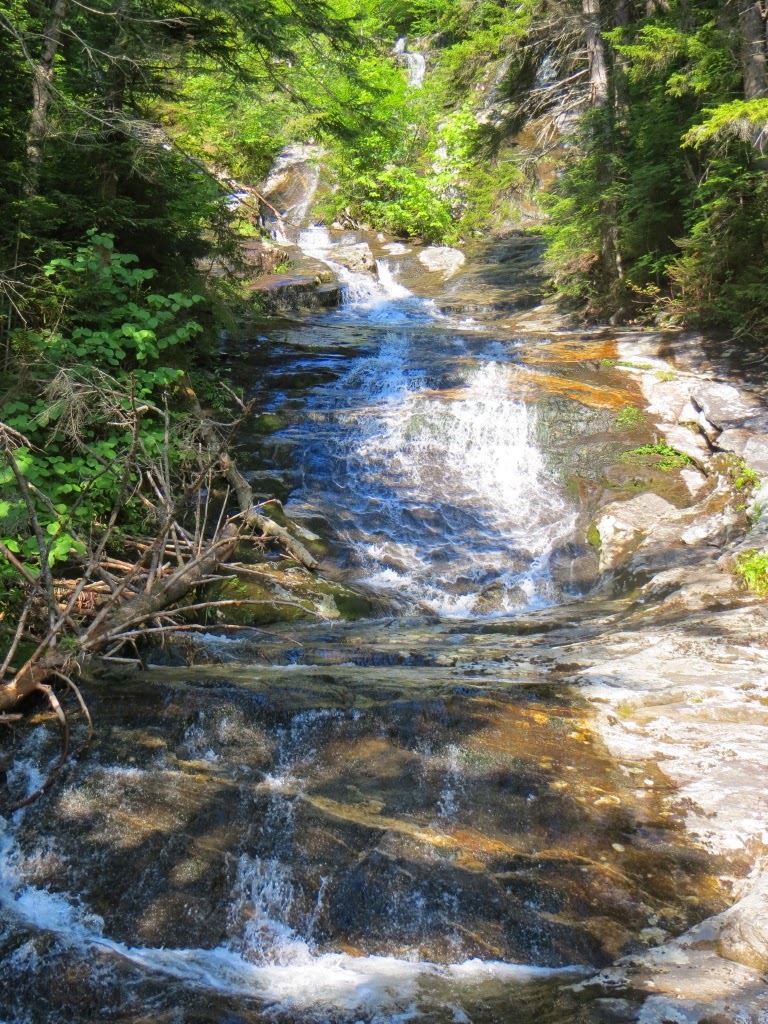
Cascade #3.


Looking down the first tricky scramble (at 2300 ft.), aided by rebar and wooden steps.


At the top of the pitch you are greeted by this cascade.


Despite its steepness, the trail lures you on with tantalizing glimpses of higher cascades.


Probably the biggest single drop along the trail, at about 2550-2600 ft.


Higher up the trail.


A pin step & rebar combo. This is some great trail engineering in near-impossible terrain by the Dartmouth Outing Club.


A side view.


I took a break on a great ledge perch in the stream, looking down into a small gorge.

A sweeping arc of pin steps placed by the DOC trail crew. Good luck getting up or down this slippery ledge without them!


This cascade at 2900 ft. was my turn-around point, as I needed to get down and open the store.
A hazy view of Mt. Wolf.


Looking down the long set of pin steps. This must be a tough spot for AT thru-hikers with tall heavy packs.


An "interesting" spot along the descent.


I stopped here for a few minutes to enjoy the cooling spray..aaaahhhh!


A quick side trip out to Beaver Pond, where I saw a juvenile Common Loon.


Looking up at the Beaver Brook ravine, site of a short but memorable morning climb.