On a beautiful spring morning I headed back down to the western NH
section of the Appalachian Trail for a climb up another of the
interesting smaller peaks dubbed the "Middle Connecticut River
Mountains" in the AMC White Mountain Guide. At 2110 ft., Holts Ledge is the smallest of the major summits in this loosely affiliated group.
Holts
Ledge is noted for the great bands of cliffs on its east face. For a
number of years this has been a nesting site for Peregrine Falcons. There are good views along the edge of these cliffs, and additional views are available from the nearby trails of the Dartmouth Skiway. Holts Ledge is presumably named after the Holt
family of Lyme; an 1892 atlas shows several Holts residing in the area west of the
mountain. The 1932 Dartmouth Outing Club
Handbook noted that it was
specifically named for Holt’s Tavern, once located along the Grafton-Canaan
Turnpike at the base of the cliffs.
As I had done before, I combined a climb of Holts with a fun bushwhack to Bear Hill (1948 ft.), its western spur. I parked in a designated area next to the Dartmouth Skiway and took the northern approach on the Holts Ledge Trail.

First trout lilies of the season. These were the only ones I saw in bloom.
Typical of the Appalachian Trail in this area, the ascent was through open hardwoods.
At 0.8 mile I turned right onto the spur trail that gently descends to Trapper John Shelter.
Waiting for another busy thru-hiking season. Trapper John Shelter was named by the Dartmouth Outing Club (DOC) for a Dartmouth-grad character from the popular 1970s comedy, M*A*S*H.
Some interesting artifacts were displayed on the old stone fireplace and chimney in front of the shelter.
Trapper John visitors can avail themselves of a new state-of-the-art privy.
From the shelter I bushwhacked up a secluded valley towards the broad saddle between Holts Ledge and Bear Hill. The hardwood forest in this basin is wonderfully open. This is why I come to this region in spring.
Spring beauties!
Approaching the saddle.
A gnarled maple.
The east and south slopes of Bear Hill are steep. It was not difficult to make a weaving route up through the ledge bands on the east side.
Looking down from atop one of the ledge bands.
The yellow-blazed AT corridor boundary runs along the crest of Bear Hill.
The wooded summit of Bear Hill.
There were a number of familiar names in the register for this NH 500 highest "peak." This was my third visit here.
On the west knob of Bear Hill is this lovely grassy meadow.
Neat area.
I dropped down to the edge of a south-facing cliff for a nice view of North Moose Mountain.
Descending into fine hardwoods in the Bear Hill-Holts Ledge col.
From here I bushwhacked directly up to the summit of Holts Ledge, passing these shattered blocks of quartzite along the way.
The woods were open the whole way, with a beautiful ground cover in this glade.
More hardwood bliss. I stirred up a deer in this area.
Park-like on the final approach to the summit.
The Holts Ledge Trail/Appalachian Trail passes through a fine spruce forest on the elongated summit crest. This section reminded me of the Wapack Trail in southern New Hampshire.
I descended several hundred feet to the south, then went off-trail to a precarious perch atop a south-facing cliff that I had visited once before.
Here there was a nice vista to the Moose Mountains on the right, with Croydon Peak in the distance and Goose Pond on the left.
I humped back up over the summit and descended a delightful section of trail to outlooks atop the east-facing cliffs.
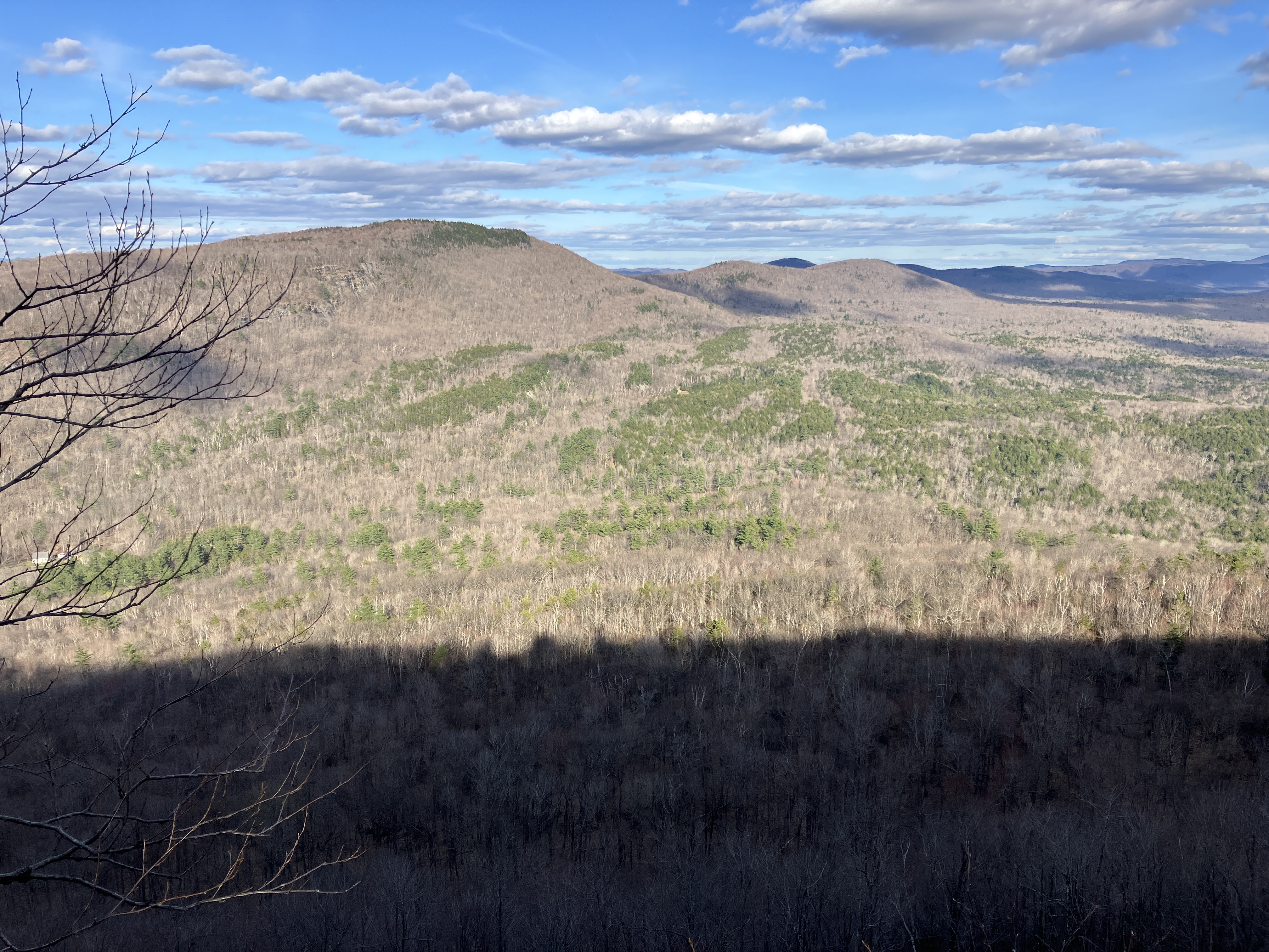
The first outlook has a sweeping view to the east, including nearby Winslow Ledge.
You look out over a great expanse of remote, little-known country to Mount Cardigan on the horizon. To the right of center is Clark Pond, alongside which an old route of the Appalachian Trail once led.
Down-look.
The next outlook offers a spectacular view along the cliffs to Mount Cube and the great bulk of Smarts Mountain. If you zoom in you can see Carr Mountain and Mount Tripyramid on the far right. This spot is closer to the Peregrine Falcon nesting cliff and is sometimes posted against entry, though it was not on this day. Even if it is not posted, visitors should remain quiet so as not to disturb the falcons.
Smarts, with Lambert Ridge in front on the left.
The area directly above the nesting cliffs is fenced off to protect both the nesting falcons and some rare vegetation that grows atop the cliff.
Good view here, too.
On the recommendation of local hiker Spence, who lives at the base of Moose Mountain, I descended via the easy-rated Big Green ski trail of the Dartmouth Skiway. Spence had just come down from a climb of Holts Ledge with his two youngsters as I was getting ready to head up, and we had a good chat.
Easy rolling terrain with nearly constant views.
This remarkable glacial erratic rests beside the trail.
Mount Cube in the distance.
Smarts Mountain peeks over Lambert Ridge. This was a very enjoyable way to end another fine spring day in the lower hills south of Mount Moosilauke.


Good to see you Steve! I realized after our chat that I forgot to mention that glacial erratic and hoped you would take the ski trail down so you could see it. It seems so out of place where it sits. My children were enthralled with it- I had to drag them away:) I’ve got to get up to Bear Hill soon before the bugs and underbrush come out in force. Happy trails!!!
ReplyDeleteGreat to see you, Spence! I had a nice traverse of Moose yesterday. Couldn't remember where that western view was that you mentioned. A trout lily bonanza!
ReplyDelete