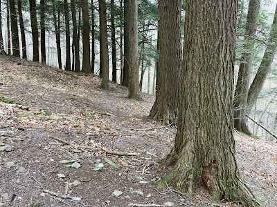
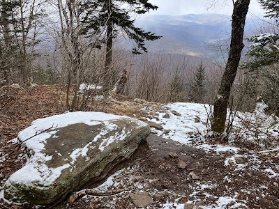
On a chilly, cloudy day with persistent (but non-accumulating) flurries, Carol dropped me off at the remote trailhead in Rider Hollow and headed out to the towns of Shandaken and Phoenicia for some geocaching. My objective for the day was to do a loop hike over Balsam Mountain (3607 ft.), one of the four required winter peaks for the Catskill 3500 Club. While the previous day's hike to Blackhead Mountain was all about the views, today's hike was for appreciation of quiet. less-used trails and picturesque woods.
Near the start of the hike, a footbridge provides a view of the pretty creek that drains Rider Hollow.
In 0.3 mile, the loop over Balsam splits. I went clockwise, up via Mine Hollow and down via Rider Hollow.
Partway up the Mine Hollow Trail is a stand of old-growth hemlocks. Most of the hemlocks in the Catskills were harvested in the 1800s for their bark, which is high in tannin and was used for tanning animal hides at the many tanneries in the region.
Then the trail climbs rather steeply to the ridgecrest through classic Catskill hardwood forest.
Black cherry (on the left) is one of the distinctive components of the Catskill ridge hardwood forest.
The ridge part of the loop follows the Pine Hill-West Branch Trail, a 14-mile route that passes over Belleayre, Balsam, Haynes, Eagle and Big Indian Mountains. Although views are scarce on this wooded ridge, the trail provides delightful walking with good footing.
Much of the trail passes through first growth (never logged) forest, as documented by Catskill forest historian Dr. Michael Kudish.When I come upon an especially fine open hardwood glade in the Whites, I often refer to it as "Catskillian." This is what I mean.
A fun scramble up through a typical Catskill ledge band.
The New York Dept. of Environmental Conservation (DEC), manager of the Catskill Forest Preserve, has signs posted wherever a trail crosses the 3500-ft. elevation.
A bit of snow approaching Balsam's long, level summit crest.
About 0.2 mile north of the summit the trail passes a nice viewpoint that peers down at the hamlet of Big Indian and out to several peaks along the Devil's Path. This was a day where vistas were fuzzed out to varying degrees by drifting snow flurries. In this photo, you can see (L to R) Sherrill, North Dome, Rusk (in back), West Kill, Hunter and (faintly) Plateau. This was about the best I got during an hour's sojourn up here.
View of the viewpoint from the trail.
The actual summit of Balsam is just off the trail on a spur path and is marked by this shark-fin rock.
As the trail descends to the SW, it passes through a magical ridgetop forest.
Meadow-like areas are interspersed among the gnarled trees.
Picturesque Catskill ledges.
More black cherries. I've now done three different sections on the Pine Hill-West Branch Trail and it has become one of my favorite Catskill paths.
Trail junction in the col between Balsam and Haynes.
Dropping into the upper end of Rider Hollow.
These hardwood-cloaked Catskill drainages are beautiful.
After a steep descent, the trail eases along the creek in the lower part of the hollow.
Easy walkin' along the creek.
Rider Hollow Lean-To, likely a popular spot in summer. On this end-of-winter hike I didn't see another hiker.
Carol was waiting at the trailhead, having snagged 14 geocaches during the day. On the drive back we stopped for a look up at Balsam Mountain from a park in Big Indian.


No comments:
Post a Comment