
This hike combined a geocaching quest with a hike over the top of Cannon Mountain. There is a geocache that was placed along the Hi-Cannon Trail last fall that nobody has found yet. Several experienced and dogged geocachers have tried, and all have failed. On this day my wife Carol and her geocaching partners Sue Kenn and Pam Palmer had their sights set on finding "The Spider." If successful, this would mark geocache find #6,000 for both Carol and Pam. (Sue is up to more than 7,400 finds. I'm a slacker at 1,099.)
The three ladies got an early start, and I followed a half-hour or so later, heading up the Lonesome Lake Trail.

A number of log check steps have recently been installed on the lower part of the trail.
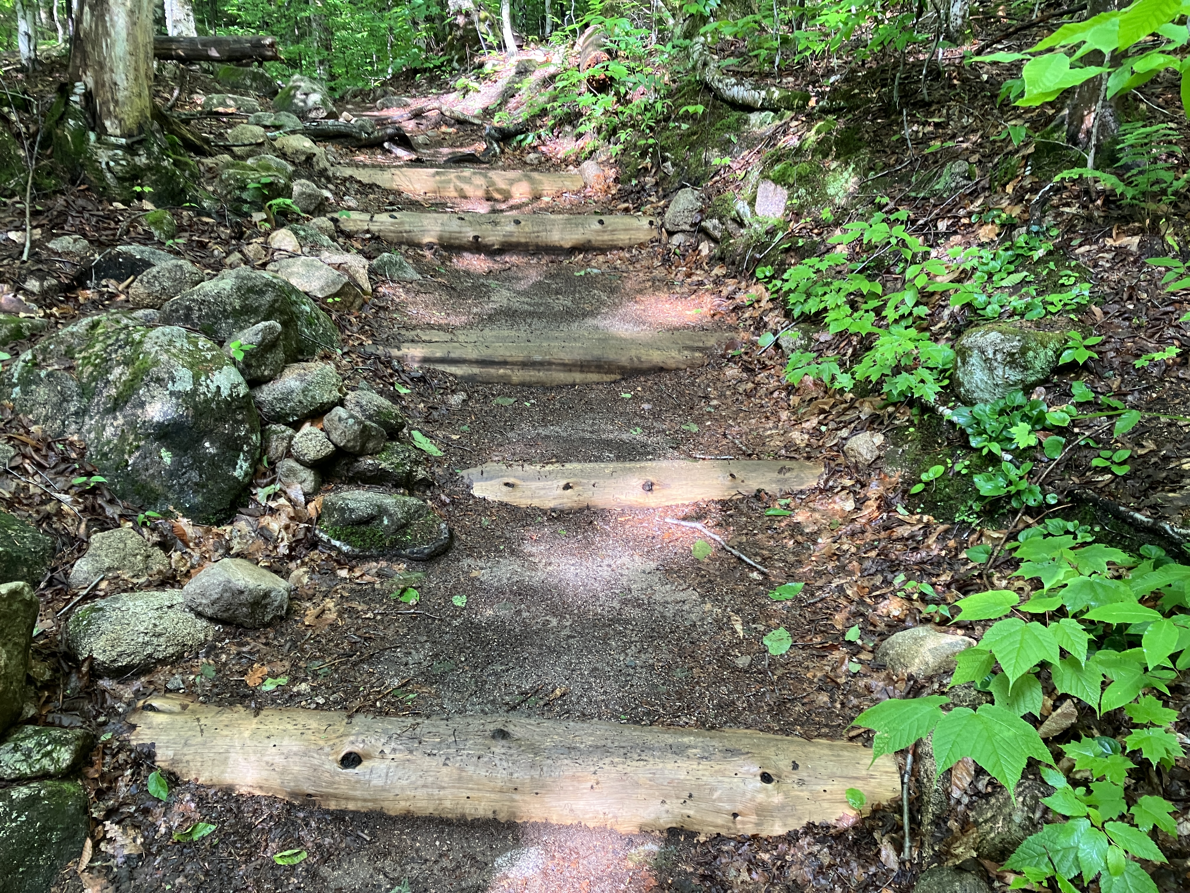
It's a steady 1000-ft. climb up to the lake.

The familiar view of the Kinsmans from the eastern shore.

Looking over towards the Cannon Balls ridge.

The Dodge Cut-Off is a lovely, lightly-used trail that provides a connection across to the Hi-Cannon Trail.

When I arrived at the prominent upturned tree dubbed "The Spider," Carol, Sue and Pam were getting down and dirty. They had been searching under the rootball for a half-hour or more with no success.

I took a few turns under the rootball myself, but we could not find the bloody thing. My geocaching endurance is less than theirs, so after an hour and a half I called it quits and headed up the Hi-Cannon Trail to at least go to the outlooks above Lonesome Lake. (As it turned out, after three-plus hours of searching there was still no find, even after getting a specific hint via message from the cache owner. We all agreed that this was probably the most difficult cache we have ever looked for.)

I hadn't hiked Cannon in summer in a few years, and its gnarly trails were a bit of an eye-opener.

An "interesting" spot where Hi-Cannon Trail threads the needle along a precipitous slope.

First view of Franconia Ridge.

This section is a full-body workout.

The famous ladder that places this trail as an "elective" hike on the Terrifying 25 list.

Looking down the ladder.

View from the top of the ladder.

These 2 X 6 (?) boards bolted to the ledge help hikers safely negotiate the tricky ledge traverse at the top of the ladder.

View down Franconia Notch from the first of three sloping ledge outlooks the trail passes on a traverse at ~3500 ft.

The third outlook is the best, peering down at Lonesome Lake with South Kinsman beyond. I took a nice lunch break here.

A true bird's-eye view.

Rather than return down the ladder and the difficult terrain below, I decided to continue up to the summit and descend via Kinsman Ridge Trail, miserable as I knew that would be. The Hi-Cannon Trail has a few more scrambles in store above the outlooks.

After a mellow stretch along Kinsman Ridge Trail, I arrived at the summit area.

Traffic was apparently light on the Tramway, so it was pretty quiet up in the observation tower. This is the south view, looking over the humpy ridge the Kinsman Ridge Trail follows.

I love the view down into the Coppermine Brook valley.

The Kinsmans and the Cannon Balls.

I spent some time studying the many slides on the west flank of Franconia Ridge.

The famous L & L pair.

The mighty Lafayette.

View south through the notch while heading in the open down Kinsman Ridge Trail.

Cannon's East Peak and Franconia Ridge.

This is a neat subalpine area.

Crossing some rough talus.
Looking back at the summit.

Across the flat top of East Peak.

The open ledges of the East Peak are one of the great spots.

Another angle on Franconia Ridge.

A recent rockfall on the flank of the Old Bridle Path ridge.

Older, mostly overgrown slides (which buried the highway in 1948 and 1959) next to a narrow, more recent slide on the steep west flank of Lafayette. I didn't linger long on the ledges as thunderstorms were predicted.

The descent off East Peak on Kinsman Ridge Trail is relentlessly rough. Here the trail follows the upper edge of a gnarly ski trail, with a view out to the new rockfall on Eagle Cliff and distant horizons beyond.

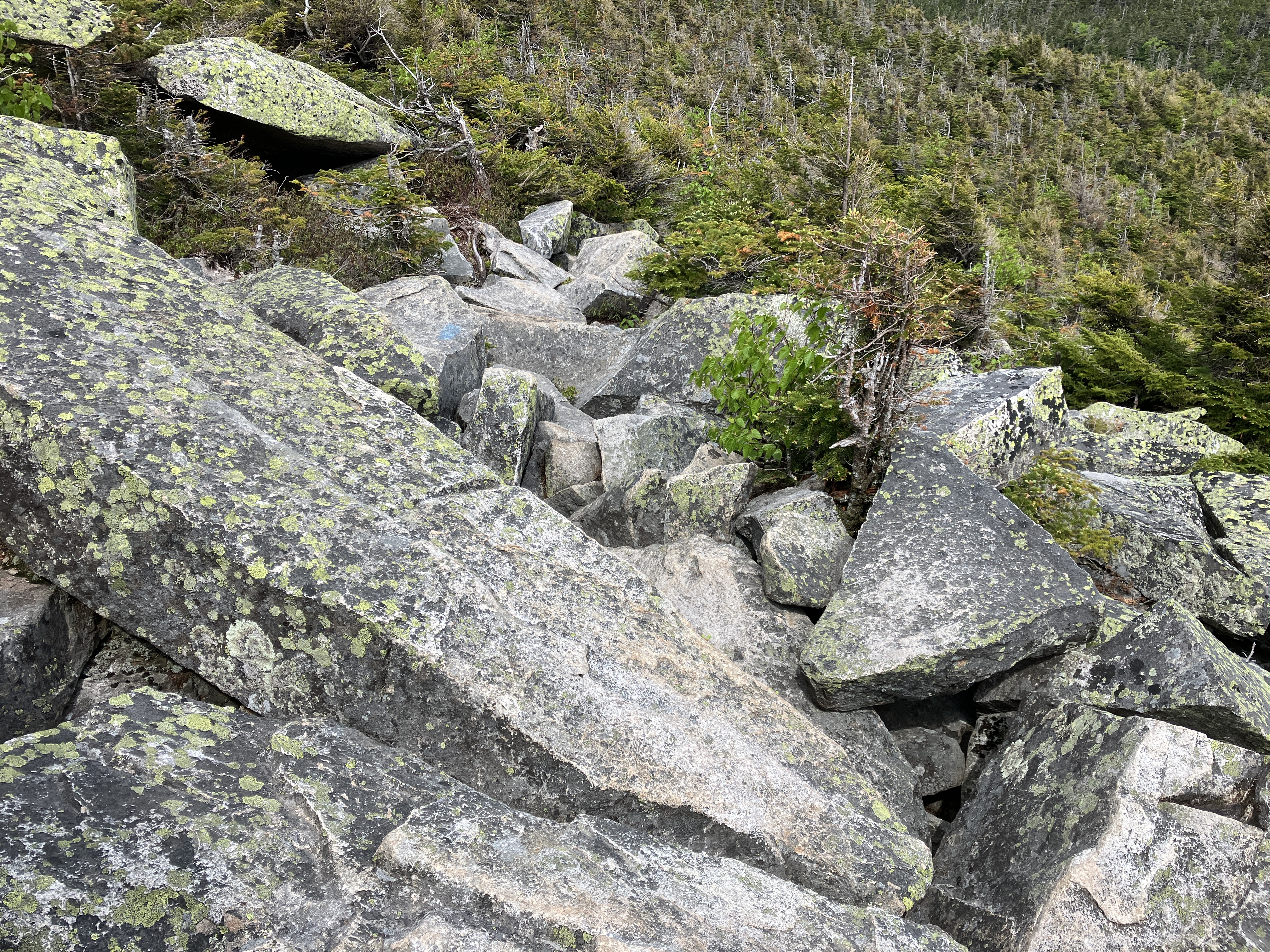
Some truly gnarly footing in this section. The sharply angled rocks make for slow going on the descent.


A broad view beyond Echo Lake from the section along the ski trail.

Ugh.


Part of the notorious eroded gravel trench on the lower part of the trail. I actually found this to be easier going than the rough, wet, rocky footing above.

This washout dropoff does present a bit of a challenge.

The trench goes ever on.

That has to be one of the longest 1.5 mile trail sections in the Whites. I was happy to reach the trailhead, where there was a great look at the Eagle Cliff rockfall. Carol was waiting in the car with a cold soda - thank you!


No comments:
Post a Comment