
On a sweltering sunny day I trekked into the Downes Brook valley and paid visits to a pair of slides on the flank of Mt. Passaconaway. After a visit to the lower slabs of the Downes Brook Slide on the north side of the mountain (location of the abandoned Downes Brook Slide Trail), I bushwhacked across to the track of the Northwest Slide and ascended to the top of the huge rock slab that is its most prominent feature.
Not too far along the Downes Brook Trail was this sled runner, presumably from a logging camp of the Bartlett & Albany Railroad (1887-1894).

The first crossing of Downes Brook is at a nice ledgy spot, with a small cascade and pool just downstream.

The easy grades of Downes Brook Trail, with the stream as a frequent companion, are well-suited for a hot, muggy day,

The fourth crossing of the brook is a wide one. Low water levels made for easy passage.

I wasn't the only one making a crossing.


Into the Wilderness.

A less common white ladyslipper.

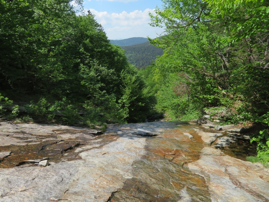
Interesting jointing in the granite on the lower part of the Downes Brook Slide track.

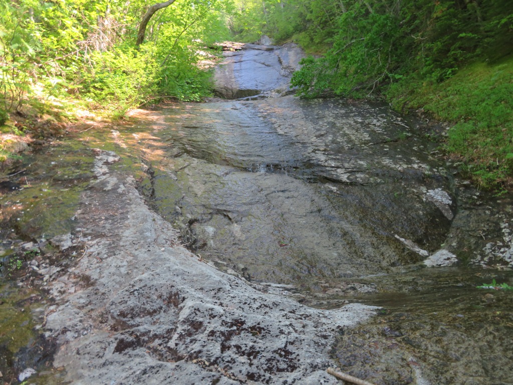
Cascade and pool.

With the water level sparse, it was easy to pick a safe route up through the ledges.

The last cascade before reaching the open slabs.

A basalt dike cutting across the Conway granite.

Side view.

White violets sheltering under a lip of rock.

Onto the lower, low-angle slabs, still mostly bare 120 years after the slide came thundering down.

Interesting water pattern.

Part of the stream hugs a low rock wall.

An island of vegetation that includes birch, red maple, white pine and mountain holly.

After taking a break on a slab in the shade of a white pine, where there was a healthy population of red ants, I climbed to the next set of ledges for a view of Potash Mountain (right) and "South Potash (left).

From here I struck into the woods and headed southwestward.

For a while I floundered in a sea of hobblebush.

Eventually I made my way to the runout track of the Northwest Slide. When Cath Goodwin and I visited this slide in March, the track was an open and firm snowshoe highway.

A tumble of rocks on the slide track.

This sluice was the first of several cascades on the approach to the big slab.

Cascade and pool - a familiar pattern on these slides.

And another.

The top of the big slab is in sight ahead, behind and above a lower fifty-foot drop.

A flat spot at the base of the lower drop, from which to take in the scene.

I climbed partway up the lower drop, but retreated and bushwhacked up around it.

I emerged for a striking view of the huge upper slab and its high, thin cascade.

In high water, this would be an impressive waterfall.

The slab is massive.

The slide pauses on flat ledges at the base of the big slab.
Looking up.

Side view.

I scrambled a little way up to the right of the cascade, and it looked passable above. But I've found on several slides that what looks relatively gentle from below is often much steeper when you get up on it, and it can be very tricky to get back down. Not knowing what it might be like higher up, I once again backed off and headed into the woods to bushwhack up beside the slide.

When I reached this side vantage, I was glad I did not continue scrambling up. There is serious exposure out there, and the wet streaks are dangerously slick. The upper part of Mt. Passaconaway peers over in back.

Where the terrain eases, across from the top of the slab, there appeared to be the remnant of an old tote road from the Swift River Railroad logging era of a century ago.

I came back onto the slide on a water-streaked swath of ledge above the big slab.

I made my way down to a favorite perch where I could see Middle and North Tripyramid and The Fool Killer.

The view continues across to Mt. Carrigain on the right. Franconia Ridge could be seen dimly in the distance.

Carrigain looms massively through the haze.

Plenty of time for a slide snooze in the sun.

Looking up the slide from my perch.

Before making the descent through the woods, I carefully picked my way up dry swaths of ledge to the base of the next steep pitch on the slide, at 2800 ft. In March Cath Goodwin and I snowshoed on and off the slide up to the very top at 3100 ft., but it was too hot to continue up any further this day.
This slide, too, has a basalt dike.

For the descent around the slab, I used a route through some open hardwoods that Cath and I had discovered in March.

A fine old sugar maple.

Below the slide track, my view along the descent to Downes Brook Trail was mostly like this.

I reached Downes Brook at one more interesting rock feature, a sort of half-flume on the streambank. A mosquito-pestered return along the Downes Brook Trail concluded an interesting if sweaty day.


No comments:
Post a Comment