
A longer, more varied and much less traveled route to this Sandwich
Range giant than Dicey's Mill Trail, using six different trails.
Afterwards, I realized that I have now climbed a Northeast 4000-footer
in seven different decades. Is there a patch for that?
Entering the Wilderness on Oliverian Brook Trail. Conditions on the lower trails were hardpacked/crusty/choppy.

On
to Passaconaway Cutoff, the adopted trail of the AMC Four Thousand
Footer Committee, which I maintain with the help of friends. In good
shape today with only a couple of new easy stepover blowdowns.

The crossing of the West Branch of Oliverian Brook rarely freezes well, but with low water it was fairly easy using small rocks.

This hardwood stretch of the Cutoff is enjoyable in any season.

As an alternative to climbing Passaconaway, I had considered bushwhacking up to the mountain's East Slide, but a short off-trail tour on breakable crust nixed that idea.

Halfway up the Cutoff I ran into avid peakbaggers/bushwhackers Zach Porter and Bryan Cuddihee, who were descending after climbing to the summit of Square Ledge. They were the only hikers I saw all day, other than a trio of campers setting up at the Camp Rich tentsite at the end of the day.

Looking up the West Branch.

Long angling climb on the upper half of the Cutoff.

With the leaves down, there are frequent glimpses of the imposing mass of Passaconaway, and its East Slide through the trees. I like how Charles Edward Beals, Jr. describes the mountain in his 1916 classic, "Passaconaway in the White Mountains": "...the loftiest, wildest, yet most symmetrical, most awe-inspiring mountain of the Sandwich Range."

On to the next trail in the sequence.

At this point you are 3.6 miles into the hike, but there is a 1500 ft. climb still ahead.

Oh, darn, the bareboot blues for the next mile.

Looking
up the Nanamocomuck Slide, which, along with East Slide, fell during
the 1938 hurricane. The trail skirts along the base.

Looking back down part of the long, stiff climb on Square Ledge Trail.

Next up, a short link on one of the most interesting trails in the Sandwich Range.

Ugh.

A peek south over Mt. Wonalancet to Lake Winnipesaukee.

In winter, I cut across the East Loop to avoid the very steep climb on the upper Walden Trail.

The only tracks on this trail were postholes from a single barebooter. That must have been fun.

I was happy to reach the smoothly packed highway of Dicey's Mill Trail, the oldest footpath on the mountain (1891).

A pleasant switchbacking climb up the cone, before a steep burst at the top.

Thanks to the sawyer who removed this blowdown.

It doesn't look steep in the photo, but there's one little scramble just before the top that is icy underneath.

Arriving at the NW viewpoint, just before the summit. It's strictly a stand-up view, but there's lots to see.

Nice angle on Tripyramid nearby to the west, with Tecumseh, Moosilauke and the Osceolas behind.
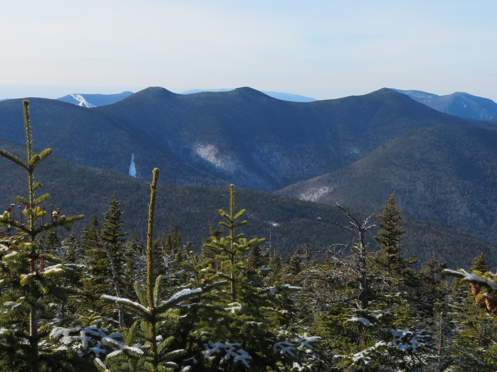
West Sleeper, Tecumseh, South Tripyramid, and the West Sleeper slide, which I had visited two days earlier with Ray "Jazzbo" Caron.

Osceolas behind North Tripyramid.

Hancocks and Carrigain, with Twins/Bonds/Zealand behind.

Franconia Ridge.

Garfield.

Sandwich Dome and Jennings Peak.

The Sleepers.

The flat wooded summit of Passaconaway.

Trail sign by the junction with the short summit spur.

Walden Trail along the summit plateau.

On to the eastern outlook on Walden Trail.

Paugus and Chocorua, the eastern peaks of the Sandwich Range.

Paugus rising above Square Ledge and the upper Oliverian Brook valley.

Chocorua and the Three Sisters.

When climbing Passaconaway, I highly recommend making the side trip down to the north outlook, about a half-mile round trip with 180 ft. of climbing on the way back. Well worth it.

Descending the spur path.

Welcome to the show. On a clear winter day, this is one of the most amazing viewpoints in the Whites, with 38 NH 4000-footers visible and a dramatic dropoff in front. Charles Edward Beals, Jr. called it a "lofty eagle-nest of a cliff."

Looking east.

Looking NW.
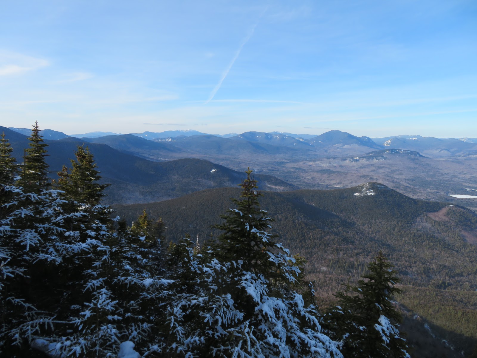
The Presys behind Mt. Tremont.

George in his winter finery.

Wildcats and Carters.

Looking down on Hedgehog Mountain.


Potash, Green's Cliff, Carrigain and the Willey Range.

Carrigain Notch.


No comments:
Post a Comment