
First snowshoe hike of the season, a bushwhack in Waterville Valley. Approached via Livermore Trail and Cascade Brook X-C Trail, then whacked up the ridge between Slide Brook and Cascade Brook to the 3140-ft. western spur of West Sleeper, in search of views of South Tripyramid. Made a loop descent past the beaver meadows at the head of Cascade Brook, north of Lost Pass, and followed the old Woodbury Trail back to the X-C trail. Excellent snowshoeing conditions with powder atop a solid frozen granular base. Depths ranged from 3" at the trailhead to more than a foot in places at the higher elevations.
After 1.5 miles I had first tracks on Livermore Trail.

Up the Cascade Brook X-C Trail. Once the Waterville Valley Nordic Center opens for the season, a trail pass will be required for this trail. This section is one-way downhill for skiing.

Left the trail at 2200 ft. and headed up through open hardwoods.

Great to be laying down tracks through the woods.

An old bear tree.

Good woods. This ridge never had a trail along its crest, but in 1915 a trail was opened across the ridge at about this point, connecting the old Woodbury Trail (Waterville to Mt. Whiteface) with the trail leading to the South Slide of Tripyramid. It joined the latter trail near the small gorge on Slide Brook called the "V," and was named the "V" to Whiteface Trail. It was soon obliterated by logging.

Powder getting deeper.

Fallen giant.

An extensive flat, open wet area at 2600 ft.

Park-like.

There was more hobblebush than I remembered from a previous whack of this ridge in 2006.

Tripyramid through the trees.

Some large yellow birches on this ridge.

Wandering through open glades along the crest.

A good 16" of powder here.

Looking back.

From an open spot, a view of South Tripyramid and the top of the South Slide. Middle Tripyramid peers over in back.
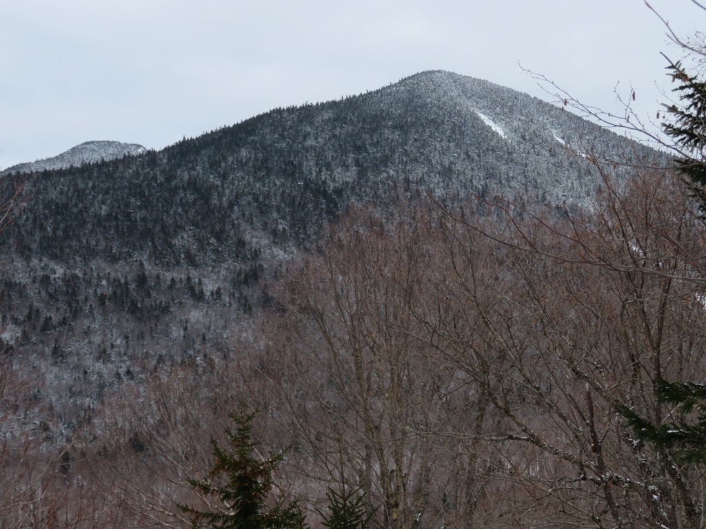
Zoomed.

Wonderful ridge.

Good snow load.

Due to trail-breaking, it took four hours to reach the summit of West West Sleeper.

Looking back at the summit high point. It has only a bit over 100 ft. of prominence, so it's not on any peakbagging list.

Birch glade.

Crossing an open hollow. Strong feeling of remoteness out here.

Head-on view of South Tripyramid. The lower right slide strip fell during Tropical Storm Irene in 2011. In 2006 I found a slightly more open view in this neighborhood, but there wasn't time for extensive searching.

Descending SE through gentle open glades.

Gorgeous.

A wandering bear. Looking for Lost Pass?

It wasn't all peaches and cream. Several blowdown areas required meandering detours.

Northernmost of the three beaver meadows/swamps at the head of Cascade Brook. A flat SW spur of East Sleeper in the distance.

It took quite a while to navigate a route through the tangled swamps, with several shaky stream crossings.

Northern meadow from the other end. Spiky softwoods give a northwoods look to this high plateau.

Nice vista of South Tripyramid from a spot at the edge of the middle meadow.

Zoomed.

Somehow I made this crossing without getting my snowshoes wet.

Making tracks down the Cascade Brook valley on the old Woodbury Trail.This was originally opened in 1902 by Dr. William R. Woodbury and other Watervilleans as a long (6.5 mi. one way) route from Waterville Valley to Mount Whiteface. It was officially abandoned in 1957. It has received sporadic clearing by backcountry ski enthusiasts since the 1990s. Its corridor along an old logging road is mostly easy to follow and is still occasionally used by skiers and snowshoers, but there are numerous wet areas and a number of blowdowns. It is too wet for summer use.

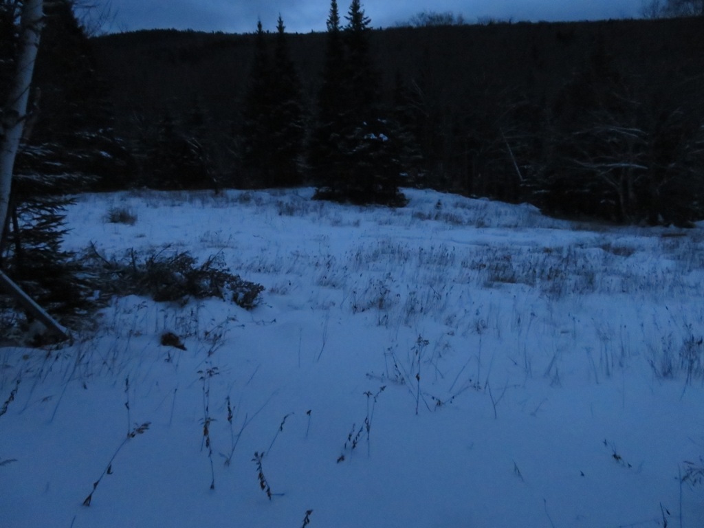
Dusk at the clearing of Cascade Camp along the Cascade Brook X-C Trail. It was used by the Parker-Young Co. for 1940s logging operations. Headlamp time came shortly after passing this spot.

No comments:
Post a Comment