
A LOOK BACK AT THE 2016 HIKING YEAR: JULY TO DECEMBER
While many of my hikes in the first half of 2016 were bushwhacks, during the second half I largely focused on checking trails in various corners of the Whites for the forthcoming (2017) 30th edition of the AMC White Mountain Guide.
On a fine early summer day I made a traverse of Mount Moriah, ascending via the Carter-Moriah Trail from Gorham and descending on the Stony Brook Trail. The southward view from the rocky summit is ample reward for the 4.5 mile climb.

My favorite views on Moriah are from the south cliffs, gazing down into the Moriah Brook valley and out to the Baldfaces and Carters.

The short new connecting path called Frankenstein Cutoff makes possible a loop taking in Frankenstein Cliff and Ripley Falls. This view looks south down the Saco River valley from the main Frankenstein Cliff viewpoint.

Looking down from the top of Ripley Falls.

On a hot and hazy day Carol and I climbed Pine Mountain in Gorham. Here Carol scrambles up the "sporty" Ledge Trail.

Wide views are found on the glacier-scoured ledges atop the south cliffs of Pine Mountain.

The north outlook on Mount Crescent in Randolph offers a matchless vista of the Kilkenny mountains - the Pliny and Pilot Ranges.

From Mount Crescent I made a loop out to the isolated Pond of Safety using the Underhill Path and Four Soldiers Path. A bushwhack around to the north shore rewarded with this view of the Northern Peaks across the water.

Continuing to check trails in the northern Whites, I paid a visit to the cool, damp and mossy Devil's Hopyard, where the trail ends at this impressive rock face.

Then I followed the Kilkenny Ridge Trail south to the great granite buttress of Rogers Ledge, one of my favorite spots in the mountains. This view looks west to the wild, trailless Pilot Ridge.

One early morning I did a short bushwhack up along Walker Brook in Franconia Notch, viewing several attractive small cascades.

On another morning I went partway up Falling Waters Trail to Cloudland Falls.

Another morning tramp brought me to picturesque Little East Pond in the shadow of Scar Ridge.

In late July my niece Rebecca Smith, up visiting from Georgia, joined me for a climb of Doublehead Mountain in the Squam Range, with its great open ledge overlooking Squam Lake. Rebecca is a fitness buff who has completed half-marathons and a Tough Mudder.

On another morning jaunt I visited Lonesome Lake, a longtime favorite, savoring the fine view of the Kinsmans from its eastern shore.

On a full-day loop in the southern Mahoosucs, I took a break on ledges at the top of Dryad Fall.

Farther up I followed the spur trail to the magnificent Bald Cap Peak Ledges, opened by the Shelburne Trails Club in 2012.

After visiting Dream Lake I stopped by Moss Pond on the Mahoosuc Trail and watched this cow moose for a while.

One of the best hikes of the summer was a south-to-north traverse of the Kinsmans, which brought me past bog-rimmed Harrington Pond, set on a high shoulder of South Kinsman.

Ledges a bit south of South Kinsman's summit look down the Eliza Brook valley to Bog Pond and Mount Wolf. Harrington Pond can be seen on the right.

A ledge below the main summit ledge on North Kinsman gazes down on Kinsman Pond.

I enjoyed several fine views of the Wild River while checking out relocations on the Highwater Trail.

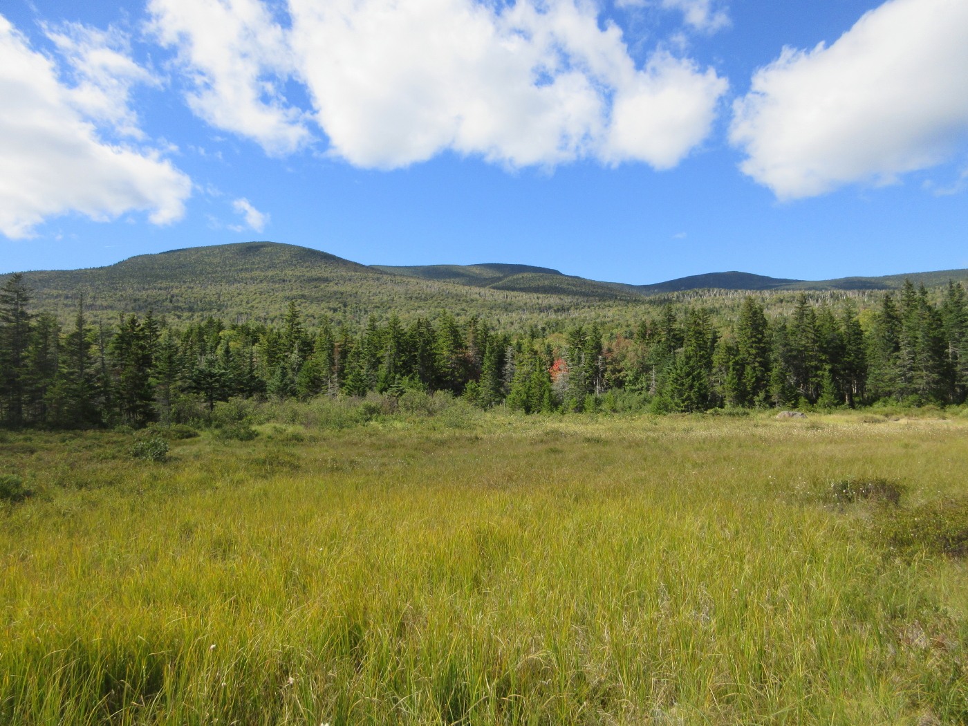
I made a short bushwhack to this pretty beaver meadow just inside the Wild River Wilderness.

Heading north once again, I joined Greg Ortiz for a traverse of a new section of the Cohos Trail to North Percy Peak. We started out from Nash Stream Road by ledgy Pond Brook Falls.

We walked nearly 4 miles of newly opened trail, most of it under the name of Trio Trail.

North Percy is one of the great open peaks of northern New Hampshire. Here Greg looks out towards Christine Lake and the Pilot Range.

I joined my brother Drew and Stacie, a friend of his from the AMC camp at Three Mile Island, for a climb of Mount Israel. We approached along the Guinea Pond Trail from the rough Sandwich Notch Road.

Stacie and Drew enjoy lunch and views of the Sandwich Range at the summit of Mount Israel.

Ledges on the western side of Blueberry Mountain in the Benton Range open wide views across the Connecticut River valley into Vermont.

During a family visit, I joined my brother Drew and my nephew Michael Meguerdichian for a hike to East Pond (seen here) and Little East Pond.

One morning I got up early for a climb up the open ledges of Welch Mountain.

One of the longest hikes of the year was a traverse of the heart of the Mahoosucs with Mark Klim, leading over Mount Carlo, the three peaks of Goose Eye Mountain, and Fulling Mill Mountain. Ascending Goose Eye from the south, AT hikers must clamber up this precipitous ledge with the aid of iron rungs.

Coming off the East Peak of Goose Eye, Mark surveys the open subalpine meadows leading across towards the North Peak.

This section is like walking the Crawford Path without the crowds.

On the open south summit of Fulling Mill Mountain, we were treated to the rare phenomenon known as the Brocken Spectre. That's my shadow in the middle of the rainbow circle.

I spent an afternoon at the beautiful Pondicherry National Wildlife Refuge, where the shore of Cherry Pond offers sweeping views of the Presidentials.

After visiting Little Cherry Pond, I came back past Cherry Pond for some alpenglow on the Presys.

A few days later I enjoyed a higher perspective on the Presidentials from the great open ledges of the Owl's Head on Cherry Mountain.

A hike into Perkins Notch in the Wild River Wilderness brought me to No-Ketchum Pond, a boggy pool with a view of the Carter Dome massif.

From the Rainbow Trail I bushwhacked across the slope through wonderful lush, open glades

My destination was a favorite remote beaver meadow with a sprawling view of Carter Dome and its spurs.
One of the beavers who flooded the Bog Brook Trail near its junction with the Wild River Trail.

Another long valley walk led me along the Hancock Notch Trail from the east, where I witnessed this damage from Tropical Storm Irene at the confluence of the Sawyer River and a major tributary.

Farther west I bushwhacked to a peaceful beaver pond with a unique view of South Hancock and the mountain's massive eastern ridge, which bears two glacial cirques.

The somber spruce forest of Hancock Notch.

The Sandwich Range seen beyond the Dry Brook valley from the summit of South Moat Mountain.

On a fine September day Mark Klim and I took the long back-door route to Mizpah Spring Hut and Mount Pierce via the Dry River Trail and the notoriously obscure Mount Clinton Trail. A mile and a half in on the Dry River Trail, the branches part for this fine view up the valley to Mounts Monroe and Washington and the headwall of Oakes Gulf.

Mark soaks up the sun on the edge of the Dry River.

On the Mount Clinton Trail.

We received a warm welcome from fall hut crew member Chris, who has been in my store several times.

Evening sun illuminates the northward view from Mount Pierce.

I took a hike up the west end of the Hurricane Trail on the south ridge of Mount Moosilauke, to check out several relocations and a new spur cut to a ledge with a view south towards Chokecherry Hill and Carr Mountain.

Later that day I trekked in to the scenic notch between Mount Kineo and Mount Cushman on the newly cleared Hubbard Brook Trail.

On a misty day in early October, six of us made a loop over West Royce Mountain and along the Wild River for the 28th annual White Mountain Cropwalk, a "hike for hunger" that benefits the programs of Church World Service. This moss-lined section of the Basin Rim Trail on the south shoulder of West Royce was one of the trip highlights.

The Cropwalkers - Gary Tompkins, Thom Davis, Dennis Lynch, Roger Doucette and Candace Morrison - pose on a ledge at the edge of the Basin Rim, with Basin Pond in the background.

Nice colors along the Wild River.

On a cloudy day Linda Moore and I traversed the Cooley Hill ridge via the Jericho Road Trail and new trails in the Cooley-Jericho Community Forest. Along the way we bushwhacked to a ledge with an unusual view of the Kinsmans seen across the Easton valley.

Linda emerges from a cave she explored behind the view ledge.

A couple days later I made a solo pilgrimage out to Owl's Head Mountain in the Pemi Wilderness. On the way there I paused to savor this beautiful morning scene at Black Pond.

Mounts Flume and Liberty rise beyond golden slopes, from the Owl's Head slide.

The cairn at the "new," true summit of Owl's Head, 0.2 mile north of the "old" summit.

Alpenglow on Bondcliff from a beaver swamp near the Franconia Brook Trail.

On a peak foliage day I made a long loop in the Three Ponds area. This view from the south end of Middle Pond looks north to Whitcher Hill.

Carr Mountain from the north end of Middle Pond.

Another angle on Carr Mountain, from the vast bog north of Foxglove Pond.

After traversing over the flank of Whitcher Hill, I looped back to the south along the Brown Brook Marshes, passing through some gorgeous park-like hardwood glades.

One day I did a series of short hikes in the Crawford Notch area, enjoying this Notch view from the Sam Willey Trail.

Later that day I visited Sawyer Pond, with its view of Owl Cliff and Mount Tremont.

Little Sawyer Pond was also on the agenda.

Stunning sugar maple glades on the Crescent Range, along the RMC's new Crystal Mine Trail.

This mine site, now in the Randolph Community Forest, was used by General Electric Co. during World War II to provide quartz crystals for radio sets. It's an interesting 4-mile round trip hike with just 650 ft. of elevation gain.

Another bright October day was spent rambling trails near the Philbrook Farm Inn in Shelburne. The "other" Mount Cabot has a fine ledge looking south to the Moriahs and Presidentials.

The Shelburne Trails Club had just reopened an old spur trail to little Judson Pond.

I spent a chilly day rambling around the Albany Mountain area on the northeastern fringe of the Whites. An unofficial but well-marked path leads from the end of the Albany Mountain spur trail to this fantastic view ledge at the south end of Albany Mountain.

The Albany Brook Trail leads to secluded Round Pond.

Back to bushwhacking on Acteon Ridge, I scrambled my way to the top of a south-facing cliff on Bald Knob.

This oak-fringed ledge ramp on a spur of Acteon Ridge has become a favorite haunt.

Bushwhacking off Sandwich Notch Road, I found this peek at Upper Hall Pond and East Weetamoo.

Later that day I made my second visit of 2016 to the great view ledge on the 2732-ft. Black Mountain, off the Algonquin Trail.

On a herd path/bushwhack hike to Black Mountain Pond, I made a side trip to this old beaver meadow high in the valley.

I whacked to a ledge above Black Mountain Pond with a sweet pond-and-mountain vista.

A sun-washed beach at Black Mountain Pond.

On a bluebird day I made a bushwhack probe from the Smarts Brook Trail up a spur ridge of the 3500-ft. Black Mountain, finding some hardwood heaven along the way.

Snow-caked Sandwich and Black from the Smarts Brook beaver pond.

Another whack off Smarts Brook Trail lifted me to a great view ledge between Sachem Peak and Middle Acteon Peak.

A ghostly Mount Moosilauke hovers behind Welch and Dickey Mountains.

The gateway to The Scaur, the fine ledge viewpoint atop the Kettles Path in Waterville Valley.

"Nature's Sculpture" is the name of a geocache placed here by Carol, along the wonderful new Irene's Path.

Another cliff, occasionally scaled by rock climbers, on the south side of Bald Knob.

"The Old Wooden Ship," one of the Davis Boulders along the Goodrich Rock Trail.

Peering out from a natural shelter under the "House Boulder."

Mount Osceola from the top of the old Snows Mountain Ski Area.

One of my favorite trees, in a col along the Snows Mountain Trail.

View of Welch/Dickey and the southern ridges of Mount Tecumseh from a clifftop reached by a spur off an unofficial mountain bike trail in the Smarts Brook area.

I made a return to Sachem Peak on Acteon Ridge with Mark Klim just before Christmas, approaching from Rt. 49 up the High Brook drainage through deep snow. High in the valley we crossed some nice open, snowy ledges with vistas of Tecumseh and Osceola.

Interesting light beyond ledges on Sachem Peak.

Sandwich Dome's summit presides over the upper Smarts Brook valley.

The shadow of the Sachem engulfs Mark, with Jennings Peak beyond.

* 55 mountains, including 9 NH 4000-Footers, 2 NE 100 Highest, 5 Catskill 3500 peaks, and 9 52 With a View peaks.
* 33 White Mountain ponds
* 21 White Mountain waterfalls and 2 in the Catskills.
SAFE AND HAPPY HIKING IN 2017!

Thanks, Steve! Fueling my imagination for next summer!
ReplyDeleteThanks, Paul - look forward to seeing you in the summer!
DeleteSteve
Great summary of the year.
ReplyDeleteGood luck on the trail in 2017 Steve!
Thank you - hope you have a great year in the mountains!
DeleteSteve