HIGH BROOK LEDGES & SACHEM PEAK: 12/21/16
On the first day of winter Mark Klim and I undertook a snowshoe bushwhack to ledges up near the head of the High Brook drainage, and beyond to the spectacular top of Sachem Peak. It was a fine day, sunny and comfortable, though a foot-plus of sugary snow made for slow going.
We parked at the High Brook Picnic Area off Rt. 49 and walked 0.3 mile up the highway to a logging road that leads up to the powerline and beyond into the drainage of High Brook. Just past the powerline this open area provided a view of Jennings Peak.
The old road led for a while along the north side of High Brook.
Mark heading into the morning sun along the logging road.
Where the logging road swings left along the north fork of High Brook, we left it, crossed the fork, and slogged through a flat area infested with hobblebush.
This area of diverging drainages was rather confusing. We made two more crossings before heading up our target ridge. Though the streams were small, mounded snow and uncertain ice made the crossings tricky.
After the third crossing, we headed up a broad ridge between two forks of the brook, crossing this old contouring logging road at 1900 ft.
We found mostly fine open woods on this ridge.
After a fairly long, steady climb we veered eastward and up towards the High Brook ledges.
We arrived at the sloping, snowy ledges (elevation about 2450 ft.) after three hours of snowshoeing.
Mount Osceola could be seen to the north.
This was a neat remote spot to visit on a sunny winter day.
It offered a good perspective on the long southern extension of the Mount Tecumseh range.
Welch and Dickey loomed impressively across the Mad River valley.
While sitting here for a lunch break we saw two adult Bald Eagles sail by, heading west towards the Pemigewasset River, we assumed.
Tecumseh and Osceola from the upper part of the ledges.
The ledgy top of Sachem peeks over the trees.
We decided to continue up towards Sachem Peak and at least try to reach a view ledge along the eastern side of the ridgecrest. A frontal assault on the steep north side was out of the question, so we made a loop out to the east and then south up to the Sachem-Jennings col, where we found wonderfully open woods.
Jennings Peak from the first ledge on the east ridge.
A tussle with dense conifers brought us to a second ledge with this view across to massive Sandwich Dome.
We wouldn't be continuing in this direction! We did a lot of weaving and some snowshoe-clawing to get up to the summit.
Mark on the third view ledge.
After a flanking maneuver around a steep wall we struggled our way up the summit ledges, getting this perspective and unusual lighting along the way.
The summit of Sachem! We got here at 2:50 pm and could only spend about 20 minutes refueling and taking in the 360-degree view.
Looking down the High Brook drainage. The ledges we visited earlier are the snowy patches glimpsed in the lower center.
Sandwich Dome presides over the upper Smarts Brook valley.
King of the hill.
Looking across the Smarts Brook valley to Black Mountain and the Algonquin Trail ridge.
A hazy vista down the valley.
Looking north. The distant Presidentials were in the clouds.
Jennings and Sandwich are connected by a gentle ridge.
Beautiful late afternoon light and shadow.
Mark is engulfed by the shadow of the Sachem.
Descending over the High Brook ledges with dusk drawing on.
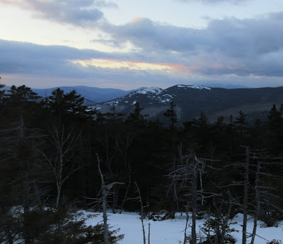
A bit of a sunset over Welch and Dickey. Time to get moving! We did the last half-mile by headlamp. A memorable snowshoe trek!


No comments:
Post a Comment