
PONDICHERRY JOURNEYS
Over the last few days I've enjoyed two hikes into the interesting and scenic Pondicherry region on the northern edge of the White Mountains. On Friday afternoon, 9/10, I wandered the various lowland trails in Pondicherry National Wildlife Refuge, with visits to Cherry Pond and Little Cherry Pond. On Tuesday, 9/13 I climbed the nearby peaks of Owl's Head and Mount Martha, the two principal peaks of sprawling Cherry Mountain. This mountain was originally called Pondicherry Mtn., a name which appeared on the charter map for nearby Bretton Woods in 1772, in Jeremy Belknap’s journal of a 1784 tour through the White Mountains, and in several other sources. Pondicherry was the capital of French India and historians have speculated that the name was applied by French explorers venturing down from Canada. In 1963 the name was also applied to the wildlife refuge when it was first created.
1) PONDICHERRY WILDLIFE REFUGE, 9/9/16
I spent the late afternoon and evening wandering around the trails of the Pondicherry Division of Silvio O. Conte National Wildlife Refuge. These easygoing trails around Cherry and Little Cherry Ponds offer striking mountain views, unusual wildlife, and a variety of wetlands and forests.
This trail map is posted at the trailhead parking area off Airport/Hazen Road.

The excellent Pondicherry trail map by Wilderness Map Co. shows a "state champion" white spruce tree in about this location.

The Pondicherry Rail Trail reaches Cherry Pond in 1.5 miles of easy railroad bed walking.

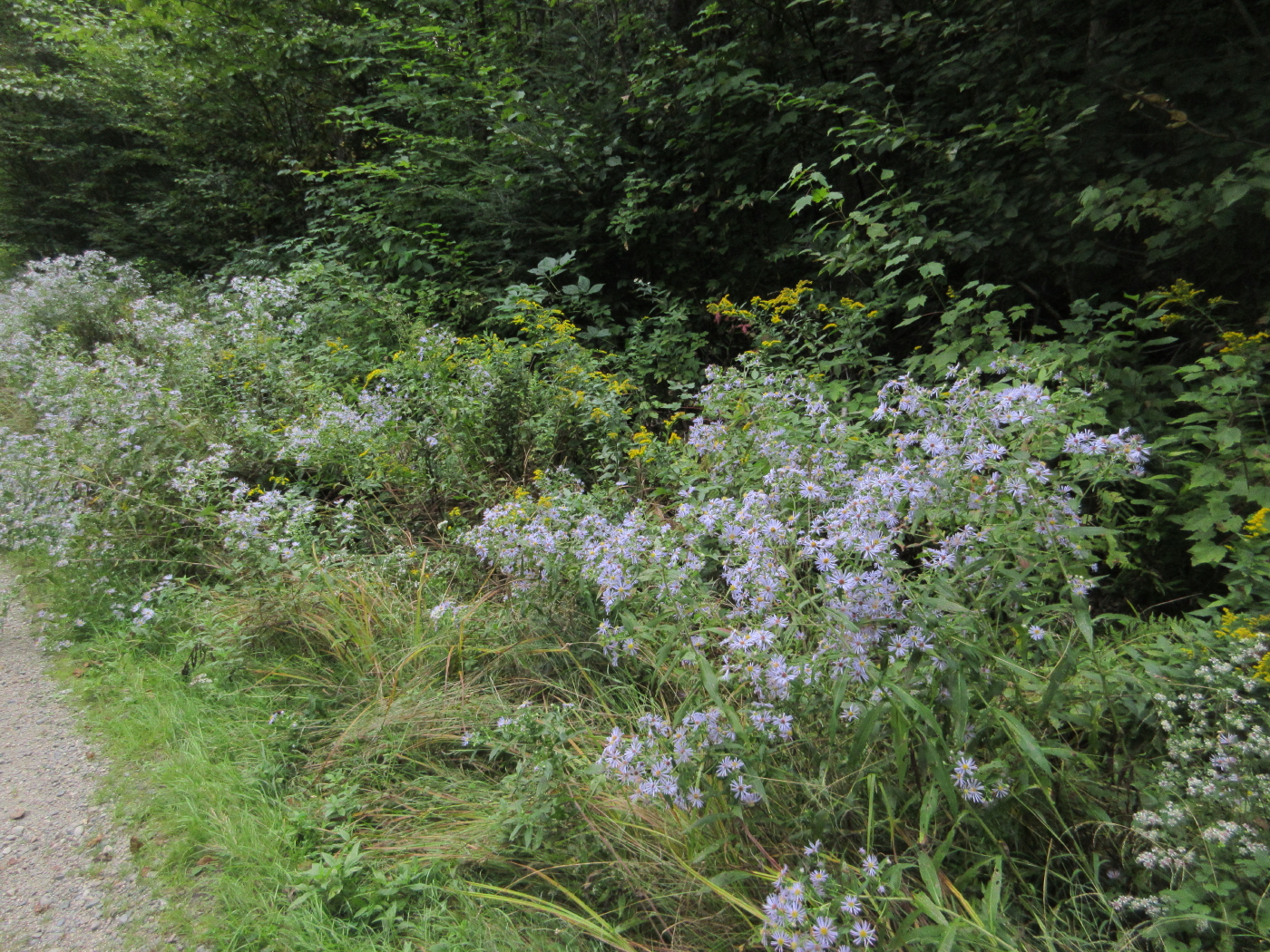
Asters and goldenrod bloom in abundance here in late summer.
The viewing platform at Cherry Pond is dedicated to legendary NH ornithologist and naturalist Tudor Richards, who was instrumental in creating the refuge.

The viewing platform, a popular birding location. More than 230 bird species have been recorded on the refuge, which has been designated as an Important Bird Area.

Long view across to the Pliny Range.

Cherry Pond has long been famous for its watery vistas of the Presidential Range.

A restful spot along the Shore Path.

Owl's Head and Cherry Mountain.

Another angle on the Presys. There were Wood Ducks and a Common Loon out on the pond, and Belted Kingfishers were rattling around.

This trail, a short link in the Cohos Trail, follows an "ice push rampart" along the shore of Cherry Pond and adjacent wetlands. This is a low berm pushed up on the shore by expanding ice, over thousands of years.

A bench along the Ice Ramparts Trail offers this view of Owl's Head/Cherry.

This large black cherry, perhaps another champion tree shown on the map, is near the junction of the Ice Ramparts and Colonel Whipple Trails.

Mt. Washington finally breaks free from its cloud cap.

Viewing platform at Little Cherry Pond, where the evening sun was glaring across the water. Saw a Double-Crested Cormorant here.

This place has a real primeval aura when the ducks and frogs are squawking.

An unusual geocache near the Little Cherry Pond Trail. As I was signing in I heard a tapping overhead, and looked up to see a Black-backed Woodpecker, a "northern specialty" of the boreal forest.

Alpenglow on the Presys.

Dusk at Moorhen Marsh, a half-mile up the Presidential Rail Trail.

2) OWL'S HEAD & MOUNT MARTHA, 9/13/16
On a gorgeous late summer day with low humidity, I made a long-overdue return to the spectacular ledges on Owl's Head, the northern spur of Cherry Mountain. And a ramble along Martha's Mile to Mount Martha is always a delight.
Owl's Head Trail is well-maintained by the Randolph Mountain Club. It leaves from a good parking area off Rt. 115.

After an initial somewhat mucky meandering lower section, rerouted twice since 2000 due to landowner issues, it follows an old logging road through young hardwoods to a crossing of Stanley Slide Brook, named for the massive 1885 landslide that crashed down the slope and killed a farmhand named Walker. The slide received wide coverage in the media.

Just above the crossing the trail enters the WMNF and climbs through a fine hardwood forest.

It gets down to business and goes up 1600 ft. in the upper 1.3 miles. This is the last pitch before it gains a northwestern ridge.

View to the Northeast Kingdom from the true summit.

Approaching the ledges just down on the SW side.

Vast western horizons.

Perhaps the best end-to-end view of the Presidentials anywhere, seen beyond the wild little Walker Valley, "The Humps" and the Dartmouth Range.

Mount Chocorua through Crawford Notch.

Oh yeah!

Looking NE to the distant Crescent and Mahoosuc Ranges.


Great ledges! There are few better spots to hang out in the sun for a while.

Mount Martha looms close by to the south.

Nice new sign as Martha's Mile makes a short, steep drop off the ledges.

A typical open forest scene along the wonderful Martha's Mile, admirably maintained by John "1HappyHiker" Compton.

An impressively gnarled old white birch in the col.

A small clearing and Presidential view at the flat, brushy summit of Mount Martha. Not quite as good as Owl's Head's Presy vista.

The cleared NW vista has become quite restricted.

A beaten path leads down to a sweeping vista west and SW, best viewed while standing.

Two dozen 4000-footers can be seen from this one spot.

Liberty across to North Kinsman.

Carrigain, Hancock and Bretton Woods Ski Area.

Supports remain from the old fire tower.

Summit geocache.


The upper part of the section leading to Cherry Mountain Road is a fine woods walk, but I didn't go far when I realized I'd left my GPS up on the summit.

Ferny footway on Martha's Mile.

Approaching from this side, these two venerable birches look like the guardians of Owl's Head.

The steep pitch up to the ledges. Tricky in winter.

The Presidentials view is better in late afternoon light.

The Northern Peaks and Mount Washington.

Washington and Monroe. The top of the Great Gulf headwall can be seen in shadow.

Before heading home, I made a short but steep and thick bushwhack down the east side of the cone to a ledge I had spotted on Google Earth.

The joke was on me, as this was the only view it offered.

Working a route back up around little cliff bands.

Lush high-elevation forest.

I wasn't totally skunked on the whack, as I chanced upon this framed vista of Mounts Starr King and Waumbek, with Mount Cabot peering over on the left. The pond is an artificial impoundment on the east side of Rt. 115A.


No comments:
Post a Comment