
SANDWICH NOTCH RAMBLE: 5/3/16
This 12-miler on a gray day had a little bit of everything: ponds, beaver meadows, waterfalls, historic sites, and an obscure viewpoint. The route consisted of hiking trails, a ski trail, some road walking, fisherman's paths and some bushwhacking.
I started from the Smarts Brook trailhead on Rt. 49 and followed the Smarts Brook and Tritown Trails...

...and then the Atwood Ski Trail.

The ski trail is used by mountain bikers and along the way there were junctions with several other mountain bike trails with clever names ("Uncle Wiggly" was another) and spiffy signs.

This part of the ski trail was quite well-worn.

The ski trail reaches Atwood Pond by a ledge with a nice view over the water.

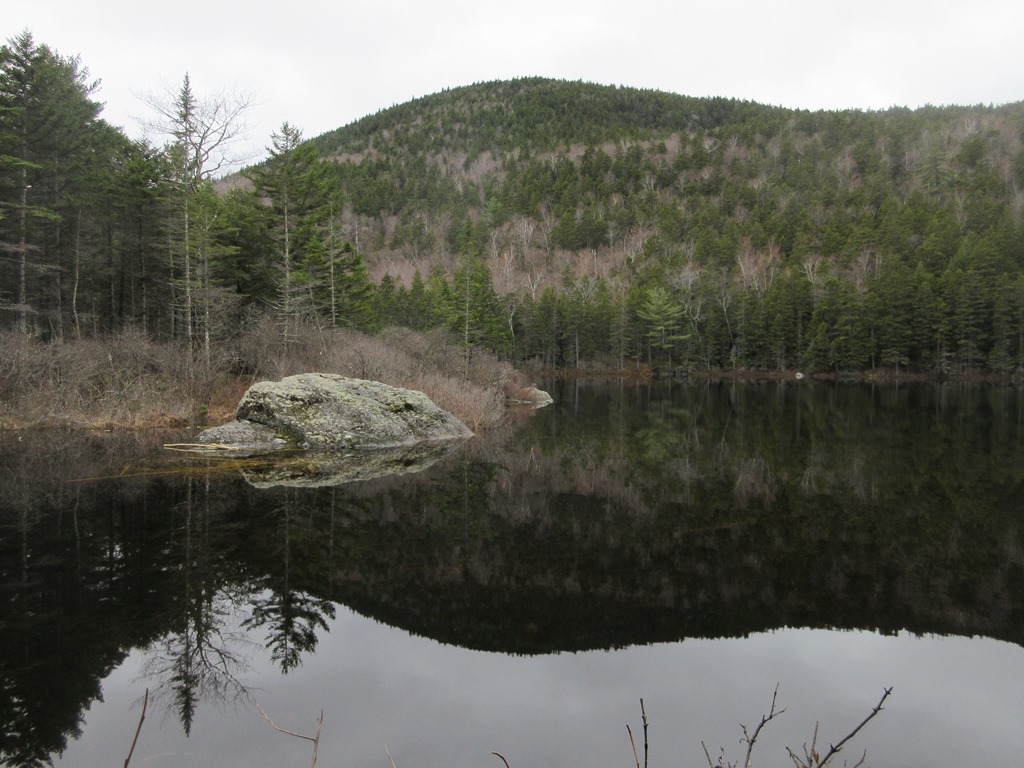
An old beaver dam at the pond's outlet.

I followed the ski trail out to Sandwich Notch Road, then followed an old woods road and path back in to the best sitting ledge at the pond, right across the outlet from the first ledge I visited.

This spot had a wide-open view over the small, still pond.

Next I checked out the cellar hole at the 1830s homestead of Ezra and Polly Atwood, off Sandwich Notch Road. There are dozens of historic sites in Sandwich Notch that are described in a booklet published by the Sandwich Historical Society, which can be purchased at http://www.sandwichhistorical.org/excursions-61---70.html. The Sandwich Notch publication is the 69th Excursion, 1988. A previous version was published in the 16th Excursion, 1935.

Nearby are the remnants of a barn foundation.

Pleasant walking along Sandwich Notch Road. On the two road walk segments I saw just one vehicle, the only folks I encountered all day.

One of the steep paved pitches where, if you're driving, you hope no one is coming the other way because you can't see over your hood. Motoring over the Notch road is always somewhat of an adventure and is best done with a high-clearance vehicle.

The short, steep side road to Upper Hall Pond had not yet been opened for the season.

The peaceful scene at Upper Hall Pond, looking across at rugged spurs of Mount Weetamoo in the Campton Range. The calls of two loons echoed off the mountainside.

Remains of a former private camp at Upper Hall Pond burned by the Forest Service after this inholding was acquired for the WMNF.

Not a bad spot for your front yard.

A swampy meadow to the south of Upper Hall Pond.

I followed an obscure fisherman's path down to Middle Hall Pond. Just above Middle Hall Pond the brook that flows between the ponds plunges over an impressive but officially nameless waterfall.

A closer look at the lower part of the waterfall.

Rugged rocks beside the falls.

Side view, partway up.

The upper falls.

Converging sluices.

Looking down from the upper falls.

The inlet brook slides its way into Middle Hall Pond.

Middle Hall Pond from the inlet.

This beaver-gnawed tree is ready to topple.

Middle Hall Pond is a small and secluded gem nestled at the foot of the Campton Range. In the middle it's 56 feet deep.
View from a sitting rock on the south shore.

Leaving Middle Hall Pond.

The unofficial, orange-blazed fisherman's path between Middle and Lower Hall Ponds passes by this interesting ledge.

Next to it is an enormous mossy rock face.

Nice hardwood forest along the path.

The view from the SW shore of Lower Hall Pond, with Black Mountain and Sandwich Dome obscured by clouds.

The inviting viewpoint.

Following more fisherman's paths and an old logging road, I passed another viewspot on the NW side of Lower Hall.

Looking down an inlet brook drifting towards Lower Hall.

The Moses Hall Place, the only remaining house in Sandwich Notch, is set on a small private inholding. This house was actually built in 1877, after the Sandwich Notch community had mostly faded away. The older original house at this site is now a woodshed.

Next was a 3/4 mile walk up the Algonquin Trail.

A beaver meadow just off the trail a short way in.

Another beaver meadow at the 3/4 mile mark.

Near here I followed the trace of the 19th century North Road to another historic site behind the location of the Durgin Farm.

Traces of a barn foundation.

One of many stone piles found along the North Road, which ran from Sandwich Notch Road near the height-of-land past Guinea Pond to Mount Israel Road. The Sandwich Notch community flourished in the early to mid-1800s, and was mostly abandoned by the time of the Civil War. For more images of historic sites in Sandwich Notch, visit photographer Erin Paul Donovan's gallery.

I followed the trace of the old North Road until it petered out, then bushwhacked to this neat spot.

Just beyond was a beaver meadow tucked in among steep slopes.

Looking back to the south.

Rugged ledges behind the meadow.

Leaving the beaver meadow.

A last look back.

Above the meadow the inlet brook plunges over a lofty cascade.

Bushwhacking north, I crossed this pretty plateau of hardwoods.

Another beaver pond farther up the little valley.

A gorgeous hardwood stand with lots of white ash. Might be a likely spot to find some Dutchman's Breeches flowers in a week or two.

I continued up onto a spur ridge of Black Mountain adorned with several ledgy meadows.

I gained a view of the Campton Range from the uppermost meadow.

There was lots of moose sign up here.

At 6:30 pm, it was time to bushwhack down through a hardwood valley to the Smarts Brook Trail. I was familiar with this route, having snowshoed it in January.

One of numerous cascades on a tributary of Smarts Brook.

The largest of the cascades, which I'd seen as an ice flow in January.

This and the other cascades were in good flow after the previous day's rain.

A ledgy waterslide.

Dusk at the beaver pond by the Smarts Brook Trail. I was able to hoof it out the last 1.5 miles without resorting to the headlamp. It was a most interesting day!


Just discovered your blog here, looks like a wonderful day. Was thinking of taking the kids on a hike to the Hall ponds after reading this.
ReplyDeleteThe Hall Ponds are beautiful, and it's a nice mild backcountry adventure.
DeleteSteve
Stealth camping available at the ponds?
Delete