Saturday, October 12, 2013


MOUNT CARRIGAIN: 10/10/13

The mighty Carrigain had been on my hike wish list this year, and when my good friend Harry Cunningham called and asked if I wanted to hike it with him this week, it was a go. Harry drove up from Concord in the morning, picked me up in Lincoln, and we headed over to the Sawyer River Road. We were on the Signal Ridge Trail just after 9:00 am on a cool, crisp morning with high thin clouds but excellent visibility.


The Signal Ridge Trail gives you a nice easy warm-up in the first two miles, including a scenic stretch alongside Whiteface Brook.


On the third of three 2012 relocations, the Signal Ridge Trail now crosses Carrigain Brook on a section that was formerly part of the Carrigain Notch Trail.


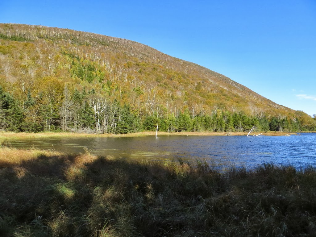
We made a short off-trail foray to the edge of a beaver meadow for a neat view up to Signal Ridge.


New bog bridges near the beaver meadow, placed in June by volunteers organized by the Four Thousand Footer Committee (led by Keith D'Alessandro) and the Saco Ranger District (Cristin Bailey).


October is a great time to be in the hardwoods, here on a new trail segment along the relocation. The hike to Carrigain is now 5.3 mi.each way, 0.3 mi. longer than before, with an extra 50 ft. of elevation gain each way.

Shortly beyond the relocation, the trail gets down to business and begins a long steady climb up the east flank of Signal Ridge. The crux is a mile-long sidehill traverse that features some tedious, sharp-edged rocky footing in places.


A framed view east at about 3400 ft. along the traverse.


A twisting, turning stretch of trail ascends to the crest of Signal Ridge.


First open views on Signal Ridge, looking down into the lower Carrigain Brook valley. Still some nice foliage colors down there.


Harry takes it all in - a fitting reward for a long climb.


Relaxing on the ledges at the top of Signal Ridge - one of the great spots in the mountains.


Looking north from Signal Ridge past Vose Spur and peak "4266," northeastern spurs of Mount Carrigain.


Getting ready to head for the summit, just a half-mile away.


Along the ridge we chatted with AMC trip leader and "grid" finisher Dave Langley, who was hiking with Walter (L) and Kody (R). Dave is proprietor of Paws Applause Natural Pet Supplies & Grooming Salon in Scarborough, ME.


Peering down into Carrigain Notch. Some of the early ascents of Carrigain by members of the White Mountain Club (Portland, ME) were made up this precipitous slope. They named this "Burnt Hat Ridge" after an incident in which a chapeau fell victim to a campfire.


We checked out the old firewarden's well on the way up to the summit. Definitely don't drink the water...


A well-built rock staircase on the final approach to the summit.


Summit benchmark under the tower.


In the tower, newly refurbished by the Forest Service in September, Harry makes friends with a local resident.


Looking down on sharp-edged Signal Ridge.


The wild, cliff-faced peak of Northwest Hancock with the Franconia Range beyond.


Layers of ridges beyond the pointy peak of South Hancock. Killington Peak in Vermont can be seen in the distance on the far R. Distant points visible today included Dix Mountain in the Adirondacks, Mt. Snow in southern Vermont, Mt. Monadnock in southern NH and the Camden Hills on the Maine coast. This morning the Mount Washington Observatory had reported 130-mile visibility!


Mt. Washington and the Dry River valley beyond the Webster Cliffs.


Harry gets in his traditional summit snooze. There was literally zero wind up in the tower, and we were in shirtsleeves all day. A perfect Carrigain day!


My favorite view from Carrigain is north over the vast forested expanse of the eastern Pemigewasset Wilderness.


A zoom on Mt. Hale through Zealand Notch.


The broad mass of Mount Moosilauke beyond nearby North Hancock.


South to the Sandwich Range. Forty-three of the other forty-seven White Mountain 4000-footers were easily visible today.


We had the tower to ourselves for all but about 20 minutes of our 1 hour 40 min. stay. One group of three guys from Maine came up the Desolation Trail, having done the loop through Carrigain Notch. (See this blog post for a report on that route from a 2009 hike.) Just before we left, a solo hiker came up and obliged us by taking our photo.


Pausing for a last look from Signal Ridge on the way down. A trek to Carrigain is always a memorable event, but this day was extra special.


Wednesday, October 2, 2013


SLIDE BROOK RAVINE: 10/1/13

Being on a Moosilauke theme lately, I decided to undertake a bushwhack journey to a large slide in the ravine of Slide Brook on the SW side of the mountain, which is prominently seen from viewpoints along the shore of Mud Pond in Tunnel Brook Notch and from an outlook on Blueberry Mountain. I had first visited this slide on a wet day back in 1996 and wanted to return on a sunny day. Other attractions for the hike were the hardwood foliage along the Tunnel Brook Trail, scenic Mud Pond, and cascades along the bushwhack section of Slide Brook.

I started out from the southern Tunnel Brook trailhead on Long Pond Road near Glencliff. This trail has mostly easy grades, with one moderate climb up to Tunnel Brook Notch, and excellent footing. It follows Slide Brook much of the way, crossing it twice. This scene is at the second crossing.


The trail passes a small manmade pond on Slide Brook maintained as a water supply for the Glencliff Home. Two kingfishers flew by here, giving their loud rattling call.


The hardwood-rich Tunnel Brook Trail is an especially delightful walk during foliage season.


After 2.3 mi. I arrived at Mud Pond, the southernmost of the chain of beaver ponds in Tunnel Brook Notch. This scenic area is one of my favorite locations in the Whites.


Looking across the south end of Mud Pond to Slide Brook Ravine - its slides hidden in morning shadow - and the South Peak of Mt. Moosilauke.


En route to Slide Brook Ravine, I bushwhacked past the south end of Mud Pond, enjoying views of Mt. Clough...


...and the profile of Tunnel Brook Notch.


The bushwhack started out in open hardwoods, but I knew that wouldn't last. Overall, though, the woods were not overly thick most of the way up to the base of the slide.


Farther up the valley this weedy little opening looked almost like an old logging camp site, or at least a portion of road.


From my previous trip I knew the base of the slide would be found just below this cascade.


To my surprise, it was marked by a cairn - perhaps by slide-running skiers?


Starting up the lower track of the slide.


Pearly Everlasting has colonized this patch of gravel.


As I slowly and carefully made my way up the very steep pitch, the first views back to Mt. Clough began to appear.


At 3400 ft. the slide opened up. It's a monster of a slide, with thousands of loose rocks making for treacherous footing.


Western view to Mt. Cube, Piermont Mtn. and Blueberry Mtn., with Vermont on the horizon.


A slide down-look.


I especially like the view down to Mud Pond and slide-scarred Mt. Clough. It's interesting to note that the Clough slides are mostly stripped down to bare bedrock, quite unlike the rubbly slide here in Slide Brook Ravine.


A closer look at Clough.


A zoom on Mud Pond, with an old slide track visible above.


 From my perch at 3600 ft., looking up to the top of the slide, which extends up to 3800 ft.


An old, mostly revegetated slide on the north side of Slide Brook Ravine.


From the edge of the slide, I had a good look at the biggest slide on the north wall of the ravine. I hoped to visit it, though I wasn't sure I had enough time. From my perch on the big slide on the south wall of the ravine, I planned to descend/slab across to meet Slide Brook higher up than where I left it (at 3100 ft.), and then continue up to the base of the north slide at 3400 ft. The very steep terrain and dense scrubby conifers had other plans. I ended up doing a lot more descending than traversing, and it was slow going.


Eventually I crossed this old slide track, one of two I had seen on Google Earth along my planned traverse.


This little stream is the headwater of Slide Brook, but I didn't realize it at the time and thought it was the second slide track I needed to cross. I kept slabbing across the steep slopes trying to reach the "real" brook. I couldn't understand why it wasn't rising up to meet my route. When I finally consulted my map, compass and GPS I saw, to my chagrin, that I had circled around the headwall and was actually descending on the north side of the ravine! By now it was too late to climb back up through the gnarly terrain.


Instead, I made a leisurely descent along the brook, re-visiting some cascades I'd seen on the way up, and finding some new ones.


There were many nice vignettes along Slide Brook.


I took a long break on a sitting ledge at the base of this cascade.


Another nice cascade. None of them are named.


Eventually I pulled away from the brook and descended through the colorful open hardwoods towards Mud Pond.


I ended up by the north end of Mud Pond, and with some maneuvering crossed on the old beaver dam.


Back on the Tunnel Brook Trail on the west side of the pond, I sat at a favorite spot and enjoyed the evening sun lighting up the western slopes of Moosilauke.


A slightly different perspective.


A closer look at the slide I had visited. From Mud Pond I headed down Tunnel Brook Trail at a brisk pace. The day had one more surprise in store for me. About halfway down, a young but good-sized bull moose came barreling out of the woods right in front of me, trotted down the trail a ways, then turned around to look at me. Not a good situation during rutting season. I stood still while eyeing escape options on either side of the trail, and was relieved when after about ten seconds he swung around and continued running down the trail. I could see his tracks gouged into the trail until the crossing of Slide Brook below the reservoir pond, after which I breathed a sigh of relief. An exciting ending to a fine day of exploration.