
Tuesday, May 16, 2023

Scenes from Another Tripyramid Ramble: 5/15/23

Snapshots from a twelve-hour ramble on and off trail on the SW side of Mount Tripyramid, featuring spring flowers, varied woods, slides old and new, blowdowns and beaver meadows.

A patch of wood anemones alongside the Livermore Trail.


Painted trilliums.


Slide Brook at the top of White Cascade.


Along the Livermore Trail.


It was a jackpot day for Dutchman's breeches at an off-trail location.


Red trillium.


More Dutchmen.


Close-up.


The flower glade.


Artifact from the original Avalanche Camp, early 1900s.


Woods along Avalanche Brook coming to life.


Old logging road near Cold Brook.


Hardwood dreams.


Was hoping for a trout lily bonanza, and found it.


Forest bathing.


Trout lily close-up.


Crossing Cold Brook.


Can this be called bushwhacking?


Ten days earlier there was a patch of snow one to two feet deep here, at the foot of the 1869 South Slide.


This little ridge beside the 1869 South Slide is a "debris flow levee." Debris flow is a more precise term for the type of landslides that occur in the Whites.


Following the Mount Tripyramid Trail up the lower open stretch of the 1869 South Slide.


View to the SW from the top of the open patch. Sandwich Dome and Jennings Peak on the left.


Lost Pass from an open patch that may be the westernmost of three tracks of the 1885 South Slide.


Mounts Tecumseh, Moosilauke and Osceola.


Continuing across to the 2011 South Slide, which apparently "refreshed" the central track of the 1885 South Slide.


Looking across the 2011 South Slide to Mount Tecumseh.


Bushwhacking to open patches on the easternmost track of the 1885 South Slide. Somewhere along these traverses between the slides the clinging conifers yanked a pair of sunglasses out of a zippered side pocket on my pack. A 45-minute search, more or less retracing my steps, proved fruitless. 


Intimate view over the wild and remote Lost Pass region from an open patch on the eastern track of the 1885 South Slide. I would soon be heading that way.


Descending off-trail from the 1885 South Slide, crossing a headwater of Slide Brook.


Different kind of open woods in here.


Jumbled terrain ascending to a broad saddle between West Sleeper and its NW spur. Wild country out here!


Small meadow on the 3030-ft. saddle.


Blowdown devastation from the 2017 Halloween storm. West Sleeper in the background.


Good area for moose, and there were tracks and other signs of their presence.


On the south side of the saddle, a headwater of Cascade Brook.


Topsy-turvy forest.
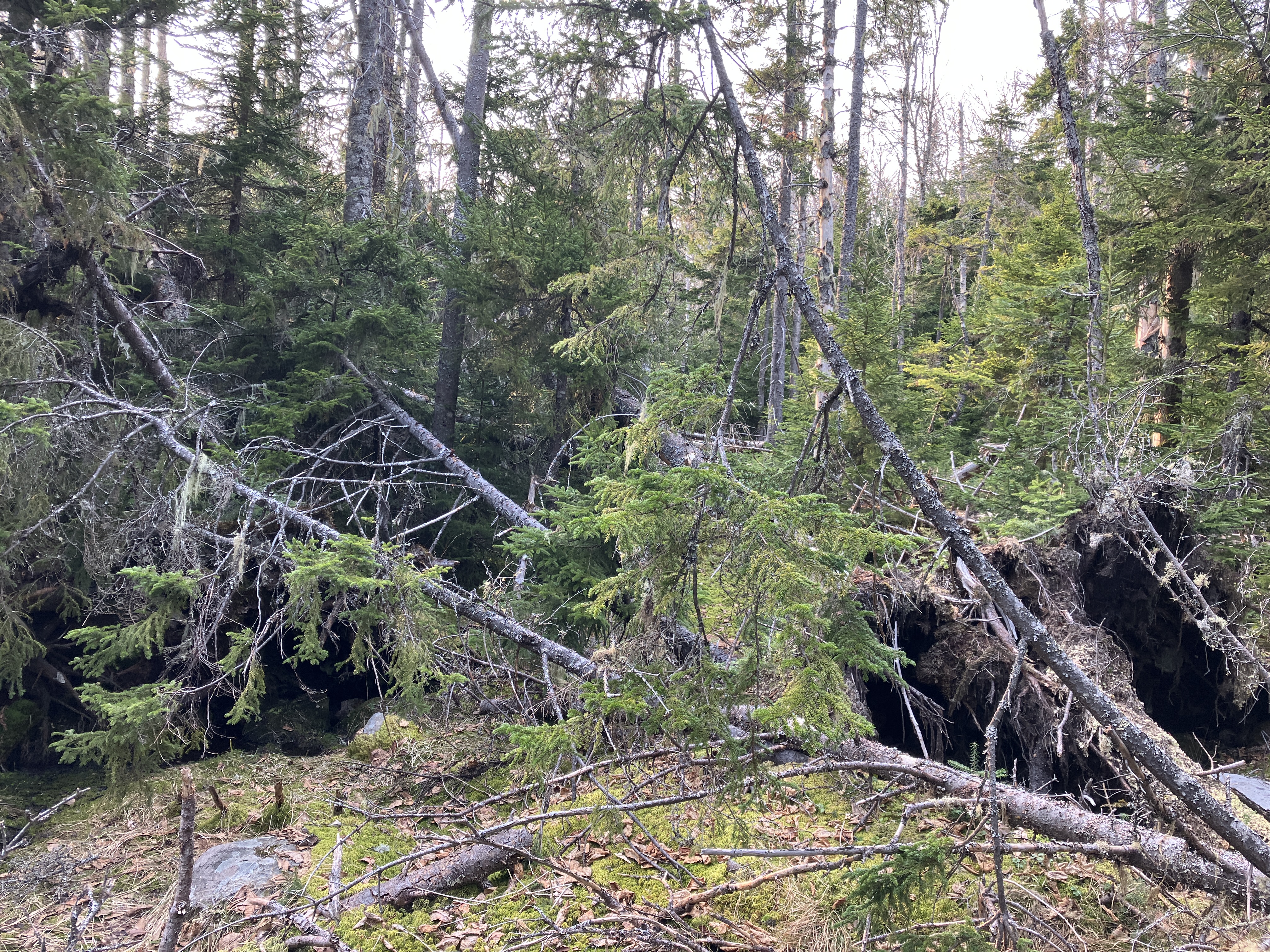


Roadblock, detour needed.


Looking back at the way through. Good flexibility test.


Remote beaver meadow at the head of Cascade Brook. Spur ridge of East Sleeper in the distance.


South Tripyramid presides over the scene.


The clearing of Cascade Camp, used by loggers of the Parker-Young Company in the 1930s and 1940s, now traversed by a Waterville valley X-C ski trail.


Sunday, May 14, 2023

Adirondacks: Winch Pond & Marsh Pond, 5/12/23


On our getaway day, the weather was still gorgeous, so I opted for a short bushwhack exploration amidst the cluster of ponds near Wilmington Notch, at the edge of the Sentinel Range Wilderness. I started with a steep, rocky climb on the trail that leads to popular Copperas Pond, where I had gone snowshoeing on our last visit in March.


I turned onto the less-used trail that leads to secluded Winch Pond.


On the approach to Winch Pond, the trail passes an old beaver meadow with a screened view of Stewart Mountain, one of four rough, trailless Adirondack Hundred Highest peaks in the Sentinel Range. (Traversing all four of these peaks in a day is considered a tour de force of Adirondack bushwhacking.)


Quiet beauty at Winch Pond. A Northern Waterthrush was singing here.


Near here I launched my bushwhack to hidden Marsh Pond, nestled right at the base of the Sentinel Range. Along the way I crossed this beaver meadow on the outlet brook of Winch Pond.


Rolling terrain.


When I emerged at the edge of Marsh Pond, I was surprised to find an active osprey nest in a tall snag about 100 yards away. Despite this distance, the parents were not pleased with my presence, so I did not linger long. Even with a brief visit, I was able to absorb the wilderness flavor of this place. To the east, the wild, hulking mass of Stewart Mountain (3615 ft.) dominated the scene.


Zoomed in, it looks downright intimidating.


Looming to the SE was the rolling crest of Kilburn Mountain (3881 ft.), highest peak in the Sentinel Range. 


Standing in this wild and secluded spot, this wonderful passage about Marsh Pond in Barbara McMartin's Discover the Northern Adirondacks took on new meaning:
 

The prevailing feeling at Marsh Pond, so surprisingly close as the crow flies to a major highway corridor, is one of deep remoteness.  The steep, dark, spruce-clad slopes of the mountains, their summits bristling with cripplebrush, convey a sense of palpable aloofness that both tantalizes and threatens the would-be explorer of those high regions. You will not be the first to sit by the shore of this quiet pond, looking up at the range that is the heart of this wilderness, and say to yourself, "Not today...but someday."


Adirondacks: Little Burn & Big Burn Mountain Ledges, 5/11/23


On the second of our two full days in the Adirondacks, Carol and I spent the morning geocaching in Saranac Lake, including an "adventure lab" driving tour of five "cure cottages," private sanatoriums used for the treatment of tuberculosis from the late 1800s through the 1940s.  We then took a walk on trails in a small in-town preserve known as "The Pines," finding two out of three geocaches there.


Partway into the afternoon Carol dropped me off at the trailhead for Haystack and McKenzie Mountains (two peaks on the popular Saranac 6er list). She headed back to Saranac Lake for some more geocaching and I set off on the trail approach for a bushwhack to ledges on Little Burn and Big Burn Mountains, two lower peaks on the southern edge of the McKenzie Mountain Wilderness. I had looked over at these mountains from Haystack Mountain a few years ago, and had read about Little Burn in Barbara McMartin's Discover the Northern Adirondacks.


Nice hardwood forest as the trail approaches the base of Little Burn.


A distinctive glacial erratic.


The trail makes a long traverse along the base of Little Burn.


After a mile or so I headed off-trail, up the slope, soon passing this neat rock wall.


After a steep climb to the little ridge I headed up the crest towards the ledges. Hardwoods and birch were everywhere in this area.


Looking down into the lovely valley between Little Burn and Big Burn, which I would cross a little later.


The Little Burn ledges may be low in elevation - just 2300 ft. - but they offer a big-time view to the High Peaks.


Scarface Mountain, another Saranac 6er peak, dominates the view southward across the valley.


Looking SW to Ampersand Mountain (yet another Saranac 6er summit) and Oseetah Lake.


Zooming in a bit, from L to R are Pitchoff, Cascade, Big Slide, Yard, Armstrong and Gothics.


Marcy, Gray, Colden, Wright, Algonquin and Iroquois.


Jack pines (needles in pairs) growing behind the ledges.


Parting shot - love the puffy clouds!


On the north side of the ridge I found a ledge with a view NW to McKenzie Pond and Baker Mountain (the lowest of the Saranac 6ers).


Close by to the north I could see the cliff band on Big Burn Mountain. The ledges looked like they could be accessed from above.


I dropped into the secluded hardwood valley between Little Burn and Big Burn.


I made a flanking maneuver to gain the ridgecrest coming down from Big Burn and climbed steeply through open woods with lots of birch. Both of these mountains were burned in a 1908 forest fire.


I soon reached the first of three clifftop vantages looking out over the crest of Little Burn.


Steeply sloping slabs with a High Peaks vista.


More views to the SW. Seward Mountain can be seen at the L, behind a shoulder of Scarface.


It was getting on towards evening, but I decided to continue up the ridge in search of more ledges. The wonderfully open woods made the decision easy.


Deer antler.


Approaching the next level of the ridge, a shoulder at ~2700 ft.


A peek out at McKenzie Mountain (L) and Moose Mountain (R), the two highest peaks of the McKenzie Mountain Wilderness, both over 3800 ft.


Wow, did I find some great whacking territory this week.


Found a higher south-facing ledge, with an expanded High Peaks view.


A hurried search on the north side of the shoulder paid off - a big expanse of ledge with a wide vista to the NW, including distant Saint Regis Mountain (yes, another Saranac 6er) to the left of McKenzie Pond and Baker Mountain.


To the north, a close-up view of Haystack Mountain (L) and McKenzie Mountain (R), giving me clear views of all the Saranac 6ers on this hike.


I left these ledges at the late hour of 6:30, but the bushwhack descent of 800 ft. elevation went quickly thanks to the great woods and mostly reliable footing. Then it was an easy mile or so on the trail back to meet Carol at the trailhead with daylight to spare (well, not a LOT of daylight).