
On a partly sunny, hot and humid day I took a long tour through the south-central part of the Pemigewasset Wilderness, starting at the Hancock Overlook trailhead at the hairpin turn on the Kanc Highway, and ending at the Lincoln Woods trailhead, where Carol kindly picked me up and shuttled me back to my car. My route followed the Hancock Notch Trail, Cedar Brook Trail and Pemi East Side Trail. The highlight of the trip was a bushwhack most of the way up and back down the big Cedar Brook Slide on the west side of Hancock's north ridge. In 14 miles, 12 1/2 of them on-trail, I did not see another hiker, only a couple of campers at the Franconia Brook Campsite.
Even the approach to the Hancocks was quiet with a 7 am start. At 1.3 miles on the Hancock Notch Trail there's a nice outlook over the North Fork of Hancock Branch to a ridge of Mt. Hitchcock.

A familiar junction for Hancock hikers.

Along the relocation done on Cedar Brook Trail by the WMNF Pemi District trail crew a few years ago, now well worn-in. Four of the five crossings of the North Fork are now bypassed. I first walked this relo shortly after it was done, when it was soft and spongy.

At the junction of Cedar Brook Trail (left) and Hancock Loop Trail (right), the difference in usage level is notable.

Beyond the Hancock Loop junction, the Cedar Brook Trail is a walk on the wild side as it ascends to the broad pass between Mt. Hitchcock and North Hancock. Kudos to new trail adopter Rebecca Sperry, who has done much brushing work on the trail this summer, carrying on after longtime Cedar Brook Trail adopters John Gutowski and June Rogier retired. This is a long and remote trail, challenging to maintain.

Wild spruce forest approaching the Pemi Wilderness boundary at the height-of-land.

An Adirondack-style mudhole just north of the height-of-land.

Descending north into the Pemi, the trail is wet and rough for a stretch, reminiscent of the trails heading out to Mt. Isolation.

This blowdown series a bit farther down will need a hearty team to tackle it.

High in the valley the trail crosses a headwater stream of Cedar Brook, and from here on down the walking is wonderfully good on old tote roads, and in the lower 1.4 miles, on a logging railroad grade.

This tributary is informally named Slide Brook, as it flows down from the big slide on the west flank of Hancock's north ridge. That name appeared in the Cedar Brook Trail description in the AMC White Mountain Guide from the late 1940s through the mid-1970s.

The first half of the bushwhack to the bottom of the slide was through fairly open woods, while the second half was thicker but not terrible.

Emerging at the bottom of the slide, with the top glimpsed far above.

Not far up I came to a severely gouged section referred to as the "half pipe" in a couple of trip reports. This slide originally came down during a massive rainstorm in early November 1927. It was "refreshed" during the deluge of Tropical Storm Irene in August 2011, when this gouging presumably took place. Here I scrambled up onto the upper right edge where the footing was more stable.

Red rocks up on the edge.

Peering down into the trough. Yikes!

In this view the trough carved by Irene is on the right and the older slide track is on the left. Quite a contrast from when some friends and I climbed this slide in 1995 en route to Northwest Hancock and then North Hancock.

First views back to Mts. Flume and Liberty.

Heading up the widest expanse of the slide.

A broad-spreading white pine has created its own micro-habitat.

Expanding views, now taking in Mt. Hitchcock and all the Franconia Ridge peaks.

I bypassed this trough through the island of trees on the right.

Giant chockstone.

Here the older middle swath of the slide is revegetating with tiny balsam firs, with gouges from Irene on either side.

Breaking out onto the most open part of the upper slide.

Rocky chaos from Irene.

Most of the way up the slide, at 3440 ft., I found a good rock seat (bottom of photo) and took an hour-long break to savor the scene and the views.

Peering down the slide.

Big view over some remote country. Mt. Hitchcock and North Hitchcock rise beyond the Cedar Brook valley, with Mt. Moosilauke in the distance. Lower Franconia Range to the right.

Mts. Lincoln and Lafayette behind Owl's Head.

Irene gouging to my left...

...and to my right.

Back at the bottom of the slide, after a slow, careful descent on the loose rock, I could look back and see where I was near the top.

Continuing down Cedar Brook Trail from Slide Brook, I soon passed the site of Camp 24A of the East Branch & Lincoln Railroad, a small mountain camp marked by this ferny clearing a short distance off the trail.

Great trail walking down the valley on old tote roads.

This sled runner sticks up from the ground right on the trail.

A bit farther down the valley the trail edges precariously across this undercut washout. Caution advised! I believe a short relocation will be done here.

Looking up Cedar Brook from the washout. Irene really tore down through this valley.

Not far below the washout, the trail drops down to the old railroad grade and soon comes to the opening in the woods that was the site of Camp 24. This was a very large camp used by Parker-Young Company in the 1930s and 1940s as a base for logging in the expansive Cedar Brook valley - the last major timber cut in the Pemi.

There are quite a few artifacts in this area, though it seemed there are fewer than the last time I came through here in 2012. As always, a reminder that these are protected by federal law and should not be removed or disturbed.

Part of an old lantern.

After another mile of easy railroad grade walking, I came to the junction with the Pemi East Side Trail, which was originally a truck road built in the 1940s by Parker-Young Co. for hauling timber. Today the 2.3 mile section from here to Franconia Brook Campsite is a wonderful, mellow woods walk through the East Branch valley.

Down the valley a ways I like to make my way off-trail to this view of Bondcliff and its pointy south spur peak.

Towards the west end of this trail section are some beautiful ledge slabs fringing the river.

There are several colonies of yellow avens on the ledges, with their flowers gone by. Could they be mountain avens?
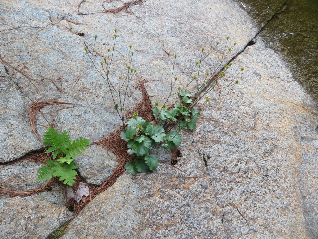
More ledges, illuminated by the evening sun.

The "Ranger's Pool" on the East Branch, another highlight on a trek with a great variety of wilderness scenery.


