Wednesday, August 14, 2013


PEMIGEWASSET WILDERNESS RAMBLE: 8/12/13

I like to undertake at least one long ramble into the Pemi Wilderness each summer, and with Carol generously covering the store for me, today was the day. The plan was for a ramble along the East Branch followed by a bushwhack to some cliffs overlooking the Cedar Brook valley, which I had first visited back in 1997. I rode my mountain bike in (except for walking up two hills!) the first 2.9 mi. on the East Side Trail, to the gate at the Wilderness boundary. It's a rougher ride than it used to be, thanks to several areas washed out by Tropical Storm Irene.

Before heading out on my hike into the Cedar Brook area, I checked out the crossing of the East Branch near the gate. I watched a hiker cross the river, wading up to his thighs in places. He dropped his pack and came back across, intending to take his wife and two young kids across it to go to Franconia Falls. As I found out later, thankfully they thought better of it and went to pools along the East Side Trail instead.

 
Welcome to the Pemi!


The first of several beauty spots I visited along the East Branch was the Ranger's Pool.


This spot doesn't get a fraction of the traffic seen at Franconia Falls.


A bit farther along the trail are these fine ledge slabs.


A short bushwhack earned me this view of Bondcliff and its sharp southern spur.


I did a little exploring along the lower end of Cedar Brook, passing this spot with damage from Tropical Storm Irene.


Wonderful easy walking on the East Side Trail. Hard to imagine this as a busy truck logging road in the 1940s.

Another favorite spot along the river.


Beautiful open woods on an island in the stream.


The premier backcountry stream in the Whites.

Old mossy stump.


A northern spur of Mt. Hancock looms above the river.


More fine cruising on the East Side Trail.


Big Rock and Mt. Flume.


Rocky riverbed.


I went a little way up Cedar Brook Trail before starting my whack, which was in open hardwoods for the lower part.


Then the woods got thicker with plenty of blowdown.


From the northern end of the cliffs, a view of Owl's Head and Mts. Lincoln & Lafayette.


Looking south from the northernmost crag.


Things were pretty ugly and prickly in the woods behind the cliffs. Wearing shorts (duh!), I picked up some pretty good scratches. At one spot I had to resort to an undignified crawl under some blowdown.


The view up the Cedar Brook valley was as good as I remembered from my visit 16 years ago.


An interesting fractured crag.


The South, Middle (main) and North Peaks of Mt. Hitchcock.


From a nice ledge perch, looking towards Whaleback Mountain and Mts. Flume and Liberty.


Good spot for a boot shot.


From the southern end of the cliffs, Mts. Flume, Liberty and Little Haystack.


North Hitchcock is quite a cone from this angle.


Four Hitchcock peaks in one photo, including East Hitchcock on the L.


A good dropoff in front.


Back at the north end of the cliffs, an end-to-end view of the Franconia Range.


After whacking back down, railroad grade walking on the Cedar Brook Trail. This valley was logged by the Parker-Young Company mainly in the 1930s and 1940s.


Crossing of Cedar Brook on the East Side Trail.


Neat slabs on the East Branch, Whaleback in the distance.


Another angle on the slabs. Many great spots through here.


An Irene-created view of Mt. Flume from a high bank - caution required, as it is severely undercut. A great day rambling in the Pemi, with lots of variety.


Tuesday, August 6, 2013


MIDDLE & NORTH TRIPYRAMID: 8/5/13

This spectacular cool, sunny, fall-like day started out with low clouds smothering the higher and more northern peaks. Not fully trusting the forecast that the clouds would clear, I shelved a plan to hike the Twins and opted for a more southern pair of peaks, where the sun was already shining. The Sabbaday Brook Trail is one of my favorites, so I decided to traverse the Tripyramids by going up Sabbaday and down the more direct Pine Bend Brook Trail. After passing a few tourists by Sabbaday Falls, I didn't see another person on the rest of the 4.9 mi. length of the trail. The three major crossings after Sabbaday Falls were fairly easy with the current low water flows.


At 1.3 mi. a sign welcomes you to the Sandwich Range Wilderness.


The trail follows an old logging road for a long ways up the valley - good walking.


After the fourth crossing, you enter the remote and magical upper valley of Sabbaday. There are several miniature meadows along the trail.


Tropical Storm Irene wreaked some havoc in the area of the fifth and sixth brook crossings.


A beautiful stretch deep in the valley.


I made a short bushwhack detour to a small old slide on the lower slope of the Fool Killer.


From here I could look up at West Sleeper behind a ridge off Tripyramid.


Wispy clouds over the crest of Tripyramid.


The path winds ever on...


A remarkable high-elevation hardwood glade on the trail at 3200 ft. This is usually the territory of red spruce and balsam fir.


Some nice sugar maples in here.


The upper half-mile of Sabbaday Brook Trail is steep and rough, starting with a scramble up the slabs of an old landslide.


A nice framed view of Mt. Chocorua from the top of the slab.


New trail signs at the junction on the ridge.


Part of the stand-up view east from the ledge at the summit of Middle Tripyramid, looking down at Potash and Hedgehog Mountains.


I undertook a thick bushwhack to an off-trail ledge on Middle Tripyramid and found a fine 180-edgree view to the south, including nearby South Tripyramid with Sandwich Dome on the R.


The view down from the ledge.


Mt. Whiteface and the broad crests of the Sleepers - the heart of the Sandwich Range Wilderness.


Mts. Passaconaway and Whiteface and the long Rollins Trail ridge between them. Did I say the bushwhack was thick? My phone and wallet were plucked from a pack pocket and I had to go back and find them. It took a few anxious minutes before the wallet turned up.


View west to Mt. Tecumseh from outlook along the trail near the summit.


Vast horizons to the SW. It was clear enough today to see Mt. Monadnock in southwestern NH and Stratton Mountain and Dorset Peak in southern Vermont.


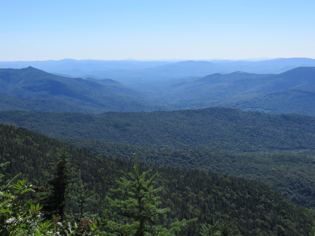
Camel's Hump peers over Vermont's Signal Mountain Range.


On the Mount Tripyramid Trail between Middle and North Peaks.


The heavily wooded summit of North Tripyramid.


A path leads a short distance beyond the summit rock to a stand-up view looking NE, with Church Pond visible down on the Albany Intervale.


Late afternoon light on the Presidentials.


I dropped down the Mount Tripyramid Trail about 200 ft. in elevation to the top of the North Slide for some additional views. If you have the time and energy, this side trip is well worth the effort if you're not ascending Tripyramid by the North Slide. In this view are (L to R) Mt. Moosilauke, the Osceolas, the Kinsmans, the Franconia Range and Mt. Garfield.


Looking down the slide and across at Scaur Peak, the Franconias/Garfield, the Hancocks and Mt. Carrigain.


The view extends around to the Presidentials.

A zoom on Mt. Garfield.


An imposing profile of Mt. Carrigain and Signal Ridge.


The upper section of the Pine Bend Brook Trail is one of the roughest stretches of trail in the Sandwich Range.


There are a number of slippery slabs and spots requiring awkward maneuvers.


A mellow stretch of Pine Bend Brook Trail approaching the gentle Scaur Ridge.


Cool tree near the Scaur Ridge Trail junction.


Fine rock step work by the Saco Ranger District trail crew on the lower steep part of Pine Bend Brook Trail. Some tough terrain along this trail, certainly in keeping with the rugged architecture of Mount Tripyramid, one of the most distinctive mountains in the Whites.