On a sunny, cool, almost fall-like day, I went on a long slide-hunting bushwhack in The Bowl, the deep, bowl-shaped glacial cirque enclosed by Mt. Whiteface, Mt. Passaconaway and the Wonalancet Range. On the broad floor is an old growth hardwood forest that has never been logged. The Bowl was saved from lumbering about 1915 through the efforts of Katherine Sleeper Walden, Edgar Rich and other members of the Wonalancet Out Door Club. The land was then added to the WMNF, and today The Bowl Research Natural Area includes more than 1,500 acres. A great deal of ecological research has been conducted here. There are no trails leading into the main part of valley, which is drained by the Wonalancet River; it is skirted by the Dicey's Mill, Tom Wiggin and Rollins Trails. Please note that camping and fires are prohibited in The Bowl Research Natural Area.
Three long, thin, mostly revegetated old slides mark the steep eastern face of Mount Whiteface, which forms the western wall of The Bowl. They are visible in this photo taken years ago from the summit of Hibbard Mountain, when the ledge there had a view. The southern and middle slides run parallel very close together, as seen bottom center in the photo. I had been to the lower part of the southernmost slide several times, and wanted to see it during the current state of high water flow, which has produced lovely cascades on recently visited slides. My more ambitious goal was to make a steep climb to a large open slab area on the northernmost of the three slides. This is the prominent white streak seen right of center high on the east slope of Whiteface.
Classic Wonalancet Out Door Club trail signs at the scenic Ferncroft trailhead.

Mount Whiteface looms large as the Dicey's Mill Trail crosses a privately owned field, whose owners graciously permit hiker access. The Bowl is hidden around the corner.
Welcome!
The Dicey's Mill Trail passes through a fine mature hardwood forest as it skirts the edge of The Bowl.
Heading off-trail across Passaconaway Brook, the eastern branch of the Wonalancet River.
Into The Bowl!
A primeval forest scene.
There are many large sugar maples on the gentle floor of The Bowl. Some of these are thought to be 250-300 years old.
Here there be giants.
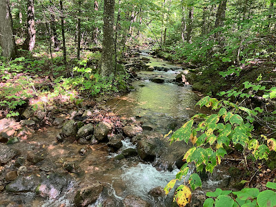
Scene along the Wonalancet River, which is really just a mountain brook.
Looking up at one of the largest maples in the valley.
Poles for scale.
One of several open seeps scattered through the forest. I skirted around this wet and fragile place.
This looked like a patch of Zigzag Goldenrod (Broadleaf Goldenrod) at the edge of the seep. The white flower at the upper right looks like White Snakeroot.
Following a rocky tributary that serves as the drainage for the three slides.
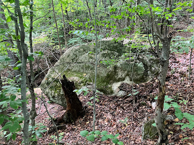
The Prow.
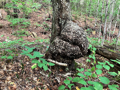
Burly.
Nice cascade, a preview of much more to come.
A dry secondary slide track parallels the brook.
Looking up the track of the northern slide, where it joins the main drainage.
An open, sparsely vegetated outwash area from the southern and middle slides.
Start of a cascade series at the lower end of the southern slide.
Graceful.
The middle slide joins from the right.
Approaching the massive footwall of the southern slide. In winter this is an impressive ice cliff. This was the first time I'd seen it as a fully flowing waterfall.
Wow.
Rock overhang on the right side of the footwall.
Nice spot for a lunch break.
From the base of the footwall a short, steep climb and traverse brought me to the middle slide and more cascades.
From here there was a long traversing climb to reach the northern slide. The terrain started out a little rough but not too bad.
Deer hooves had punched little holes into the turf.
The whacking soon became very rough, with blowdowns, rocks and holes. The traverse was tiring and time-consuming.
There were many large old, moss-covered blowdowns to clamber over. Researchers have noted that much of the old-growth spruce up on the walls of The Bowl were toppled by the 1938 hurricane.
Now heading directly up the slope, steeply and into the thick of it.
A little better going for a while.
I had my doubts, but at mid-afternoon I arrived at the bottom of the big slab, elevation 3150 ft.
There will be no climbing up this.
Side view while bushwhacking along the edge, treading lightly in mossy areas.
Mount Passaconaway at the head of The Bowl.
The large slab on the Bowl headwall may be the remnant of an old slide.

Looking east to the Wonalancet Range with the south peak of Mount Paugus and Mount Chocorua in the distance.
Looking up at the smaller upper slab of the slide.
Another wet one, par for the course during this rainy summer.
Another angle on Passaconaway.
I tried a different route for the thousand-foot descent to the floor of the valley, figuring it might be better and couldn't be much worse. It was about the same, with much slow and laborious going - steep with uncertain footing.
Wilderness, indeed.
Claustrophobic.
Forest monolith.
Much lower down, the slide track opened up as a fine cascade.
View from the bottom.
I was happy to finally exit the blowdown-riddled spruce forest and return to the open hardwoods on the valley floor.
A peaceful scene on the Wonalancet River. I was able to get back to the Dicey's Mill Trail and go partway down it before putting the headlamp on.


Hi Steve, Fantastic trip report and photos as always. I appreciate that you slogged it out on that northern slide track to confirm for the world that it would be a tough whack. I have been in there for a few visits and have seen the Southern slide lit up with this summer’s deluge. Thanks again for the field report.
ReplyDeleteMark in Madison
Hi Mark, The climb to the northern slide slabs I would not care to repeat! That footwall on the southern slide is one of my favorite off-trail spots. For some reason it just impresses me.
DeleteNice hiking (and navigating!), Steve
ReplyDeleteThanks, Steve!
DeleteA local to the Wonolancet area, that is by far my favorite place to bushwack. I was in there two months ago and found what looked to be a hermit shelter. Old cans, fire pit remnants, and a decent foot path leading back to Tom Wiggins. Got a little spooked out but carried on into the bowl anyways. Enjoy your content! Much appreciated.
ReplyDeleteWow, I've never encountered anything like that in there. Spooky indeed! It is an amazing area.
ReplyDelete