TUNNEL BROOK NOTCH: 9/27/12
On the way to the trailhead, I stopped to check out a couple of roadside water bodies. Near the junction of Rt. 118 and Rt. 25 is the pond impounded by Hildreth Dam, with a view north to Webster Slide Mountain.

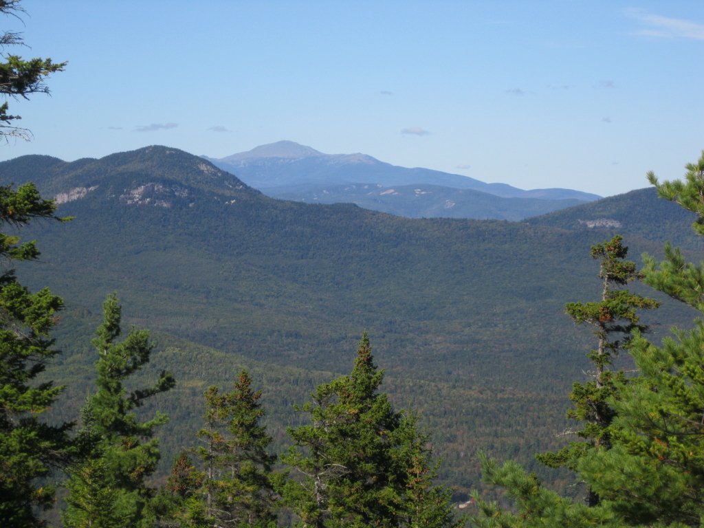
Along Rt. 25 northwest of Glencliff is Oliverian Pond; from the top of the dam you get a great view of the massive cliff in the Benton Range known as Owl's Head.

The south end of Tunnel Brook Trail starts on the gravel Long Pond Rd., a short distance up from High St. in Glencliff. Parking is roadside and limited here, even more so with a large broken tree limb blocking part of the parking space. I usually approach Tunnel Brook Notch from the N trailhead, which is closer to home, but Tunnel Brook Rd. was wiped out by Irene and won't be open for some time.

I hadn't done this southern approach for a few years, and had forgotten how pleasant it is: easy to moderate grades, good footing, and shadowing the dancing waters of Slide Brook much of the way. Parts of the trail follow an old road which once connected the Glencliff area on the S with the Wildwood area on the N.

There are many views of Slide Brook, with its dark, mossy rocks. This is at the trail's second crossing of the brook.

At 1.1 mi. the trail passes a small reservoir that provides drinking water for the State of NH Glencliff Home. The pond is held back by this small dam and spillway.

Nice spot for a break (but hikers should take care not to pollute the water of the reservoir and brook).

In this section the trail runs along the edge of the Benton State Forest. This tree marks the corner where the state forest meets the WMNF boundary.

Above the reservoir the trail passes through fine hardwood forest with some large trees.

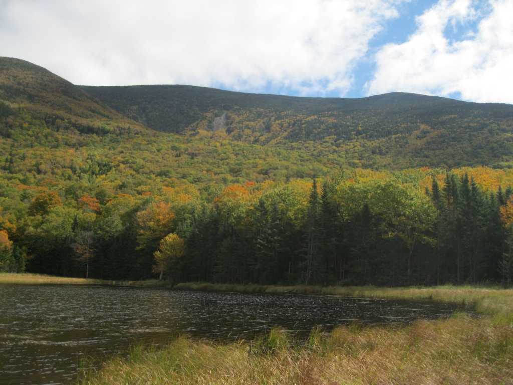
After a moderate climb, the trail crosses a broad height-of-land and descends slightly to the southernmost and largest beaver pond, named Mud Pond. A faint path leads out to the SW corner of the pond for a first look at Moosilauke's South Peak and the big slides up in Slide Brook ravine. The upper slopes were speckled with some nice birch golds, and the maples were turning down on the floor of the notch.

The Tunnel Brook Trail offers some smooth walking as it traverses along the southern beaver ponds.

In one spot the trail has been flooded by beaver activity; a bypass can be followed through the woods to the L.

From a grassy spot you can look south down the first few beaver ponds.

A long, curving beaver dam holds this pond in place.

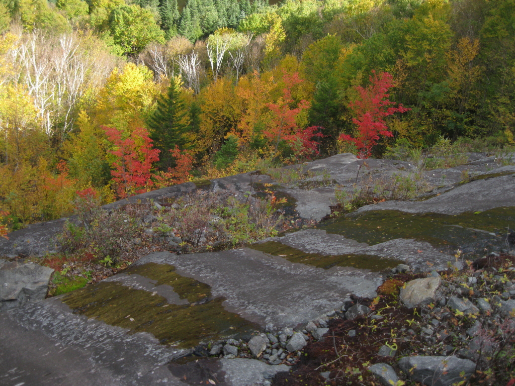
Just to the W of this pond, I made a short bushwhack up to one of the smaller of the seven or so landslides on the steep face of Mt. Clough. These slides reportedly came down during the big storm of November, 1927.

From an open spot I enjoyed a view of South Peak and the biggest Slide Brook slide.

Back along the trail, a beautiful hardwood and birch glade.

Crossing Tunnel Brook in the heart of the notch.

From the next beaver pond, there's a great view of the biggest Clough slide, my next objective.

After a short but steep bushwhack through scrubby, rocky woods, I emerged on a shelf atop the lower open slabs of the slide. Looking N, I could see the mountains of the Nash Stream Forest in the distance beyond a NW spur of Moosilauke.

I scrambled another hundred feet higher up the slide, which has fairly grippy rock, except where it's wet.

Up here the slide is wide open and exhilarating, with views down to some of the beaver ponds. I later measured the width of the slide on Google Earth as nearly 250 feet across.

Looking across the slide to the South Peak and its western slope.

Looking up the slide. I once continued to the top of this slide and bushwhacked to the summit of Mt. Clough, one of New Hampshire's 100 Highest peaks. Above the slide it was brutally steep, rough and thick. I found a much easier descent route down the N ridge of Clough.

Peering down at the northernmost beaver ponds. The strip of conifers above the ponds marks the path of another old slide, now almost completely revegetated.

Some nice colors looking north.

The spur of Moosilauke is laced with prominent fir waves.

A few years ago I bushwhacked up that ridge and found some good views of the Clough slides from fir wave openings.

On the descent, looking down at the lower slabs of the slide.
Heading back along Tunnel Brook Trail, a beaver pond tucked in against a steep hardwood slope.

Looking across Mud Pond.

From the shore of Mud Pond, late afternoon light on Slide Brook ravine and South Peak.

Back near the trailhead, a cascade on Jeffers Brook. Great area!