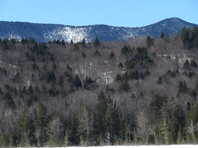
Firm snowpack made for ideal conditions for snowshoe bushwhacking in the
Albany Intervale to Church Pond and Little Church Pond, with their
stellar mountain views, and nearby hardwood-cloaked Sugar Hill.
The
biggest obstacle to visiting Church Ponds in winter is crossing the
Swift River. Where the Church Pond Trail crosses, the river is shallow
and shoaly and never freezes well. In the past I have fashioned
precarious crossings on log jams. For this trip I tried a new approach,
across from the Sabbday Falls parking area, where the river is rockier.
As hoped, there was a decent snow bridge, though the ridiculously steep
climb up the bank beyond was a surprise.
After crossing the river, I bushwhacked northeast to Church Pond. The forest was 100% open, mostly hardwoods...
...with some mixed hemlock woods.
Nicely sculpted Pileated Woodpecker excavations.
After crossing a nearby snowmobile trail, I emerged into the great wide open at the southwest end of Church Pond. It was solidly frozen with a layer of crusty snow on top. (With warm weather in the forecast, both the river and pond crossings will soon become unsafe.)
Of all the ponds in the Whites, Church Pond may have the best mountain views when you can get out on the surface in winter. Here the rolling ridge of Mt. Tremont rises behind the rock faces of Owl's Cliff.
Green's Cliff sprawls to the northwest.
The northeast end of the pond offers sweet views of the Sandwich Range.
North Tripyramid pokes up behind the Fool Killer, with West Sleeper on the L and Scaur Peak on the R. From here you can see how the Fool Killer was named: It blends in with North Tripyramid so that it looks like one mountain mass. Early climbers ascending from Albany Intervale would reach the top of the spur peak, only to discover that reaching the main summit entailed a drop to a broad col and a long, steep climb up the cone.
Zoom on North Tripyramid.
The hardwoods of Sugar Hill, to the west, looked inviting.
The Sleepers far up the Sabbaday Brook valley.
The Church Pond Trail ends at this lovely spot known simply as "The Knoll," cloaked in red pine.
Looking down the narrow eastern arm of the pond to Birch Hill.
Hedgehog Mountain, Mt. Passaconaway and Potash Mountain, all in a row.
Passaconaway and Potash.
The mighty Passaconaway.
Darkly wooded Hedgehog.
Bear Mountain to the northeast.
Bushwhacking to secluded, little-visited Little Church Pond.
Beaver dam at the outlet of Little Church.
In his 1916 classic, "Passaconaway in the White Mountains," Charles Edward Beals, Jr. wrote of this pond, "A sense of utter loneliness and desolation sweeps over one as he gazes upon this tiny sheet of water so completely buried in the great wilderness." From the south end there is a striking view of Green's Cliff.
Beals,
Jr. again: "Green’s Cliff defiantly raises its oblong redoubt far above
us, and, from here, is a mountain worthy of respect and admiration – a
truly magnificent and imposing rampart."
The previous day Mark Klim and I had lounged for hours in the sun on the mountain's SW ledge. Gazing down at the ponds kindled a desire for an overdue revisit.
The outlet brook, flowing towards Church Pond.
Parting shot.
Fine hemlock grove between the ponds.
Back at Church Pond, I spent a lazy hour soaking up the brilliant spring sun.
Looking across at The Knoll.
Both forks of the Downes Brook Slides could be seen on Mt. Passaconaway.
There must currently be great views from the snowfield just north of the Scaur Ridge/Pine Bend Brook Trail junction.
Owl's Cliff, front and center. There are many rock climbing routes up there.
On the way back I decided to ascend a southeastern ridge to Sugar Hill (1860 ft.), as I had seen it many times along the Kanc but had never been there.
A glimpse of Church Pond below.
Elbow tree.
Along the upper ridge I snowshoed through a magnificent hardwood forest.
Gorgeous!
The summit of Sugar Hill. I signed in a register jar that had a handful of familiar hardcore bushwhacker names in it.
Bear tree at the summit.
Early spring at its best.
Big hemlocks on the ridge.
A towering presence.
Spring is slowly progressing.
Potash Mountain is a landmark as I head south back to the river. Luckily the snow bridge was still holding strong at 42 degrees.
The Church Ponds neighborhood.


