Saturday, July 28, 2012


BLACK MOUNTAIN POND: 7/25/12

On a perfect midsummer day - sunny after morning clouds, temp in 70s, low humidity - I decided to make the fairly long walk through the southwestern wilds of the Sandwich Range to one of my favorite spots - Black Mountain Pond. This clean and clear six-acre gem nestles at the base of Black Mountain, the rugged, ledgy SW shoulder of Sandwich Dome.

I've always felt that the toughest part of the hike to Black Mountain Pond is the five-mile drive in on the steep, narrow and gnarly Sandwich Notch Road. Some of the pitches on this road are startlingly steep, and you just hope there's no one coming the other way 'cause you can't see over your hood when going over the crest.


Parking for the Guinea Pond Trail is a little ways up the Beebe River Rd., just north of the trailhead. There's  no parking where the trail leaves Sandwich Notch Rd.


After crossing under a powerline, the Guinea Pond Trail provides easy cruising along the bed of the old Beebe River logging railroad (1917-1942), which extended all the way up past Flat Mountain Pond.


About a mile in you enter an extensive swampy area. Earlier in the summer this stretch is good for birding, and for being eaten alive by various flying insects.


There are a couple of good views of sprawling Sandwich Dome across the swamp.


From another spot, a peek at the SE shoulder of Sandwich Dome.


After 1.6 mi., I turned L onto one of my favorite routes, the Black Mountain Pond Trail.


The Beebe River was absurdly low. A few years ago, after some heavy rain, a group of us couldn't cross the raging stream here; we had to go upstream and wade at a wider, shallower spot.


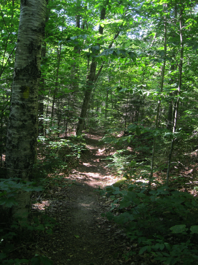
The Black Mountain Pond Trail makes a long, mostly easy-graded meander up the Beebe River valley, passing through a variety of woods.


The trail crosses the Beebe River again where it emerges from an old beaver meadow.


In the next section, the trail passes by some interesting cascades and natural bathtubs in the stream.


Farther up the valley, a side trail leads to Mary Cary Falls.


The flow was meager today!


Here is Mary Cary Falls with a strong flow of water.


Because it has been heavily camped over the years, Black Mountain Pond is in a Forest Protection Area,


The Forest Service and Squam Lakes Association (the trail maintainer) have created a hardened tentsite above the pond.


I followed a path down to a ledgy spot on the shore with a great view across to Black Mountain, the higher of two SW shoulders of Sandwich Dome with that name. The steep and rough upper mile of the Black Mountain Pond Trail winds up this rugged slope, well to the L of the prominent cliffs.


Lower down on the slope I studied an off-trail ledge I had visited a few years ago, and planned to return to today (seen near the bottom of the photo).


Looking south down the pond. The water level is down during this dry summer.


I returned to the trail and followed it to a spot on the SE shore near the site of a former shelter.


Just north of Black Mountain Pond, the trail passes by an old beaver pond. Right beyond here, the trail begins its steep climb to the Algonquin Trail on Black Mountain.


A short but thick bushwhack in steep terrain brought me to the ledge. Dropping down to it was a little precarious, but doable. On my previous visit, the view had been mostly shrouded in fog. This time, all was revealed. Black Mountain Pond fills the foreground, with Mt. Israel (R) and the Ossipee Range (L) beyond.


I found a little pocket to sit in on the ledge, and spent an hour relaxing and taking it in.


A broadside view of Mt. Israel and Dinsmore Mountain, its western spur.


An open ferny spot along the whack back to the trail.


Steep pitch just above the beaver pond.


Higher up, this trail is pretty challenging in places (photo taken on a previous hike).


Back at Black Mountain Pond in late afternoon light.


Heading back down the meandering trail.


Partway down, I made a short off-trail detour to visit an old beaver meadow. Lots of interesting wetlands in this area.


The trail continues down through endless wild woods in this quiet southwestern corner of the Sandwich Range Wilderness. I did not see one other hiker on this 9-mile midsummer trek.


On the way back along Sandwich Notch Road, I stopped to admire this view of Jennings Peak, Sandwich Dome and Black Mountain from a clearing by a lonely house. What a beautiful area!


Sunday, July 22, 2012


BRAD'S BLUFF & LILA'S LEDGE: 7/20/12

After attending a WMNF volunteer event at Dolly Copp Campground, I had the second half of the afternoon free for a short hike. Out of the many options in the Gorham/Pinkham Notch area, I chose a fun little loop behind the AMC Pinkham Notch Visitor Center. Using the Old Jackson Road, Crew-Cut Trail, George's Gorge Trail and Liebskind's Loop, this 2.8 mile circuit traverses a low but rugged ridge, leading through interesting woods and passing two viewpoints: Brad's Bluff and Lila's Ledge.

The loop starts with a 0.4 mi. jaunt up the rolling, rocky Old Jackson Road to a junction with the Crew-Cut Trail.


Next I turned left onto George's Gorge Trail, which follows a small brook at the head of Peabody River, with some steep and rocky pitches.


Next up was a R turn onto Liebeskind's Loop, named for an AMC trail crew member who helped build this path in the 1970s.


A short down-and-up led to Brad's Bluff (2575 ft.), a viewpoint named for Bradford Swan, an energetic AMC volunteer who laid out this neat little trail network in the 1960s/1970s. Swan was the theater/arts critic for the Providence Journal-Bulletin and also served as editor of the AMC journal, Appalachia.


This spot has a fine view south down Pinkham Notch.


Mt. Chocorua is seen on the horizon; Rocky Branch Ridge is on the R.


Looking up at Boott Spur and the large slide unleashed on the Hillman's Highway ski route by Tropical Storm Irene.


As it descends towards Lila's Ledge, Liebeskind's Loop passes by some neat cliff faces.


Some nice spruce woods here, giving the area a higher elevation feeling.


A side path leads to Lila's Ledge (named for Bradford Swan's wife). The last short pitch down to the ledge perch is quite steep and could be tricky in wet or icy conditions.


This outcrop has a superb view of the massive eastern face of Mt. Washington, with its dramatic ravines. Unfortunately late afternoon doesn't offer the best lighting for photos. This shot shows Lion Head, the main summit above the Ravine of Raymond Cataract, and craggy Huntington Ravine.


Boott Spur, Tuckerman Ravine and Lion Head.


A hazy closer look at Raymond Cataract, an off-trail feature that displays two majestic waterfalls.


In addition to a view down Pinkham Notch similar to that from Brad's Bluff, Lila's Ledge offers a look across at Wildcat Mountain, with the top of Carter Dome peering over in the back on the left. From Lila's Ledge, it's a quick mostly downhill jaunt on Liebeskind's Loop, Crew-Cut Trail and Old Jackson Road back to the AMC visitor center. This is a fine family hike, but watch little ones carefully at Lila's Ledge.


Tuesday, July 17, 2012


MORNING HIKES OFF THE KANC

Beating the heat during a sultry week with a couple of before-work jaunts along the western Kancamagus Highway.

PITCHER FALLS: 7/15/12

This cascade on the South Fork of Hancock Branch is accessed by a short but obscure, overgrown and blowdown-strewn path from a pulloff on the Kanc. The falls and path were mentioned in a 1990s WMNF handout on waterfalls in the Pemigewasset Ranger District, which is where I learned about it. I hadn't been here in a few years, time for a re-visit.

It took less than ten minutes to get to the big granite slab at the top of Pitcher Falls - a great place to relax and take in a framed view of East Osceola (L) and the main Osceola summit (R).


A closer look at the view.


The wooded spire of East Osceola.


The main Osceola summit, with the Split Cliff jutting out on the R.


I bushwhacked down a steep slope for a look at the main part of Pitcher Falls. It's more of a waterslide than a waterfall, but quite attractive.


Interesting ledge shelves near the bottom of the falls.


Back at the top, a peek at Middle Osceola.


Found some mountain avens (with the rounded leaves and faded yellow flowers) growing on a ledge.


There was an interesting basalt dike (the gray rock) in the brookbed above the falls. Wonder if there are other cascades along the South Fork?


GREELEY PONDS: 7/16/12

The next morning I took a longer walk to an old favorite, the two Greeley Ponds in Mad River Notch. There was only one car in the Greeley Ponds Trail lot when I set off, and I never saw those folks.

An easy half-hour climb (though the footing is rough at times) brought me to the height-of-land in Mad River Notch, where I admired this magnificent maple.


At Upper Greeley Pond, there are two fine viewpoints on the eastern shore, reached by an overgrown path that leaves the main trail by the pond outlet. The view up to the massive spreading eastern face of East Osceola always impresses me. The Mt. Osceola Trail climbs steeply to the R of the rock slab seen under the R end of the main ridgecrest.


A great view across to the cliffs on the mountain's NE spur. Peregrine Falcons sometimes nest here, though I didn't see any today.


I've often considered whacking to the top of these cliffs from the north for what would be a great view over the ponds and down Mad River Notch. But the woods above the clifftop look seriously gnarly and nasty. I did once whack to a lower ledge way down to the R and got a teaser of what the higher view would be like.


Neat view of the southern spurs of East Osceola. In a quiet half-hour spent on the little beach seen in the foreground, I heard or saw the following birds: White-Throated Sparrow, Swainson's Thrush, Winter Wren, Solitary and Red-Eyed Vireos, Black-Throated Green and Black-Throated Blue Warblers, Common Raven, and Belted Kingfisher. Mid to late July is the last hurrah for summer birdsong.


A side view of the Painted Cliff. Through binoculars the rock face looked strangely corrugated.


Looking north down the pond to the cliff-faced western spur of Mt. Huntington.


The shady hardwood path between the ponds, deep in Mad River Notch.


A long slide that curves down off East Osceola ends up right beside the trail. This slide is occasionally traversed by backcountry skiers.


I popped out onto the gravelly shoreline viewpoint at the NW corner of Lower Greeley Pond, looking back at the NE spur cliffs.


Here you look across at the west knob of Mt. Kancamagus, which features the "K2 Cliff," as named by early 1900s Waterville Valley trampers.


Looking south down the shallow Lower Pond, overlooked by a southern spur (home of the "K1 Cliff") of Mt. Kancamgus.


Relaxing on the beach at Lower Pond before heading back. Didn't see a single hiker at either pond, but as I headed out I passed a total of 15 people heading in.